Last Autumn sheer perseverance delivered me to the great city of Stoke-on-Trent one hundred miles away from Harlech that involved the effort of lifting my bicycle on and off 3 different trains much to the delay and at times displeasure of disgruntled passengers sharing the same doorway.
Now that Spring has finally arrived I decided to complete my tour of this captivating city, choosing to put my bike in the car and used £15 worth of petrol, saving the expense of a £38:80p train ticket.
The Ride Begins at Trent Head Well
Fringing Biddulph Moor, Trent Head Well cannot be accessed by bike so I secured it to a nearby footpath signpost. Signposting public rights of way are vitally important not just because of their function to point out a direction to follow, they signal people have every right to walk with care and consideration over what would otherwise appear to be private land.
Trent Head Well
Despite my photograph giving the impression this date stone reads 1955, this is due to erosion of the stone. It actually reads 1935 the year this Well was built. It celebrates this and nearby Springs being the official source of the Trent, Britains 3rd largest river after the Severn and Thames. The presence of these underground waters formed from the last ice age 20,000 years ago is why the city of Stoke-on- Trent is exceptionally rich in natural resources.
If I had my time over again I would have loved to study geology, the earth’s physical structure and the processes that act on it are fascinating. Today my knowledge has been informed by an expert:
Coal is formed by peat and peat commonly fills glacial drainage channels and sites of glacial lakes.
Clay dominated rocks are a type of sedimentary rock typically deposited in water. Freeze-thaw weathering generates clay particles that eventually become rock close to the surface of ground..
Emily Crane MSc, Hydrologist: British Geological Society
Thank you Emily. This explanation explains how the area benefited from natural resources such as the coal and clay that made Stoke-on-Trent a centre for mining and pottery production.
Other minerals used in the pottery industry included Lead mined in Derbyshire , Salt extracted from the Northwich area of Cheshire and later in this story I will mention the use of Sandstone extracted from Biddulph Moor and Derbyshire.
Lead.‘An Epidemic of Lead Poisoning in Earthenware Manufacture’ was the subject of a longitudinal study in Stoke-on-Trent between 1899 and 1938 by the factory inspector. The reason why earthenware pottery was more likely to leach lead and harm the health of the handler was because it is fired at lower temperatures than other types of pottery.
PaintresssDipping
The factories inspectors report explains how lead poisoning happened. Paintresses would ingest lead when licking the tip of their paint brush to create the point they needed to draw fine lines onto pottery pieces. Men ingested lead after dipping pottery into a solution of glaze causing a thin coating of lead to form on their fingers. When their fingers made mouth contact, lead was absorbed into the body; Lead was also inhaled. Females breathed in lead dust when working on Majolica glaze that was made with a high concentration of lead ( usually 65%) or they breathed fine lead laden dust particles during litho-transfer decorating tasks. Men breathed smoke containing lead during kiln work or breathed gas containing lead that was released during salt glaze firing.
How they were affected? Lead within harmful dusts or vapours enter the lungs, leaching lead into the blood circulatory system when breathing in contaminated air. When paint brushes or contaminated fingers came into contact with the mouth, lead was absorbed into the digestive tract. To this day lead from antique pottery items can still present a risk to health to people who use their teeth on the rims of pottery to detect the presence of a paste repair. Women were more predisposed to the ill health effects of lead poisoning due to physiological reasons during pregnancy, lactation and the menopause.
What were the effects of lead poisoning? . The effect affected a pottery workers ability to do their job. Lead is absorbed into the bones where most red and white blood cells are created in bone marrow. Blood vessels transport nutrients and waste out of the bones, circulating lead around the body to organs such as the brain, kidneys and liver causing a range of side effects including headaches, convulsions, poor concentration and nausea. High concentrations of lead is one cause of high blood pressure, heart problems and kidney damage . The effects on pregnant women caused miscarriage, stillbirth, premature birth, low birth weight and other health problems placing the survival and quality of life of the new born at risk. Tendons connecting bones to muscles are also affected by lead , causing a dropped wrist affecting hand movement and grip, or a dropped ankle affecting standing and walking.
In the small number of pottery factories sampled, the outcome of the factory inspectors longitudinal study revealed:
1,942 workers were suffering varying degrees of lead poisoning.
Sadly the factory inspector recorded 285 lead poisoning fatalities.
Work related lead poisoning and death was the reason for factory inspectors providing their report to parliament who then introduced laws that improved the health and safety of pottery workers.
I wonder how many people knew that lead was harming their health yet had no alternative but to continue working in unhealthy conditions.
In part 1 of this story I explained my neighbours wife visited pottery factories and took blood samples to check whether lead was present. If this was the case the individual affected was removed from tasks that exposed them to the risk of further lead poisoning. These days almost all commercially available glazes will be lead free.
Over the passage of time increasing public awareness about the ill health effects of lead, drip fed into societal changes. Lead is no longer used to make pencils or children’s toys, lead pipes were removed from houses, lead in paint has been removed as has lead in modern glasssware and to prevent exhaust emissions into the atmosphere damaging child development petrol became lead free. Despite the harmful effects of ingesting or inhaling lead it also provides a safe shield to protect healthcare staff from radiation during X-rays.
Salt: was transported along the river Weaver to the village of Anderton where a lift gave barges access to and from the Trent and Mersey canal for their cargo to reach Pottery factories. Salt created a glaze. The melting of glaze particles was helped by the addition of lead that sealed the pores of clay enabling glaze to produce a shiny surface on pottery items.
TOWN 5: TUNSTALL
30 minutes after leaving Trent Head Mill I cycled into the heart of Tunstall to see how the former Town Hall earns its right to exist by providing a service to countless generations of local residents.
This and many other Victorian buildings in the city are listed to protect their special architectural and historical interest that prevents demolition and non-approved alteration.
Tunstall Town Hall
What used to be Tunstall Town Hall has now been tastefully refurbished to accommodate businesses bringing in a revenue from room usage and also provides a community cafe, family hub, library and indoor market.
The world famous pottery premises of Booths Limited and W.H Grindley & Co used to be based in Tunstall:
Booths, Grindley and the other Stoke-on-Trent pottery manufacturers produced decorative items, ornaments, tableware, floor tiles, wall and hearth tiles, toilets and sinks. They also catered for households that did not have the luxury of toilets by manufacturing chamber pots, hand washing bowls and jugs that were filled with hot, or more commonly cold water for people to wash.
Booths marketed themselves as being the sole manufacturer of silicon china; silicon (dioxide) found in local sandstone is also known as quartz. The addition of fine silicon sand helped to capture intricate design details and created a smoother, stronger finished product suited to the regularly used dinner and tea services Booths advertised.
The Booths poster refers to agents in London, India and the Far East, Melbourne and Paris. Inland waterway routes to those places are:
The Trent and Mersey canal that connects with the Grand Union of Canals to reach London in 4 days. Items that were bound for India and the Far East would be transferred to East India Company Ships that docked on the river Thames in the East End of London.
Items bound for Australia followed the Staffordshire and Worcester Canal to access the river Severn that flows to Bristol Docks. Last year I wrote a separate cycling story on this website called ‘Navigating the Stourport (canal) Ring by bicycle’ explaining why a substantial amount of pottery from Stoke-on-Trent used this route to access Bristol docks, despite ships bound for Australia leaving from the closer Port of Liverpool.
Pottery bound for Paris would be taken along the Trent and Mersey canal to reach the river Trent that flows to Hull, the export route to Europe.
The Grindley poster states items were exported to the United States. Earlier in Part 1 of this story I revealed the Port of Liverpool was used for exports to the Americas and would reach Liverpool by heading north along Trent and Mersey canal, a journey of 2 days.
Twyfords Toilets
Booths were not the only company manufacturing toilets and hand washing bowls. The most famous were produced in the neighbouring town of Hanley by Thomas Twyford. To this day the Twyford name is regularly seen on the glaze of bowls.
I then made my way to Meir Street to see the house where in January 1899 Clarice Cliff was born, identified by a ceramic wall plaque visible to the left of a satellite dish:
The Birthplace of Clarice Cliff
Like most children of that era Clarice started work aged 13 with hours limited by laws to stop the exploitation of children. Those between 9 and 13 could not work longer than 10 hours a day and those aged 13 – 18 could not work longer than 12 hours a day.
The 1906 inquiry into the earnings and wages of Staffordshire pottery workers found the average weekly wage was based on piecework.
Piecework means workers were paid according to how many items of pottery they completed to an acceptable standard. The basic count was the dozen, but a dozen could be any number. There might be 10 large decorative items to a dozen but 36 flat plates to a dozen. This means that payment for the quantity being produced was also based on how complex the items were to make.
Like other places of work low pay for women and lower pay for children was normal practice in the pottery industry. An excuse was that men had to work harder as they handled heavy clay whereas women were undertaking less physically demanding activities such as delicate decorating work, yet:
The intricacy of delicate decorating was of equal value to the finished pottery product as the brawn used by men who lifted and shifted heavy clay.
Men received higher pay even when they worked alongside women undertaking the same tasks.
Women earn’t 36% less than men and girls earn’t 52% less than women. The reason for children being paid less was their tasks were considered to be ‘Little jobs for little people‘. The difference in pay amongst girls and boys doing the same job established a culture of ‘custom and practice’ at the very start of working life.
During those early years Clarice learn’t how to gild porcelain and paint pottery, skills that would be used in her later creations. She then went on to study pottery design at the Burslem School of Art based at the Wedgwood Institute in Burslem that I cycled off to see.
TOWN 6: BURSLEM
The Wedgwood Institute
Gosh, this is some building. Its construction was funded by public donations in memory of Josiah Wedgwood for people to improve their prospects by learning about science and business. I spent more time here than I intended to and less time than I ought to have spent looking at the decorative panels on the street facing wall.
Panels at the top of the building are months of the year and underneath them the signs of the zodiac. Although I can recognise my own birth sign from reading newspaper horoscopes the others have never registered with me. Beneath these are a series of panes showing a process producing pottery; Clay preparation, Throwing on the wheel, Glazing, Kiln loading, Firing in the Kiln, Decorating, Etching, Moulding & casting, Applying handles and attachments, Finishing and polishing.
A style and type of pottery that I can immediately recognise as being Wedgwood are the white figures set against an unglazed background of either a sand coloured, light blue, dark blue, lilac, sage green or black background collectively known as Jasperware. Some are statement pieces and knowing that Josiah Wedgwood objected to the slave trade one Jasperware design shows a slave seeking freedom.
Cookseys Entry
Around the corner from the Wedgwood Institute is Cockseys Entry that I recognised by its Victorian street lamp captured in many paintings and photographs. Above is the clock tower of Burslem Town Hall supported by stone carvings of muscular figures.
Muscular men supporting Burslem Town Hall Clock
I then pushed my bicycle through Cocksey’s Entry, a name dating back to an era when cockfighting was a popular betting bloodsport. Further injury was inflicted by metal spurs being attached to the birds natural feathering. Nineteenth century cockfighting and the use of metal spurs was common practice across the country and even gave rise to the name ‘Spurs’ for Tottenham Hotspur Football Club.
Emerging from Cockseys Entry is Burslem Town Hall. When cycling towards Burslem I could see the Town Hall from some distance away, giving me the impression it was a very large building. I discovered its height was due to it being located on high ground. When I emerged from Cockseys entry it didn’t look as large as the former town halls I have seen elsewhere. Notices at the front of the building says use is still made of it for education, yet it looked like an old sign and the building looks unused. Like the other town halls this is also grade 2 listed.
Burslem Town Hall
Cycling away from Burslem town centre I noticed this street sign on the side of a nearby building:
The name Pack Horse Lane celebrates this being the route used by a horse or donkey probably carrying pottery in one direction and salt in the other, packed in side bags carried either side of the animals back. Before the Trent and Mersey Canal opened Pack Horse Lane was used to reach the river Weaver at Winsford 30 miles away.
Access to Anderton Boat Lift from the Canal
Once the Trent and Mersey canal opened a separate engineering project began, known as ‘The Anderton Boat Lift‘. This enabled barges containing salt to rise 50 feet from the river Weaver to access the canal and be taken along this inland waterway for use by pottery factories.
I then set off to visit a place affectionately known as Molly Leighs churchyard. In the 18th century a local vicar accused Molly of being a witch. The articles I have read describe Mollys face as being scarred from smallpox and that she made a living from selling milk from her cows. Due to her bad looks and that she lived alone her only companions were animals and it was not uncommon for Molly to be seen with a pet blackbird.
It is written that Molly often chastised the local vicar for being a drunk and refused to attend the church services of a drunken rambler. The vicar accused Molly of being a Witch and as this was an era when many belived in witchcraft, men would blame her for any misfortunes they suffered. When Molly died the local vicar threw her live pet blackbird into the coffin then both were buried in the churchyard at a different angle to the other graves.
Molly Leighs tomb chest is set at a right angle to the surrounding graves
Nothing that I have read supports the vicars claim that Molly was a witch. What I have read does confirm the vicar was a drunk.
From here I made my way to Waterloo Road and the premises of Rourkes Cycles owned by a very famous bicycle frame artisan. The business was started over 50 years ago by Fenton born Brian Rourke, a top-level road racer, winning several national ‘Tour of Britain’ bicycle races, The Tour of Britain began in the 1950s. In 1954 sponsorship was taken up by Quaker Oats then in 1958 by the Milk Marketing Board to become known as the Milk Race. Brian won The Milk Race three times.
The reputation of Brian Rourke as a bespoke bicycle frame builder is well known amongst elite cyclists. In 2010 journalist and author Robert Penn wrote a book telling the story of Brian building a dream bicycle that was praised in the Sunday Times as being ‘a best seller ‘ and serialised on television , endorsing Brians claim they make:
‘”The right fit for you, not anyone else“
Today I had the pleasure of seeing Rourkes cycling shop. Brians son Jason now runs the business and continues the family tradition of making and supplying world famous hand-made bicycle frames to world famous cyclists, evidenced by Olympians Nicole Cook and Jason Kenny being part of their recent client list.
From here I cycled a short distance to the Trent and Mersey Canal to see this wall plaque commemorating Clarice Cliff attached to the wall of a canal side home that forms part of a larger housing development.
Marking the Newport Pottery site where Clarice Cliff produced her creations
The housing development is built on the former Newport Pottery factory site where Clarice Cliffe headed a team of Paintresses known as the Bizarre Girls who painted the ‘Bizarre’ range and other designs that she had created during the financial depression years in the 1920s and 30s.
Perhaps her use of sunshiny bright bursts of yellow, orange, cream, green and light blue colours that were cheerful to look at and were inexpensive to buy was why they became hugely popular during the financial depression of the 1920s-30s. The pottery designed by Clarice Cliff is in stark contrast to classical Wedgwood items that suited the homes of wealthy people, though Wedgwood also made affordable pottery for general household use.
Clarice Cliff VaseWedgwood Urn on Pedestal
A short distance from here I arrived at Nile Street where Royal Doulton pottery was made until the mid 1970s.
An archived image of Bottle-Shaped Kilns at the Doulton factory, Burslem
Fat-bellied bottle kilns were a feature of the Doulton factory that emerged from the Potteries twin bounty of coal and clay that fired and filled these kilns making this and the wider city of Stoke-on-Trent one of Britain’s most thriving and prosperous industrial centres.
The social history of Doulton is quite interesting. When the Cholera epidemics of 1832 and 1864 resulted in the death of thousands of people in London they improved public health by manufacturing sewer pipes that prevented foul water contaminating drinking water.
Doulton specialised in salt glazed stoneware articles obtaining their supply of salt from Cheshire. In the 1900s King Edward VII bestowed a Royal warrant enabling them to trade as Royal Doulton, the name we are familiar with today.
Royal Doulton went on to design and manufacture decorative figurines including women, children, animals, characters from literature and my favourite – though not popular these days – the Toby Jug. Their figurine ideas sold so well they were copied by Wedgwoods and other pottery manufacturers.
The former site of Royal Doulton
Cheers
In 2005 the famous Doulton Nile Street factory closed and today I discovered the factory site is being replaced by a housing development with a very apt marketing name of Kiln Gate. Close by is the famous Titanic Brewery that I visited to buy a night-cap. For the rest of the day I carried this bottle in my bicycle pannier bag to take home and enjoy drinking on Easter Sunday.
From here I returned to the town centre and saw ‘The Leopard Hotel’ that was ravaged by fire some 18 months ago. This was the place where Josiah Wedgwood and Dr Erasmus Darwin met with James Brindley to discuss building the Trent and Mersey Canal, a super-highway of the industrial revolution that could carry larger quantities of raw materials and finished pottery products faster, cheaper and with less breakage than being carried across the backs of pack horses.
The fire damaged Leopard
I like the names Erasmus and Josiah as they create an image of an important person and they certainly were. Darwin and Wedgwood were also good friends and shared common interests; Josiahs grand-daughter Emma married Erasmus’ Grandson, the famous Charles Darwin.
A descendant of Josiah Wedgwood was the mother of former MP Antony Wedgwood-Benn who was famed for getting the law changed to stop hereditary peerages that had enabled the landed gentry to automatically become members of the House of Lords.
I then cycled to Hanley where the premises of James & George Meakin – ‘The Eagle ‘ and the ‘Eastwood Works‘ were mentioned in the factory inspectors report of workers being poisoned by lead.
Eastwood works factoryEagle works factory
Both factories produced large quantities of affordable Ironstone China made from white clay combined with flint to imitate the look of more expensive porcelain. I discovered from an internet search an active collectors club with countless images of the products made in these factories; gravy boats, tureens, tea and coffee sets.
These days the hugely successful Emma Bridgewater Pottery Company now occupies the Eastwood factory site that still displays its original name. Close by land once occupied by the Eagle Works is now a housing development though a pair flint calcining kilns were left as a reminder of the sites heritage . Calcining kilns were used to burn flint before being ground up and mixed with white clay to produce their wares.
Meeting world famous Anita Harris
Stoke on Trent is where the world famous and hugely talented Anita Harris is based. Her work includes exclusive designs for Liberty, Harrods, Tiffany and Bloomingdales. She now works from a boutique studio in Longton so made my way to see her by cycling along an old Roman road once known as Rykeneld Street that connected Chester with Derby.
A selfie with joyful Anita
The pottery studio is a family business run by Anita and her son Peter. Peter shapes the clay and Anita is responsible for the artwork. The end products are customised designs of beautiful and unique ceramics, one of which was a copy of a ‘Diamond Jubilee Vase‘ gifted to the late Queen Elizabeth II for her diamond jubilee and takes pride of place in a display at Windsor castle.
I asked Anita why so many pottery factories in Stoke-on-Trent closed at the same time as coal mines in the 1960s, I had wondered whether the absence of local coal was the main reason. Anita explained air pollution was a major problem in the Potteries because of the large number of kilns. Consequently ‘Clean Air Acts’ required factories to move away from coal fired kilns.
Due to the expense of installing electric or gas fuelled kilns, pottery factories began to close or move production to countries that did not require the expense of environmental protection and where labour costs were cheap such as China, Indonesia and Romania.
After leaving her pottery studio I made my way to the Gladstone Pottery museum with its bottle kilns that not only typified the landscape of the potteries, they represent the city of Stoke-on-Trent having a unique place in history….the global heart of pottery production.
Gladstone Bottle KilnsTea and cake
I was pleased to capture a photograph of the bottle kilns and following a tour the museum then celebrated my visit with a pot of tea and slice of cake presented on locally made, decorative tableware.
The end of my journey
The last time I visited Longton I didn’t capture a photo of the Town Hall and didn’t get to meet the Parish Priest of St Gregorys. This time I did:
Longton Town HallSt Gregorys Presbytery and Church
The former Town Hall occupies a prominent position in the centre of town. Signage says it functions as a business centre yet the doors were closed at the time of my visit and the building looked empty.
Close by I visited St Gregorys and introduced myself to Fr. Newell to share our family connection with St Gregorys school and church. It is useful for people ‘in the present‘ to appreciate the product of the school and church of bygone days.
I was delighted to hear St Gregorys Academy has achieved an outstanding rating for embracing Catholic worship and life – attributes that form people and the decent way they conduct themselves. My congratulations go out to the academy team for their outstanding hard work.
St Gregortys AcademyWlakers Toffee factory
When asking my eldest sister Diana whether she missed Stoke-on-Trent after our move to Birmingham, she did. She remembers opening car or train windows when passing through to smell the air.
Perhaps she remembered fumes from a multitude of coal fired kilns or more likely the memorably pleasant waft from Walkers Toffee factory based at the back of St Gregorys School.
The former school has been modernised to become an academy recognised for its outstanding standards of education. The former toffee factory was rebuilt to continue offering sensory delights for children.
Back in Harlech
The highpoint of my second visit to Stoke-on-Trent was meeting Anita Harris and seeing the high quality, bespoke items of pottery that she and her son are producing. One of these included a pot that Anita painted of an artefact from the Staffordshire hoard.
One of the first places I visited when arriving in the city six months previously was the pottery museum in Hanley where a selection of items were displayed from the Staffordshire hoard. So as a reminder both of that visit and of discovering so much about the city of my birth, this piece of pottery created by world famous Anita Harris now takes pride of place in our living room:
A lasting reminder
Interestingly the time of day that I took this photograph is roughly the same as the time displayed from the Burslem Town Hall clock – now how’s that for serendipity !
During the last world war my late father served in the Royal Navy. In 1946 he was demobbed and trained as a primary school teacher that included teaching practice at St Gregorys RC Boys and Girls junior school in Longton. The following year he returned to work at St Gregorys as a qualified teacher. We were living nearby in Blurton and 2 years after I was born dad was promoted to work at a school in Birmingham so we moved there.
My limited knowledge of Stoke-on-Trent can be compared to a tree that grew with missing roots of knowledge. Doing something about that is long overdue.
The aim of cycling here was to see the city where I was born. Set within the county of Staffordshire it received city status on June 5, 1925 as a union of 6 towns referred to as a federation, reflecting its permanency: Burslem, Fenton, Hanley, Longton, Stoke and Tunstall. City Councillors representing each town meet at the Civic Centre in Glebe Street.
The city coat of arms shows a Potter at his wheel and its base contains the latin phrase VIS UNITA FORTIOR, meaning ‘Strength United is More Powerful’. The purpose and importance of combining a simple phrase to a coat of arms represents the area, helping to establish civic identity through community unity.
By cycling to each town I had three clear objectives:-
To identify and describe at least one place of personal interest.
To take a photograph of each town hall where elected members of the town council used to meet before the City was formed and where office accommodation was provided for those responsible for administering services to that particular town.
To gain a deeper understanding of local industry.
What I knew about Stoke-on-Trent before this visit
Stoke-on-Trent takes its name from the river Trent that is formed from Springs that babble out of the ground in the Staffordshire moorlands of Biddulph that form several Brooks which combine to make a Stream. Several streams join together and enter the city as a River ‘in the making‘, less than 1 meter deep and 2 meters wide. Its limited depth and width make it unnavigable by cargo carrying boats.
The river trickling through the outskirts of Stoke-on-Trent
The British Industrial Revolution with the development of technologies for steam power was fuelled by coal. To meet this demand the Trent and Mersey Canal was built to transport coal and raw materials such as flint stone and lime that enabled the town’s pottery factories to produce goods and then export what they made across the country and across the world:
The Trent and Mersey Canal follows the flow of the river Trent to the outskirts of Nottingham where that river joins the river Derwent to create a wide, deep channel of water useable by boats journeying to the Port of Hull, an outlet for the export of pottery to Europe.
The Trent and Mersey can be used to access the Grand Union of canals leading to Birmingham and London at a junction just north of Lichfield.
In the other direction the canal reaches the river Mersey for goods to reach the Port of Liverpool, an outlet for the export of pottery to America. This connection concerned existing suppliers of coal to Liverpool who feared access to Staffordshire coal supplies would adversely affect their business.
Further to this the Staffordshire and Worcestershire canal allowed goods to reach the river Severn that flows to Bristol docks, an outlet for the export of pottery to Australia.
The Trent and Mersey Canal
My minds eye compared the damage caused to delicate pottery pieces when transported by pack horse over bumpy ground with the pottery that glided in safety along the gently flowing Trent and Mersey Canal.
The kindness of others
A cycling tour is only successful by knowing where to go and what to see and pleasingly I was suitably informed by local knowledge. Last July I was allowed to join the Our Burslem Mother Town and the Longton and Blurton Neighbourhood and Community private Facebook groups. I posted a request for advice explaining I was a pedal cyclist needing to keep safe who wanted to explore the city of my birth.
The response was tremendous and thanks to the kindness of others I was able to see and more fully appreciate buildings of interest including an abundance of museums to visit. I love museums – they reveal so much about the history of local areas and from the information received I decided to visit the Etruria Industrial museum and the Pottery museum and Arts Gallery.
In addition to museums I also planned to see the site of Hem Heath Colliery and cycle from there to visit the Middleport Pottery Works.
It had been my intention to visit all six towns in one go. Yet I spent more time in the 4 towns I did visit, that I will return at the end of March of next year to complete the tour by visiting the Gladstone Museaum , Burslem and Tunstall.
Group members also informed St Gregorys RC School of my interest in where dad trained and later taught. It is now a Catholic Academy that is classified by the ‘Office for Standards in Education‘ (Of-sted) as having Outstanding educational standards. Of-sted only name a school outstanding if they perform exceptionally well across the whole school.
As an example of excellence in practice St Gregorys Academy headteacher Mrs Victoria Brickley very kindly made contact with me. She then went into school during her summer holiday to find and send me copies of archived records mentioning dad and a selection of school photographs this story includes.
I am also thankful for safe cycling advice given by Laura Jane Smith from the Burslem Facebook group and Matthew Cliffe, Shel Pavlov and Mick Wrobleski from the Longton Facebook group to avoid cycling across busy traffic junctions and use designated cycling lanes along the side of roads, designated cycling routes through parks and to make use of the national cycling route next to the Trent and Mersey Canal. So I followed that advice aided by the computer generated cycle.travel route planner that I used to download turn-by-turn directions into my bicycle GPS system.
Having now completed the first part of my journey I have to compliment the city council whose efforts to keep cyclists safe and segregated from vehicles and pedestrians is evident through signposting, designated cycling lanes on roads, on wide paths, through parkways and the connections to a National Cycling Route that runs alongside the Trent and Mersey Canal.
It is never easy to create a cycling infrastructure in an urban industrial area that was designed for other forms of transport and the City of Stoke-on-Trent is a beacon of best practice that other councils can learn from. They even ensure cycle racks are present at public buildings such as libraries and museums where I felt comfortable in locking and leaving my bicycle to sight-see.
Getting there
Harlech Town Railway Station
When attempting to book a train and bicycle reservation ticket from my home in Harlech to Stoke railway station I discovered the branch line between Harlech and Wolverhampton would be closed. Consequently an alternative route was followed that involved a 15 mile detour of uphill cycling to reach Blaenau Ffestiniog – once known as the slate capital of the world – to board the first of 4 different trains before arriving at Stoke Station many hours later – now how’s that for perseverance !
PART 1: THE TOWNS OF STOKE, HANLEY, FENTON AND LONGTON
TOWN 1: STOKE
This was my first visit to the City Centre and you can’t beat a first impression. Mine was formed when exiting the train: Very impressive.
Instead of rushing out of the station I waited for the passengers and train to leave the platform for me to more fully appreciate the moment.
Stoke-on-Trent Mainline Station
This beautiful station building looks like a row of houses with a central coaching arch. A glass roof spans the platforms serving a dual purpose to let in light and provide shelter from the elements.
From the outside this lovely building has a frontage of dark red brick leading the eye skywards where three towering gables are capped with spherical stone finials.
The City of Stoke-on-Trent Railway Station
An ornate roof terrace and decorative first floor bay window is supported by 9 stout columns that flank fan light windows that do much more than let in light. Apart from being an integral part of the buildings architecture they are pleasing to look at and provide a line of vision for people to see into or out of the building. They also provide a degree of insulation during cold weather and act as a barrier to keep rain water out of the stations many rooms. When darkness falls Victorian styled cast iron street lamps illuminate the pavement, casting light through those windows into the building.
Standing opposite the city railway station
Immediately in front of the station is this statue honouring Josiah Wedgwood whose pottery bearing his name was carried by canals to be exported from Englands Ports, making him known across the world. He was born in Burslem, a town I would visit next year.
From here I set off to cycle a very short distance to Glebe Street where the Civic Centre replaced individual town halls for City Council meetings and where departments responsible for the councils services are mostly based.
Stoke Town Hall: Glebe Street
This place once housed a Police Station and Court of Law and after its use as a place for council meetings and council administrative functions this marvellous building continues to serve the community.
Before setting out I contacted the local town councillor to ask of the ways in which community benefits flow from how buildings like the Old Town Hall for Stoke are operated and managed.
Stoke-on-Trent Civic Centre attached to the old town hall of Stoke
Stoke Councillor Daniela Santoro confirms the town hall is still owned and used by the City Council and that the Kings Hall function room hosts charity events, graduations and wedding celebrations for peoples’ happy memories to be within a venue steeped with a history of public service.
From here cycled to Hanley where I would stay for the following 2 nights.
TOWN 2 : HANLEY
Hanley Town Hall
Hanley Town Hall has the structure of a grandiose building and was initially built as a hotel. Following the loss of ocean liner RMS Titanic in April 1912 a plaque was unveiled here to commemorate the life of Captain Edward Smith who had been born in Hanley. The plaque states:
“Captain Smith having done all man could do for the safety of passengers and crew, remained at his post on the sinking ship until the end”
The building is now empty and for sale, enabling its future use to provide employment opportunities.
My overnight stays would be at the nearby Premier Inn. Having spent much of today sat on a bicycle saddle or train seat I was desperate to stretch my legs so after checking in I went for a walk to visit the nearby Pottery museum and Arts gallery. Their exhibits extend from art and pottery to a Spitfire plane and these items of antiquity:-
The Christian Cross
This forms part of the Staffordshire hoard that was found by people using a metal detector close to the ancient roman road of Watling Street that I followed on a previously bicycle ride.
Roman roads created a military protected trade route around the Roman Empire. In its day it was the fastest and most direct route to move legions of soldiers that opened a line of communication between Rome and the Roman Empire.
In AD 134 Christianity became the official religion and in AD 597 Pope Gregory 1st sent a missionary to convert pagan Britons who will be mentioned later in this story.
Jewellery of gold and silver sourced from countries within the Roman Empire
The metal detectors ‘find’ resulted in an archeological dig that unearthed more treasure, examples of which are displayed here and also in Birmingham and London museums. Scientists have dated the items to be 1,500 years old.
On the lower floor this marvellous example of engineering and its contribution to the defence of our country during the last world war is exhibited :-
World War II Spitfire
The Spitfire fighter aircraft has a place in the museum to celebrate its original designer Reginald Mitchell who was born in Talke, a former mining village on the outskirts of the city.
The following day
On September 10th this year my neighbour Roy is 93 years old, so for his birthday present I decided to take a photograph that means something special to him at Vantage Tyres and Auto Services in Hartshill :-
Roys son Dav
Roy, I hope you like the photo.
Roy established this business 57 years ago having previously been employed as a sales manager for Michelin Tyres – a French owned company based in Stoke where the Radial tyre was developed, patented and produced for millions of motorists.
Roy applied his knowledge of tyre products and an understanding of industry sales margins to start this company. His business plan aimed to open a Vantage point in each of the 6 federation towns that 100 years ago formed the city of Stoke-on-Trent. When Roy retired he handed the business over to his son who still runs it.
Roys’ late wife Pat was a nurse who visited pottery factories taking blood samples that were tested to check for lead poisoning, a work-related disease that I will mention again later in this story.
TOWN 3: FENTON
“Tummy Time” propelled me from Hartshill to the Foley Oatcake shop that one trip adviser reviewer stated is “…the best in a million miles” and another writes it is “…the best of the rest”. So I stopped here to enjoy an oatcake breakfast that will forever be associated with Fenton .
Close by the now demolished Foley Pottery factory used to make blue willow-pattern tableware. My grandmother had a set that she called her “best china “ that was stored in a glass doored china cabinet and used solely for visitors. My sister remembers gazing at the blue bridges that formed part of the decorative willow pattern. Those plates were more memorable than Grannies meals.
Fenton town hall
Fenton Town Hall is another resplendent building now occupied by local businesses with public access to a cafe and art gallery.
Before setting out on this adventure I had made contact with Bernard Lovett, a director of the Etruria Industrial Museum and arranged to meet him there to learn about its heritage and tour the site.
Brian explained brown clay found under the ground of Stoke-on-Trent was used in the early days of pottery manufacturer for tableware , mugs and tea-pots. It was also used to make pipes.
I am uncertain whether this is fact or simply a good tale that people would dig up road surfaces to remove brown clay and sell it to pottery factories – known locally as pot banks. The hole they left behind is the etymology of the term pot-hole to describe the condition of many British roads.
In the early days of pottery manufacture it is said that a pottery factory made pots from abank of clay close to the building, coining their name: Pot bank
Brian described how the demand for white tableware was generated by tableware being imported from China by the East-India shipping company, giving rise to the use of the word china for those goods.
The purpose of this factory was to grind animal bone or flint that was added to Cornish china-white clay and sold to pot banks for them to produce their wares.
Bone china is used in the manufacture of white pottery products whilst porcelain is so thin that Bernard was able to shine a torch on one surface of a cup for me to appreciate the ease of seeing the light shining through the other side. The smooth, white and lustrous quality of porcelain made it much sort after and expensive.
Pot banks used their own own methods to colour, embellish with additional design features then either hand paint and in later years transfer print their products.
Many people refer to the city of Stoke-on-Trent as ‘The Potteries’ due to pottery items produced by the likes of Doulton, Dresden, Moorcroft, Wedgwood and a good many others included on this list:-
The Pot Banks
I was curious to know how many manufacturers remain in the city of Stoke-on-Trent and where they source their clay. So I found out and asked them. Respondents revealed:
Moorcroft source their earthenware clay from Cornwall.
Emma Bridgewater sources their clay from a local supplier from a mixture of clay quarries in Cornwall, Devon and Staffordshire.
Royal Doultonis now manufactured in Indonesia and the company is owned by a Finnish company called Fishers who also own the Wedgwood brand. They still produce Wedgwood items at a factory in Barlaston, Stoke-on-Trent. The clay used in Barlaston comes from Cornwall.
Sneyd Ceramics from Burslem favour the consistency and quality of clay from Cornwall.
From here I made my way to Middleport Pottery Works to visit the Burgess & Leigh factory, shortened to “Burleigh”.
The magnificence of their pottery products here and at other pot banks came at a human cost. My minds eye picturing workers moulding wet clay with its skin purifying qualities disguises the adverse effect of industrial techniques on the health of people working in these buildings.
Dust in the factory air caused the lung disease silicosis. Terracotta, the baked clay used for pottery contains the deadly poison arsenic. Processes for decoration colour and glazing caused an epidemic of lead poisoning that even affected Josiah Wedgwood who experimented with production techniques in the small and poorly ventilated cellar of his home. Legislation was required to protect and monitor the health of people at work.
The law called for :
Improved ventilation.
Improved staff welfare facilities for washing and eating.
Improved personal protection to prevent poisoning through the skin and respiratory system.
Improved health surveillance to ensure people were not being harmed by the work they undertook. This included blood tests to detect lead poisoning, the role my neighbours wife fulfilled.
The Prevalence of Lead Poisoning amongst Pottery Workers
The positive impact of measures to stop people becoming seriously ill was reenforced in 1949 by legislation that banned the use of all lead glazes which were not low solubility. Since the implementation of the 1949 law there have been no deaths from pottery industry related lead poisoning amongst people at work in local pottery factories.
Leaving the Pottery factory I made my way to where a local coal pit once stood, Hem Heath. It closed just over 25 years ago and is remembered inside this public house:-
The pubs website states the mining history of Hem Heath can be found adorning its interior walls. It was the last of many coal pits that operated in Stoke-on-Trent:-
The 1960s mass closure of pits caused high levels of local unemployment leading to poverty related hardships affecting the home life and health of many people, saved only by resilience of local communities that supported each other – reflecting the strength of character of Stokies.
TOWN 4 :LONGTON
Roughly a mile from here was the home our family lived at, 41Beaconsfield Drive in a suburb of Longton known as Blurton.
My ProvenanceMy earliest photoA visit to where we lived
As we moved when I was 2 years of age I had not formed any memories so asked my elder sister Diana to share her memories. She recalls that before I was born our late mother walked to the end of the road to catch a bus to work at Wedgwoods. In later years my Dad told me that Beaconsfield Drive was an area where people who didn’t work down the pits were probably potters.
At the age of 8 my elder sister Diana walked to St Gregorys school alone, crossing roads and scrub land, including Goms Mill where she played with friends after school and usually got in trouble for coming home late for tea.
Would parents of today allow their 8 year old daughter to walk that distance and cross roads alone? The thought of Diana making this trip alone certainly sent a shiver of worry down my spine.
I had arranged to visit St Gregorys Academy School at 3:20pm and arrived with time to spare so explored Longton Cemetery:-
Cemetery Avenue
Longton Cemetery, like the cemeteries in the other towns of this city, is a by-product of the Industrial Revolution that increased the size of local populations. The consequence generated a need for more burial spaces than could be accommodated through the traditional practice of being interned inside a church vault or buried outdoors in the churchyard.
The Chapel Complex
The building contains two chapels under one roof. On one side is a chapel for Church of England funerals and the other for nonconformists who follow other Christian faiths including Baptists, Methodists, Presbyterians, Congregationalists and Quakers. The complex is now closed, the doors are padlocked and windows boarded.
Requiem Mass for Roman Catholics is held nearby at St Gregorys Church followed by a short service of committal at the cemetery as the coffin is lowered into the ground; the graveyard is divided up into partitions according to the of religious belief of the dearly departed.
The Cemetery Gatehouse
In years gone by it was usual for people to register a persons death at the town cemetery and this Gatehouse served that purpose. Births and marriages were part of church records.
Earlier in this story I mentioned Dad saying people either worked in the pits or were potters. His words are supported by the coat of arms of Longton Town on the cemetery gate. It shows a pottery worker holding a Pitcher and a coal miner gripping a Pick-Axe. I wondered if this coat of arms helped to form dads opinion:-
The phrase ‘Great Industria’ means ‘Let industry thrive’
Todays highpoint
For months I had been looking forward to seeing the school where dad trained and worked. I was not disappointed. Head teacher Mrs Victoria Brickley showed me inside the school and the rooms where dad once taught.
The bones of todays modern building have evolved from the original to create an infrastructure suited to the age of pupils , modern teaching methods with modifications to the building for maintenance and energy efficiency.
St Gregorys in 2023
St Gregorys in the 1940s
This photograph was one of many shared with me by Mrs Brickley. St Gregorys School and the nearby Church is named in honour of Saint Gregory. There were 4 Saints of this name – each being cannonised Popes. As there were a total of 16 Popes named Gregory 12 of them didn’t reach saint-hood.
The most famed, and probably the Pope this school is named to honour is Saint Gregory the great. I will be pleased to be corrected if this is not the case.
My last mention of that St Gregory was in June 2019. I was about to set off from Canterbury Cathedral to begin a bicycle ride to Rome ( that cycling story is stored in the December 2019 archive of this website). St Gregory was the Pope who sent a missionary named Augustine to bring the Roman Catholic faith into Britain. The first seat of the Roman Catholic faith in Britain was Canterbury Cathedral.
Mrs Brickley also sent this photo taken in the school hall during the late 1940s or early 1950 together with a staff photograph:-
Christmas Dinner
Staff Photgraph
My elder sister Diana thinks the Nuns sitting either side of the Parish Priest, Fr. Walsh are Sister Marie on the left and Sister Benignus to the right. To the right of her was Mr Mcdonald my godfather. The Nuns were part of a religious order named the Sisters of Charity of St Paul who lived in a convent close to St Gregorys church.
Mrs Brickley thoughtfully shared St Gregorys records of (a) dads teaching practice in 1946 and (B) his teaching post a month before my birth in 1954:-
Some members of the Facebook Longton and Blurton neighbourhood and Community Group remember dad and the following comments were posted that made me feel very proud of him:-
I found seeing inside the building where dad thoroughly enjoyed teaching, emotionally challenging and was honoured to have been shown around.
Regardless of the schools ‘Outstanding’ status I became aware from observing parents, pupils, teaching and support staff that people were happy and for children, being surrounded by happiness is priceless.
A wonderful school
From here I made my way to St Gregorys church which like the school has been rebuilt to meet present day needs:-
St Gregorys Church
This new church is far more welcoming than the austere building where our family worshiped. Before setting out I emailed the Parish Priest to ask if I could visit but didn’t get a reply. I’ll try again when I visit at the end of next March.
St Gregorys Church in the 1950
To the side of the old church building was the Presbytery denoting a house where a Roman Catholic Priest lives. Other religions use a different name for the homes of Clergy; a Baptist Minister lives in a Manse and an Anglican Minister lives in a Vicarage.
After such a lovely and full day I cycled back to my hotel to rest and recuperate.
My last morning in Stoke-on-Trent
I had to leave my hotel by 11am and with 3 hours to spare before catching a series of trains back to Harlech it was time for a little self indulgence.
Before supporting the work of Dame Carole Black from Bangor University I trained as an ergonomist and was employed as the Head of Health for a leading multi-national food company based in Berkshire. My role was to ensure work would not make people ill.
One year my role brought me to Stoke-on-Trent:-
The Stoke-on-Trent Cake Factory
An analysis of sickness data revealed a cluster of illnesses on a particular production line so visited the factory to understand the reason and remedy the situation.
The production line was supplying Cherry Bakewell cup-cakes along a webbed conveyor belt for operatives to place the cherry on top. The cherries for Bakewell cupcakes are naturally sticky and each cake is topped by half a cherry that had been sliced by a fine jet of water.
People were struggling to work on this line due to backache and repetitive movements causing upper limb discomfort. Others experienced motion sickness from seeing the webbed belt moving left to right at the top and right to left underneath where it returned to its starting point.
The remedy was to adjust the height of the conveyor belt to prevent stooping and over-reaching. The speed of the conveyor belt was slowed down for people to work at their optimum efficiency and workers were rested by rotating to a different activity every 30 minutes.
Those best suited to work on the belt were female whose technique enabled them to place the cherry without actually looking at the passing cup cakes.
Before visiting this food factory I had no appreciation of the human effort required to put a cherry on top of a cup-cake . 15 years have elapsed and would hope the old-fashioned use of mind and body numbing effort to repetitively place millions of sliced cherries onto millions of individual cupcakes is now an automated non-human process.
On my way back to Stoke-on-Trent main line railway station I cycled past the Royal Stoke University Hospital:-
Royal Stoke University Hospital
It is shocking to reveal the NHS in North Wales lacks the expertise to care for the critically injured. On a daily basis people are brought here by air ambulance in order to stand the very best chance of survival.
So as a resident of Harlech in North West Wales I am pleased this hospital gives people some hope of staying alive and then receive expert care to achieve the best possible recovery from life threatening and life changing injury.
Looking Forward
In March 2024 Part 2 of this story will complete my visits to the 6 federation towns beginning at the source of the Trent on Biddulph Moor. I then plan to cycle to the town of Tunstall and then explore the historical importance of Burslem. From there a ride to revisit Hanley, Fenton and Stoke leads to Longton and completes an 18 mile safe cycling tour that focuses on manufacturers of pottery. These towns were the centre of the British Pottery Industry in the 18th Century and the reason for the great city of Stoke-on-Trent being known as ‘The Potteries’.
As we live in an age when many people access the internet for bad reasons it is reassuring to know thousands of others enjoy reading innocent bicycle stories. In 2022 a total of 30,665 people visited this website who represented all the continents of the world.
These are the places I have cycled to. Use the left hand margin of this page and click the archived month and year of the story you want to read:-
March 2023: Navigating the Stourport Ring…..by Bicycle
November 2022: Cycling the Celtic Inner Circle
April 2022: Springtime in Shropshire
March 2022: Winter in Worthing
November 2021: Goodbye Bessie Hello Gyspy
October 2021: The Sound of Hurry to Dublin
June 2021: Cycling along the London to Holyhead mail coach route
August 2020: Cycling along the Harlech stagecoach Route
May 2020: Ride to Rhyd
October 2019: A visit to Sian Owen
December 2018: Cycling Via Francigena from Canterbury to Rome
September 2018: Cycling coast to coast next to Vallum Antonini
April 2018: Harbingers of a spring cycling holiday
October 2017: Cycling from Shrewsbury to Blackpool raising funds for the British Heart Foundation
July 2017: National Cycle Route 72 ‘Hadrian’s Cycleway’
May 2017: Forgotten Britain – Cycling alongside the Grand Union Canal from the City of Birmingham to the City of London
September 2016: Morecambe Bay to Whitley Bay
June 2016: The background to cycling from Lands End to John O’Groats for Tŷ Gobaith children’s hospice
May 2016: Lands End to John O’Groats. A story for the Tŷ Gobaith children
September 2015: Memory Lane; Crosby beach to the South Lake District
July 2015: Cycling alongside the Rhine from its source to the sea
October 2014: The story of Bessie my bike
August 2014: Cycling along the Trans-pennine trail
May 2012: London to Paris by bicycle
May 2010: My first 100 miler – Bangor to Aberystwyth Universities
Last year I created a circular cycling route that followed the West Coast of Wales and East Coast of Ireland returning home without having to go back the way I came.
Comparably the Canal and River Trust lists several routes called ‘Rings’ that do not require todays long narrowboats to use a turning basin. Turning basins are augmented areas of canal used since the era of horse drawn barges, celebrated in literature as being working boats.
Turning basins became known as winding holes due to a system of work where the bow of a barge was driven into the canal bank or was steered into a hole that had already been created by previous manoeuvres. With the bow acting as a pivot, bargees – the name given to those working on the barge, would then wind the boat around by standing at the stern to repeatedly plunge a (barge) pole into the bed of the canal and push until the boat turned to face the required direction.
Modern narrowboats use a less physical yet technically demanding turning technique that combines the angled direction of the tiller with a reverse thrust from the engine.
The leisure, pleasure and houseboat use of todays inland waterway system is in stark contrast to its 18th, 19th and 20th century commercial use when working boats delivered fuel for the Industrial Revolution and distributed manufactured goods.
My thanks go to the following people who generously spared their time to give advice and explanations to help me understand the history of places seen that then informed this story :-
Xanthe Burgess and Harry Smallwood from the Canal and River Trust.
Phil Clayton author & member of Birmingham Canal Navigations Society.
Emily Crane, a hydro-geologist working for the British Geology Society.
Tony Gregory from the Staffordshire and Worcestershire Canal Society.
John Hemingway from the Worcester, Birmingham and Droitwich Canal Society.
Members of the Birmingham History Forum.
My route was to follow the Stourport Ring so set out from Aldersley Junction near Wolverhampton to cycle alongside Birminghams Old Main Line, then the Worcester Canal to join the River Severn. From here I reached the Staffordshire and Worcestershire Main Line at Stourport then cycled back to Aldersley Junction. This was a journey of 80 miles, 60 of which were alongside water.
Whilst waterside cycling avoids the dangers of traffic it is certainly not a risk free route. There are multiple hazards that present a risk of injury such as the presence of pedestrians, geese, mooring bollards, bridges with low headroom, narrow slippery towpaths, long dark tunnels, deep locks – full or empty, thorns from hedges, branches from trees, debris on the ground and the injurious consequence of falling into the canal.
To mitigate some of these risks I used flat pedals to place a steadying foot on the ground to prevent a fall and wore a cycling helmet for head protection, cycling glasses for eye protection and a long sleeve cycling jacket with long trousers to prevent skin scratches. Yet the most effective safety measure is to cycle slowly and watch where you are going.
The Canal and River Trust Towpath Code (2022) is an important document to read. It encourages everyone to be considerate towards others and be aware of towpath hazards. Pedestrians take priority over cyclists.https://canalrivertrust.org.uk
This story is dedicated to Roy, my 92 year-old neighbour who for many years lived on the canals, navigated most of them and shared his recollections of this route with me. From his experience of towpath cyclists he was keen to stress that boaters standing on the towpath will only hear the sound of their diesel engine ticking over not the approaching wheels of a cyclist, so pass with caution incase they step back. He also lent me a well thumbed and mug stained copy of his 1972 Nicholsons Guide to the Waterways. It cost him the princely sum of 75p and the front cover shows a pair of narrowboats on the Birmingham Worcester Canal.
This particular guide book was published by the British Waterways Board fifty years ago. They were the public corporation that cared for the 2,200-mile network of canals and rivers in England, Scotland and Wales. Its role was to ensure those waterways could be used for everyone to enjoy.
In 2012 the Government transferred responsibility for inland waterways in England and Wales into a new charitable body, the Canal and River Trust. In Scotland the management of canals remains within the public body, British Waterways, and is responsible to the Scottish Government.
Roy, I hope this story either brings back happy memories or cures your insomnia:-
The Main Line Canal
The original canal between Wolverhampton and Birmingham was designed by James Brindley and opened in 1772 to collect, transport and deliver coal from Dudley, Netherton, Walsall and Wednesbury collieries.
To avoid boring a tunnel through very high ground or building an embankment or aqueducts to cross over very low ground its route meandered to follow natural contours of land. For that reason it is classified as being a contour canal. Brindley then used locks to raise or lower vessels between higher and lower levels of canal water.
Brindleys canal is a Main Line canal. There are other Main Lines and on this canal ‘Main’ means it is the principle source of water for numerous canals branching from it. ‘Line’ is a connection shorter in width than length as in a railway line.
The towing path into Birmingham went alongside a railway line laid after the canal was built. It was put down in the early 1800s after Parliament gave approval for the Stour Valley Railway to connect Wolverhampton, Stourbridge and Birmingham where Railway Stations would be built.
The laying of railway tracks used the same principles that Brindley and Telford adopted for canals. Canals are ‘Cut’ and railway tracks are laid through ‘Cuttings’; furthermore just as Telford built tunnels and aqueducts for his canals, railway builders built tunnels and viaducts.
Wolverhampton Station remained largely unaltered until the 1960s when Dr Beeching produced a report ‘The Reshaping of British Railways‘ (1963). It identified profitable and unprofitable services and recommended the widespread closure of uneconomic routes.
The consequence of closed railway lines increased the number of trains calling at Wolverhampton Station creating a bottleneck. To cope with extra capacity a section of the Wolverhampton to Birmingham Canal was sealed off so an additional railway line and passenger platform could be built, requiring the canal to be diverted.
The sealed off canal and a train waiting at Wolverhampton Station platform
This diversion to the Main Line was not the first. Brindleys canal was such a success it attracted businesses to wharfs along its route where they received the coal they needed to manufacture goods. Those businesses then used the canal to transport their finished products to a point of sale or export.
Because new businesses combined with existing factories the number of barges dramatically exceeded the capacity of the canal and when combined with other factors this caused considerable congestion and lengthy delays. So 50 years after Brindleys’ canal opened Thomas Telford was commissioned to straighten, widen and shorten the original route:
Key: Light Green = Brindleys original route: Brown = Telfords straighter route
To distinguish between the route created by Thomas Telford from the canal made by James Brindley, maps name the remnants of Brindleys original route the ‘Old Main Line’ and Telfords adjustments as the ‘New Main Line’.
For Thomas Telford to create a direct route he had to construct a reservoir to supply his new canal with water, two tunnels that bored through high ground and an aqueduct; the longest tunnel goes under the Black Country town of Coseley and is called the Coseley Tunnel. A shorter one built at Smethwick on the outskirts of Birmingham is called the Galton tunnel. The aqueduct supplies his New Main Line with water from a nearby reservoir he built at Rotton Park in Edgbaston.
Engine Arm AqueductGeese unhappy with my arrival on the aqueduct
Completed in 1825 the aqueduct includes a brick path for horses to tow barges and as a structure it is rare for being one of only a few aqueducts that carries one canal directly over another. It is now scheduled as an Ancient Monument.
How Telford had time to survey, design, and oversee work on the New Main Line with its tunnels, bridges and aqueduct bewilders me. Construction occurred between 1820 and 1827 when he was also in charge of constructing the Parliamentary Road between London and Holyhead (‘The Holyhead Road’, built between 1815 and 1826) that I followed and wrote about in June 2021 that can be accessed via the archived section of this blog.
The Ride Begins
Junction of the Staffs and Worcs Canal and the Birmingham Main Line
My ride began where it would end 3 days later at Aldersley Junction. This is the place where the Old Main Line meets the Staffordshire and Worcestershire Canal near to Oxley just north of Wolverhampton.
The next three days of cycling would expose me to 250 years of history seen on and from the canal towing path. Yet there is much more to see and understand about these canals that I either missed seeing or simply don’t know about or didn’t include as to do so would have extended this short story into a novel.
The Starting Point
Boaters are really friendly people. This narrowboat had arrived here from Nottingham and was heading to Chester; surely the inland waterway will be safer, prettier and far more pleasurable than taking a car along the motorway network.
A short distance from here is the centre of Wolverhampton. In the early 1990s I attended Wolverhampton Poly to study for a professional diploma and did quite well. By the time I graduated the Poly became a University so stayed on to study and attain my first degree then progressed to a higher one. At that time Wolverhampton was a town then in 2001 it was one of three towns to become a millennium City.
From the towing path a skyline sight is Chubbs Locks factory:-
Back in the 19th century Chubbs were the sole supplier of security locks to the Post Office and Prison Service. The building now stands as a reminder that Birmingham was not the only place where craftsmen worked with metal; Willenhall and Wolverhampton are also recognised centres of metalwork excellence, particularly for the work of locksmiths.
Continuing along the towing path my route took me underneath a railway bridge and alongside a handful of modern housing developments whose occupiers benefit from the relaxing sight of this lovely canal.
The housing development was close to houseboat narrowboat motionless at its mooring, perhaps waiting for a leisure and pleasure outing .
Sacks of coal and a television ariel
Two centuries ago there would be no room for motionless boats. A procession of horse drawn barges would be to-ing and fro-ing between coal pits and factories 24 hours a day every day of the week.
Interestingly the Canal and River Trust state there were 35,130 boats licensed in 2022, exceeding the numbers using the inland waterways during the industrial revolution, although they do not disclose those numbers. During the Industrial Revolution canals were privately owned that used barges for the movement of freight.
There is a significant point of difference between barges and narrowboats. A barge is over 7 ft wide and used for carrying bulk cargoes. Perhaps this hair-splitting is the reason why 19th century literature simply refer to all canal craft as boats that were used for coal (coal boats ), rubbish ( rubbish boats) or carriers whose cargo was broken down into bags, boxes, crates or sacks for items such as beer, china, chocolate, cocoa, metal products (guns, hinges, locks), potatoes, grain, tea-leafs and salt. Milk would be transported inside their own containers called churns. Goods that would be loaded directly into cargo holds included bricks, coal, lime, household rubbish and wood. Sometimes animals would be carried.
Then there were fly-boats used during the day and night designed to slide through the water with less resistance than other boats. Horses towing them were chosen for strength and speed that was helped by replacing the horses at regular stages along the journey. Later in this story I will refer to a fly-boat named ‘Saturn’.
Phil Claytons’ excellent book ‘A History of Birmingham Canal Navigations’ (2022) ISBN 9780719840197 published by Crowood Press is a ‘must read‘ for everyone wanting to know about these inland waterways. Interestingly it refers to frustrations by members of the Birmingham Canal Navigations committee towards the quality of communication from James Brindley and in contrast there was a lack of concern about the work of Thomas Telford. A better working relationship existed with him.
Phil writes about night soil (human waste) being carried to barges in pails (buckets) .
Like most towns in the early 19th century Birmingham was dirty and unsanitary. But in the second half of the century conditions improved. In the 1850s a network of sewers was dug under the streets of Birmingham and a by-law passed in 1861 stated that all new houses must be connected to a sewer. Unfortunately, it did not apply to houses already built some of whom had to wait decades before they were connected.
Members of the Birmingham History Forum were then able to tell me where the sewage taken from older houses in Birmingham was loaded:
“In the 1870s the night soil was carted to various wharfs in the occupation of the Corporation, viz., Holliday Street, Coventry Road, Great Barr Street, and Shadwell Street. A small proportion sent away to the country from a siding on the Midland Railway at Lawley Street”.
Source: BHF contributor: Pedrocut 25/03/23
So several barges of night soil would have plied along the canal network to reach farm land where it would be used as manure; manure is used to improve the ability of soil to grow produce by enriching it with nutrients.
Phil Clayton then kindly looked at documents that record Birmingham Canal Navigations Committee Meetings. In doing so he came across one particular set of minutes that were written 239 years ago with this mention of barges carrying night soil :
“no boat Laden with with Materials for Roads or Manure for Land be suffer’d to pass any Lock when the Water does not run over the Gauge (as prescribed by the Act of Parliament) without the payment of full Tonnage”.
BCN Minutes April 1784
These days human waste is channelled through a sewage system to reach treatment plants that remove solids and harmful bacteria before diluted human waste flows into our inland waterways; the sewage from Wolverhampton goes to Barnhurst treatment plant near Oxley marina which discharges into the Staffordshire and Worcestershire Canal. When untreated sewage enters the waterways serious environmental problems arise.
The 24hr activity of barges has been captured in oil on canvas by Catharine Kingcome, a Narrative Portrait Artist, that is reproduced in Phil’s book:-
“Portrait of my bike with ghosts in Galton Cutting” by Catharine Kingcome, oil on canvas 47×32 inches www.catharinekingcome.co.uk
Phil and Catharine kindly gave their permission to show the portrait in this story; a massive thank you to them.
I was not the first and won’t be the last to journey along this towing path and reflect on its history. This marvellous and clever painting portrays grey ghost users continuing their work – invisibly to some, not to the aware.
In recent years a massive investment of time, effort and money has been made to develop the original towing path into a ‘Greenway’ for walkers, joggers and cyclists which aims to deliver an infrastructure to encourage an environmentally and physically healthier alternative to motorised transport. It forms part of the Sustrans and National Cycling Network.
The boundary between this towing path and adjoining land is either a security fence, brick wall or a mixture of old and new industrial buildings that reflect urban industrial rather than rural agricultural surrounds.
Brindleys ribbed deck humped back bridge
When James Brindley built the canal most of the surrounding land would have been agricultural that people, animals and goods would still need to cross. So he built several hump-backed bridges with a deck of raised ribbed brickwork that helped prevent wet muddy feet from slipping, including the hoofs of horses that towed barges; some bridges have retained their rope channels that existed to help protect the tow line connecting the horse with its barge from fraying on sharp edges of brick.
The Industrial Revolutions’ manufactured goods included cast iron structures and writer Julian Glover tells the story of a ‘Man of Iron: Thomas Telford and The Building of Britain’ (2018) ISBN 9781408837481 published by Bloomsbury.
Julians’ book enabled me to understand why Telford ensured his New Main Line was bridged by the craftsmanship of local metal workers. And today I was able to appreciate these bridges were more than functional. Each of them creates an air of prestige and importance to the footpath, road, railway or body of water they carry.
From the Black Country into Birmingham
My ride took me through the two tunnels created by Thomas Telford. Coseley was the longest and having been forewarned by the Birmingham History Society about its length and darkness I used a 3000 lumen bicycle headlight to see where I was going.
A rare view inside Coseley Tunnel
Another feature of this canal are numerous toll islands built midstream at various key points at the junction of canal branches. Bargees would stop at them to pay a toll-keeper whose shelter was a small brick (toll) house. And each island was named according to the location where barges had to pay a toll charge such as Smethwick Stop and Winson Green Stop .
Dunkirk toll island with an overhead utility pipe reflected on the water
The first toll island I came across was named Dunkirk and despite having lived and worked in Birmingham for over 50 years I wasn’t aware of an area called Dunkirk so asked the Canal and River Trust about this name.
Xanthe Burgess, a volunteer archivist from The Canal and River Trust explained several places around the UK are named Dunkirk. The derivation of “Dun” is a fort or fortified hill and “Kirk”, a church.
This location was where the Dunkirk branch of the New Main Line stretched back 300 metres to access coal deposited from Greets Green Colliery, the Black Country pronunciation is ‘Grits Green’. The canal remained in water until 1953 long after the colliery closed then was eventually filled in and its entrance to the New Main Line sealed off.
So the toll island was the name of that branch line location. Interestingly the local area used to have a mill and forge that were also known as Dunkirk. Thank you Xanthe.
By now I was cycling towards West Bromwich where I once worked at Allied Bakeries. The Black Country town of West Brom is separated from the suburbs of Birmingham by the M5 motorway. And despite driving to and from work along the M5 countless times I had no idea its bridge supports were sunk into the New Main Line Canal:
M5 bridge support
Continuing onwards I cycled under Telfords’ shorter tunnel at Galton that was rebuilt in the 1970s. Above this newer tunnel is a road named Telford Way which doesn’t go anywhere near the town of Telford. Perhaps it was named to honour his association with this area. When exiting the Galton Tunnel I took a moment to admire a spectacular bridge arching high above me. It seemed familiar then realised it was the setting for that marvellous portrait by Catharine Kingcome.
Galton Bridge
Galton Bridge was designed by Thomas Telford and named after Samuel Tertius Galton, a Quaker industrialist who sat on the Birmingham Canal Navigation Committee at the time of its construction.
Thomas Telford was a great bridge builder; back in 1830 this bridge was said to have the largest span for a canal bridge in the world. A previous cycling adventure crossed Telfords Menai Suspension Bridge that was once the first suspension bridge in the world.
The use of Galton Bridge as a road bridge ended when the Telford Way opened and this marvellous structure is now for the sole use of cyclists and pedestrians. So I exited the canal to stand on it and capture this birds eye view of Telfords New Main Line:-
Birds Eye View from the Galton Bridge
After returning to the canal I made my way to Boulton and Watts Soho Foundry to pay homage at the main entrance.
The Soho Foundry
Thanks to the exceptional talent of Boulton and Watt major improvements were made to the design of steam engines. Their production methods enabled the completed steam engine to be loaded onto barges in sections and taken by canal for installation elsewhere. Their innovations positioned Bouton and Watt amongst the founding fathers of the Industrial Revolution.
Before the Industrial Revolution people lived off the land growing their own food, making their own clothes and bartered with neighbours for everything else. When people moved into factory towns they worked for a wage, but most coins were forgeries.
Because Boulton had shares in several Cornish copper mines he had access to large quantities of the metal. So he manufactured coin presses that would strike out genuine copper coinage for Britain and blank copper disks for other countries to strike their own money. In later years those coin press machines were sold to a man named Ralph Heaton who opened the Birmingham Mint.
Boulton and Watts Soho Foundry also forged steam pumping engines that will be mentioned later and marine engines for famous steam ships designed by Isambard Kingdom Brunel.
In addition to their accomplishments Boulton and Watt went on to employ another engineer named William Murdock, he was the genius who invented gas lights.
Back to the Canal
After savouring the history of Soho Foundry I returned to the canal towing path and was very saddened to see this spray-can graffiti.
Is it socially acceptable to deface the 250 year old craftsmanship of Georgian bricklayers whose sculpted bridge arches and interlocked walls are historic examples of 18th and 19th century canal architecture?
Over the next few days it was sad to see graffiti as a feature of areas suffering social decline. Cycling onward towards Birmingham I came across this curiosity :-
The wall once supported a railway bridge. Paul Lumsden from the Birmingham Canal Navigations (BCN) Facebook Group kindly shared this photograph of that wall and the railway line it once supported:
How it used to be – Source: Paul Lumsden 18/4/23
Thanks are also extended to Keith Wraight and Adrian Welch who responded to my appeal for information on the BCN facebook page for the story of this railway line:
” It’s part of the old Harborne line that used to cross the canal here. It opened in 1874 and ran until 1934. Harborne, Edgbaston and Ladywood built up around it. It used to terminate at a turntable just outside where Harborne High Street is now and served Chad Valley Toys and the Mitchells & Butlers brewery”.
Source: Keith Wraight 18/4/23
At the city end was the old New Street station with a stop en route for ticket checks ( because New Street was an ‘open station’ with no ticket barriers). Dissatisfaction with delays caused by the ticket checks, together with faster tram services from Harbourne into the city centre, and, possibly increase car ownership, resulted in the service becoming unprofitable and it closed to passengers but remained carrying barrels from the Cape Hill brewery to New Street for a while.
Source Adrian Welch 26/4/23
A mile or so from the former railway bridge I cycled alongside a line of narrowboats that extended into the City Centre: –
Birmingham canal side lined with narrowboats
Despite Birmingham being a City since 1889 I’ve always said ‘I’m going to town‘ and at that very moment my bicycle adventure arrived ‘in town‘ where the inland waterways of central Birmingham now resembles a street lined with bars, shops, and restaurants that surround the area known as Brindley Place.
Birmingham Remembers
Brindley Place is named to remember the original engineer of Birminghams Canals.
I exited the towing path onto Broad Street where the City Council has recently refurbished this golden statue of Boulton, Watt and Murdoch – pioneers of the Industrial Revolution; the great City of Birmingham has paid Boulton, Brindley, Murdoch and Watt a great tribute.
An afternoon of Sightseeing
After booking into my overnight stay I spent the next couple of hours wandering aimless around the City Streets, something that I haven’t had the luxury of time to do since my teenage truancy school days.
Despite many new buildings and the modern frontage of others street names haven’t changed, the most important being Colmore Row. The buildings of Birmingham City Centre are on land that was once owned by the Colmore family.
When the Colmans moved to a New Hall their estate included a Cherry orchard, a summer house that looked like a Temple and stabling for their horses. These places were later named Newhall Street, Cherry Street, Temple Row and the long track to their stables, Livery Street; my uninspiring form teacher had ‘A face as long as Livery Street’.
In its day Broad Street was the widest street in the City. Corporation Street reflected the Councils corporate responsibility for public services. New Street was named because it went to the new station serving Stour Valleys’ Railway. We now consider New Street Station as being Birminghams’ principle railway station.
A lesser known fact is that Birmingham was at the centre of the World’s pen trade producing dip pen nibs, now celebrated at the Birmingham Pen Museum. The Industrial Revolution required people to keep written records and write to order materials or quote for work. Mail Coaches then Railways enabled people to speedily send written requests and receive written replies across the country and overseas.
To meet the increasing need for written communication more people learn’t how to read and write and writers needed better implements than birds feathers (quills) sharpened with an aptly named pen-knife.
Birmingham began to mass produce metal pen nibs that could be attached to short wooden sticks that were light enough to be held between the fingers for writing.
My school dip-pen essay written 60 yrs ago
The 19th century use of dip pens continued until the 20th century when messy ink was replaced by plastic biros.
Like many people of a certain age I learn’t to write with a dip pen and wrote the attached essay in the early 1960s.
Birmingham Pen makers included brands such as Brandauer and Gillots. Both still exist although Gillot is now part of William Mitchell Pens. William Mitchell began the Pen Nib invasion of America, a journey that followed the Birmingham to Worcester canal to the River Severn then onwards to America from Bristol docks.
The Worcester Birmingham Canal
In 1791 a newspaper article informed readers that work had started on the Worcester Birmingham Canal enabling Bristol Docks to be accessed from the River Severn:
“that would give Birmingham almost every advantage of a sea-portand pour into it the produce of all countries, at the easiest and cheapest rate and at the same time take off its manufactured produce by the easiest and cheapest conveyance.”
Aris’s Birmingham Gazette 1791
Covering a distance of roughly 30 miles the principle surveyor was Josiah Lowes and various engineers went on to complete the work in 1815, which pre-dates the Grand Union of Canals between Birmingham and London docks.
Nicholsons canal guide ( yes Roy, I really did read it ) explained the motivation for people to fund the building of canals was a generous financial return from toll charges. To keep receiving their ‘Return on Capital Investment‘ the most important assets of every canal, its water and trade, were fiercely protected.
When the Worcester Canal was being constructed Birmingham Canal owners built a stop lock to prevent water from their canal entering the Worcester Canal.
This was achieved by a bar being placed into and across the canal where the Worcester and Birmingham Canal begins. The precise location is where a section of canal side stone has been cut away just below the Birmingham Main Line signage:-
The Toll Bar Channel
Once the Worcs and B’ham canal was completed the water bar was replaced by a mutually beneficial business arrangement of toll charges; tolls from boats joining The Main Line were paid to Birmingham Canal Navigations and tolls from boats going towards Worcester were paid to the Worcester Canal owners.
These days The Mailbox building occupies a commanding canal side position with a distant view of the Toll Bar channel.This prestigious building provides a venue for office, leisure and retail use as well as being the base for BBC Birmingham television and radio broadcasts. Later in this story I will refer to The Archers BBC radio programme.
The Toll Bar Channel overlooked by The Mailbox building
Pedestrians making their way to and from The Mailbox may walk over Salvage Bridge that arches over a bend in the Canal that used to be known as the Worcester Turn. Its present name references the use of a nearby wharf (Washington Wharf) owned by the City Salvage Department who operated its own fleet of rubbish boats. Rubbish from the City Centre was carried by an ‘Oss’ (horse ) drawn cart.
I asked Birmingham History Society for information about how the rubbish was transferred between the cart and barge who replied: ‘Labour was cheap so it was probably shovelled in and out’.
Washington Wharf: This long-armed night-light helped workers to see what they were doing
Because this activity occurred at the end of each working day rubbish was collected and moved at night. Once the cargo holds had been filled the barge was towed by horse to Lifford Lane ( known colloquially as Liffy Lane ) tip in Cotteridge, Kings Norton.
Liffy Lane is now the location of a recycling centre and the Lane itself is where an historically important bridge crosses this canal that will be mentioned later in my story.
Washington Wharf now provides luxury homes whose lucky residents overlook the beautiful Worcester – Birmingham canal:-
Cycling from the centre of Birmingham I found the towing path to be of similar quality and width to the one I used from Wolverhampton. And just like that towing path this was also being used as Greenway.
Having recently seen the Soho Foundry where Boulton and Watt steam pumps were made I wanted to see where one of their steam pumps had been put to good use and was able to capture this view of the building.
Insert piccy of the pumping station
Selly Oak Pumping Station Building behind the train
Selly Oak Pumping Station was bored to provide drinking water for Birminghams expanding population of people working in factories created by the Industrial Revolution. The borehole was 3.65 meters / 12 feet in diameter and sunk to a depth of 91.44 meters / 300 feet for a Boulton and Watts pump to extract between 500,000 and a million gallons of water a day. It opened on the 29th July 1879.
Scientist Emily Crane, a hydro-geologist working for the British Geology Society kindly explained to me what went on and uses three terms, ‘Recharge’, ‘Aquifers’ and ‘Discharge’:
‘Recharge’ is a term that describes where the water comes from.
An ‘Aquifer’ is porous rock or sediment saturated with groundwater.
‘Discharge’ is where water goes.
“Recharge to aquifers occurs where they are in contact with ground surface water from rainfall and sometimes from surface water bodies such as rivers.
The aquifer may be directly exposed to the ground surface or the recharge may travel through other permeable deposits or pathways to get to it.
Discharge from an aquifer may be natural e.g. to rivers, or anthropogenic, e.g. abstraction from boreholes.
The memoir (under the section “Rising water table within the Birmingham area”) says, “Prior to the 1850’s groundwater appears to have discharged into the rivers Tame and Rea from Triassic sandstones to the north-west of the Birmingham Fault via a series of spring zones occurring along the length of that fault”.
“On the final page of the record it mentions the borehole was abandoned due to pollution”.
With thanks to Emily I wondered if that water pollution was a by-product of manufacturing processes and the sewage created by an expanding population during the Industrial Revolution.
Since 1906 a continuous supply of unpolluted water has flowed by gravity from Wales into Birminghams Bartley Green reservoir that was built to hold 2.4 cubic million litres of water. This lead to the Selly Oak Pumping Station being closed and its Well capped. In later years the Pumping Station building became an electricity sub-station and the building was listed due to its architectural merits rather than heritage.
I then took this photograph of the railway bridge and road passing underneath:-
This photograph captured for me an historically important canal, railway and road transport system that has survived the test of time by adapting to new technologies and the changing needs of society.
The road is a descendant of an ancient roman route from Droitwich called the Salt Way which evolved into a stage and mail coach turnpike road. Then once the Worcester Birmingham Canal was built salt was transported along the inland waterways. The old coaching route between Birmingham and Bristol became known as the Bristol Road. The era of mail and stage coaches came to an abrupt end when in 1845 the railway arrived. Todays modern railway is used by a mixture of operators from Birmingham that run to the inland waterway destinations of Worcester and Bristol. These days road vehicles going to Bristol join the nearby M5 motorway and the canal remains commercially viable as a leisure rather than an industrial asset.
Continuing along the towing path I recognised a familiar landmark, the ‘County Girl‘ pub in Raddlebarn Road. Years ago I worked very long hours with weekends off that were few and far between in a building that once stood to my right, Selly Oak Hospital.
Like many other people we would have preferred to have spent our sunny summer days in the beer garden. Shortly after I arrived in Bournville to see this famous landmark:-
When the Cadbury family established this production unit they brought 15 acres of land with it. This would be used to provide homes with gardens and open green spaces for their employees, reflecting their Quaker beliefs that everyone should have an equal opportunity to enjoy a decent work and home life.
Barges owned by Cadburys and operated by their workers carried cocoa and milk churns
The factory location offered an excellent transport infrastructure to deliver their ingredients for food manufacture then distribute finished food products. Cocoa that was imported to Bristol Docks was transported here along the inland waterway network together with milk from cattle gazing on farmland in Frampton, Gloucestershire. Then when the railway opened trains delivered the Cocoa and for the past 50 years both milk and cocoa has been delivered by road transport.
Cadburys named their development Bournville; Bourne being the name of a stream that passed through the land and Ville, a French word for town. There is always a reason for names and my reading seems to suggest Ville was chosen to reference French chocolate’s reputation as an aphrodisiac. It is said every picture tells a story and for the sake of this story I made the ultimate financial sacrifice and brought this. The next task is to eat my words and wait…..
We once lived in Selly Oak which is close to Bournville. When the wind was blowing in the right direction the morning air would carry the aroma of Cadburys chocolate, aromatherapy rather than air pollution.
The next place of interest was Lifford Lane Guillotine Stop Lock on theStratford-on-Avon Canal, 200 metres from Kings Norton Junction.
Sign to direct boaters along the canal to Warwick 20.5 miles and Stratford 25miles or from the Stratford canal to Worcester or Birmingham
Josiah Clowes was the original engineer. Cutting ( i.e. making ) the canal began at Kings Norton in 1793 and continued until it reached the River at Stratford-on-Avon in 1816. The Riven Avon was one of two principle sources of this canals water, Earlswood Lakes the other.
When it first opened the water level at Kings Norton was 5cm / 2″ lower than the Worcester Canal, so the purpose of the Guillotine Stop Lock prevented a continual outflow of water from draining the Worcestershire canal.
Unlike conventional canal locks that need time and space to swing open the vertical action of a guillotine gate is much quicker and takes up less space. Due to its rarity and purpose the Lifford Lane Guillotine Stop lock is designated as a scheduled ancient monument together with the road bridge attached to it.
Barges exiting and entering the Stratford Canal stopped at the nearby toll house and paid for the guillotine to be raised. I wonder how many bargees feared the guillotine would drop and slice through them when passing through ?
The Toll House was recently restored and informs boaters that the toll charge to reach Birmingham would cost 5½d ( five and a half old pence – todays equivalent cost is £1:71p* ) and to reach Diglis Lock in Worcester for access to the River Severn would cost 24¼d ( 2 shillings and a farthing – todays equivalent cost is £8:20p*). *Source: National Archives Currency Convertor.
The toll noticeboard also lists different charges for different types of cargo which satisfied my interest to discover the barges on this canal were carrying: animals ( cattle, sheep, pigs), bricks, coal, chinaware, glass, grain, lime, potatoes, nails, salt, seed, soap, stone, tiles and timber.
I was now approaching Kings Norton where the Greenway ends and a more natural dirt track leads to the entrance of Wast Hills Tunnel that I know very well. I used to own a Dolphin Class 16ft canal cruiser that was moored further along this canal at Alvechurch Marina.
The entrance to Wast Hill Tunnel and the track used for centuries that reached the other side
40 years ago I made my maiden voyage through this tunnel aided by the boats spotlight. The tunnel is well over a mile long and being straight I could see an approaching boat which was much bigger than mine and kept heading straight at me. Gulp, the closer it came so did the risk of being being struck and sunk so instinctively moved out of the way.
At this point I have to say that canal people are a really friendly bunch and when I explained this was my first boat outing the words of advice still ring in my ears; canal boats always pass left side to left side, the opposite way to driving on the road.
Having learn’t my lesson for the correct direction of travel I also discovered the wisdom of wearing a hat. When I emerged into the daylight my head was soaked from a mixture of shear panic from the boat that had been bearing down on me and water dripping off the tunnel roof.
The tunnel does not have a towing path. When working boats of old arrived here the horse that had towed them would be walked over the top and the work of legging began; leggers laid down and either walked along the tunnel walls or roof to move the boat forward. It must have been hard work to leg an empty boat through a mile long tunnel and very strenuous to do with a full load. During the Industrial Revolution Legging was an actual profession, yet I wonder how many avoided that expense and did it themselves.
Rather than legging my bicycle through the tunnel I took the overland route that took me to Hopwood and rejoined the canal to catch sight of a bargee living on his Josher:-
A Josher
Fellows, Morton & Clayton (FMC) were amongst the largest canal carriers in the Birmingham Area, Pickford’s were another. FMC barges were popularly known as Joshers after one of the Company Directors, Joshua Fellows.
Above the ‘Joshers’ 322 number is the name Roach. My neighbour Roy explained FMC Ltd owned lots of barges and used names to group a set together. The fish group were given names such as Carp,Pike and in the case of this barge, Roach. Other groups name birds seen along the canal such Heron, Kingfisher and Mallard or even the Castles: Warwick, Windsor, Weoley and so on. For me this reflected a sense of order and logic within the company. And names whether for boats, buildings, countries or people have enormous importance:
Without names there are no identities. Without identities there are no stories. Without stories there no memories. Without memories there is no history.
Paul Barnett (1993) cited by Morton (08/01/23) in ‘The Ships graveyard at Purton’
A month after taking the Josher photograph I was cycling along the towing path into Wolverhampton and saw the ‘Roach’ making its way through a lock. The owner says his narrowboat is 88 years old and was one of 18 named after fish, adding there are a further 14 still in existence – reflecting the workmanship of the original boat builders and the 8 decades of careful ownership.
A mile or so later I cycled alongside the Lower and Upper Bittell Reservoirs. The Upper reservoir was built to maintain an adequate level of canal water. The Lower reservoir ensures the Upper reservoir does not run dry in times of drought:-
Upper Bittle reservoir is behind the narrowboatLower Bittle Reservour
During my canal cruising days I throughly enjoyed trips from Alvechurch to ‘town‘ and back that were usually peaceful. Yet my-oh-my, how times of changed. What should have been a very quiet journey towards Alvechurch was drowned out by the sound of vehicles using the M42:-
Noise Pollution
I then reached Alvechurch Marina. Despite never having been inside a narrowboat my neighbour Roy assures me they contain everything anyone could dream of especially as the canal is a natural waterbed:-
Alvechurch Marina: my last visit here was 40 years ago
The towing path from Alvechurch was in excellent condition taking me through familiar countryside. I used to pick blackberries from the opposite bank reaching it on my canal cruiser to enjoy their freshness, confident they had not been mauled by walkers or watered by dogs.
Onwards to Shortwood Tunnel that like Wast Hill does not have a towing path so followed a track used by horses and donkeys that were detached from the working barge whilst bargees legged through the tunnel. Because donkeys are not as strong as horses they worked in pairs, walking in single file. 80 pairs were used by the Worcester canal company yet the lead donkey would often stop to look back to find its mate so progress could be slow.
A track over Shortwood tunnel used by horses and donkeys for over 200 years; today I followed their route.
After rejoining the canal I had to exit at Hewell Marina and use a road alongside the canal to reach the other side of Tardibigge tunnel. Nicholsons guide says Tardebigge this was a fruit and potato growing area and produce was sold in the markets of Birmingham, yet only potatoes were mentioned for charging on the Kings Norton Toll House listing of cargoes.
I knew from my pre-reading the local canal society placed a plaque at Tardebigge Top Lock that I was keen to see, then spotted it on the opposite side of the towing path.
And what a pleasure it was to visit the very place where the efforts of a campaign to preserve and protect the inland waterways spread throughout the country for the benefit of so many.
When first reading about this I had an impression they met at this point when both parties were navigating along the canal network. Yet just before setting out on this journey a posting on the Birmingham History Forum drew my attention to this book I then brought: Lock Keeper’s Daughter: A Worcestershire Canal Childhood (1986) by Patricia Warner ISBN 978-0906986080 published by Shepperton Swan Ltd.
Pat recalls local people were concerned that a house boat named Cressey had moored here during the early years of World War 2 and rumours circulated it was occupied by a German spy. In fact it was home to Tom and Angela Rolt who stayed there during the war years as he worked for the Ministry of Defence as a supplies officer. A year after the war had ended Robert Aickman arrived along the canal and seeing their house boat, started up a conversation with Tom and the IWA began.
Top Lock at Tardibigge
Tardibigge is the longest flight of canal locks in the UK, 30 in total raise and lower the Worcester & Birmingham Canal 200 ft and a James Watt pump was used to refill the top lock from the Bittell reservoirs. Top Lock is the deepest at 14ft / 4.2 meters and when crossing back and forth to photograph the commemorative plaque I had a firm grip of the gate.
I would hazard a guess the risk of accidents and injury is greater at locks than elsewhere on the canal and possibly where impatient people fall out with other users.
According to the book Canals and Waterways (1987) by Michael Ware, an essential craftsman for all canals was the lock-gate maker. As each gate was individually made each lock would be a little different from the next – either in width or more usually depth. Pat Warner writes (1986) wood for the Tardibigge lock gates was either Oak or Spanish Chestnut taken from the Hewell Estate. Hewell is now now a mens prison.
I then cycled through Stoke Prior famed for the Harris Brush factory who owned over 2000 acres of surrounding woodland that was harvested and used to make paint brush handles.
Pat Warner recalls the sight of horse drawn ice breakers. Ice had to be broken to allow deliveries of coal necessary for factories to remain operational. She recalls the hard work of bargees who rocked the ice-breaking barge from side to side as the weight of the barge and metal bars that had been fitted to the hull would cut and crush ice. This sparked a memory from my days at Alvechurch Marina where I once saw a British Waterways Barge fitted with a circular saw on the bow that cut through ice.
On the horizon I caught sight of the radio masts at Wychbold that tower 700 feet, 214 meters in the air.
Wychbold Radio Masts
The Story of Droitwich Transmitting Station (1994) by John F. Phillips explains:
..….a great occasion in broadcasting history took place 90 years ago as a giant radio transmitter went on air ( live) at the British Broadcasting Corporation’s new transmitting station at Wychbold. The date was Thursday September 6th 1934 and it was built to provide the people of Birmingham with a radio signal.
In those early days the programme began with the Daily Service at 10.15 am and ended at midnight with dance music.
…….during the 2nd world war the Droitwich radio masts were crucial for enabling messages to be relayed to the French Resistance and thanks to military modifications the masts sent out a jamming signal that prevented communications to, from and between Luftwaffe aircraft approaching Britain.
Then in the 1950s a programme based in this area called ‘The Archers’ began to broadcast stories that aimed to spread information amongst farmers on how they could increase their productivity during the rationing and food shortages that were taking place at the time.
The original channel was the BBC Light Programme. The airing then changed to BBC Home Service, which is now known as BBC Radio 4.
The Daily Service is a short Christian Religious Service that has been broadcasted live every weekday morning since 1928. The broadcast used to be from a church close to Wogan House in London. Then just over 5 years ago the religious department of the BBC moved to Manchester and the live Daily Service moved there with them.
In 1984 history was made as a member of the royal family took part in an episode of The Archers. The brief scene featured Princess Margaret as a surprise guest at a fundraising fashion show held in Ambridge. The fictional fundraiser was in aid of the NSPCC and the recording from the library inside Kensington Palace stood in for Grey Gables. In the radio series the fictional Grey Gables was a country club and now a luxury hotel.
Urban myth surrounds the Wychbold radio masts; back in the 1930s local people wrote to the press claiming they could hear the sound of radio programmes coming from their cookers and one lady claimed to be able to hear a programme every time her poker touched the grate of her fireplace. My dad believed the radio frequency from these masts shattered car windscreens so turned the car radio off as we drove by.
Beyond Wychbold I caught sight of the Droitwich Junction Canal which was was cut to attract lucrative salt traffic to use the Worcester and Birmingham Canal.
The word Wych and its derivative Wich is linked to places where Brine can be found. So other than the ground underneath Wychbold and Droitwich, salt can be found underneath the Cheshire towns of Middlewich, Nantwich and Northwich.
I use salt to add flavour to food and when added to a pan of potatoes it reduces the boiling point of water to prevent it boiling over. At the other extreme when ice forms on my paving slabs a sprinkling of salt melts it away by lowering the freezing point of water.
In bygone days there was no refrigeration – except for the very wealthy who built ice-houses – so the only way to preserve meat for more than a few days was through salt. Salt draws water from food, leaving it dry and as moisture is essential for the growth of bacteria, food could be stored with less risk of poisoning people. The combination of high demand and low supply made salt expensive buy and a profitable business to operate.
To meet the demands of distribution the Droitwich Junction canal is one of two serving the town of Droitwich, the other is the Droitwich Barge Canal. The principle surveyor for both Canals was James Brindley who used different engineers to build them .
The Barge canal enabled salt to be loaded onto Wych Barges and taken to the River Severn at Hawford . These were designed with masts that were kept lowered for the barge to pass under canal bridges. Once on the River Severn the mast was raised, transforming the Wyche Barge into a Severn Trow that replaced horse power with wind power for its cargo of salt to sail down the Severn for export overseas from Bristol docks.
Severn Trows were not the only vessels to carry salt. Pat Warners book informs me that barges with spare capacity would stop to load blocks of salt to take onto Gloucester docks to load onto ocean going ships bound for far-away countries such as Australia. And in the other direction barges going to Gas Street Basin would use spare capacity by carrying blocks of salt for Birmingham shopkeepers.
Continuing along the Worcester canal I passed under the M5 for the second time in two days. On the first occasion I was cycling along Greenway through an industrial area. Today I was in a rural area where the sides of the canal are soft earth and its boundary to a farmers field is a traditional Hawthorne hedge and a haven for wildlife, wildflowers and wildfowl.
It was great to follow a route that was not polluted by fast food and drinks litter. Pleasingly someone has made an effort to ensure notice boards are clean and contain educative information – what a pleasant change for someone to take care, well done to whoever is responsible.
Diglis basin
The centre of Worcester, like Wolverhampton and Birmingham, is flanked by canal-side homes then joy-oh-joy I arrived at Diglis Basin and its lock for river craft to enter or leave the River Severn.
These historically important locks are a vital link to the River Severn for the to-ing and fro-ing of cargoes at Gloucester and Bristol docks, exporting and importing goods across the world, including:
Cocoa for Cadburys was and is still imported from Ghana in West Africa where the main harvesting period takes place between October and December.
During the industrial revolution Pen Nibs mass produced in Birmingham by William Mitchell passed through here to reach Bristol Docks for export to America.
A short distance away Royal Worcester Porcelain was moved along the inland waterways that would struggle to remain undamaged on the rutted roads of Britain.
To understand the business case for moving cargoes to and from Bristol information held by Bristol Reference Library: Bristol : a centre for prompt and economical distribution of seaborne merchandise (1919) published by Arrowsmith explained the charges were 20% less than London and as loading/ unloading was a lot faster the overheads of warehousing for storage were reduced.
South of Worcester the River is tidal and north of Worcester it is shallow. So before the railway era improvements were made to make the River as easy to use as possible. South of Worcester the Gloucester to Sharpness Canal was built then northwards a series of weirs and locks were built to bypass sandbanks and bends to create a depth of 10ft / 3 meters to Bewdley, just beyond the Staffordshire and Worcester canal at Stourport. John Hemingway from the Worcester, Birmingham and Droitwich Canal Society explained:
“When the Gloucester and Sharpness Canal opened excellent docking facilities were provided at Gloucester where transhipment from barges onto larger vessels going to Bristol could take place”.
The River Severn
Until 20th century improvements to roads the River Severn was an essential trade route that brought wealth and prosperity. I was curious to know who thehauliers were and what cargoes were carried. According to the Waterways Journal Vol 3 published by the Boat Museum Society (2001):
The largest independent hauler was The Severn and Canal Carrying Company based in Gloucester who owned fifty trows / canal boats which sailed up the River Severn as far as Bewdley with access to the canal network at various places including Gloucester and Sharpness, Tewkesbury, Worcester, Hawford and Stourport.
When George Cadbury became a Director of The Severn and Canal Carrying Company four of the companies boats were specifically reserved to transport Cocoa from Bristol docks to his Bournville factory. During the war years they carried vital supplies including condensed milk to Birmingham from Cadburys farmland cattle grazing on meadows in the Frampton upon Severn area.
Other cargoes included Coalport China. I later discovered a list of River Severn accidents and in 1799 a boat carrying Coalport China capsized and those on board drowned.
In 1880 when John Lysaght of Bristol established rolling works at WolverhamptonThe Severn and Canal Carrying Company carried his sheet iron along the Staffordshire and Worcester Canal to the River Severn for export at Bristol docks.
The River Severn also carried large three-legged cast iron cauldrons from Bewdley that were loaded onto Trows and taken to ships docked at Bristol for export to the Guinea Cannibal Trade – Blimey !
When I worked for Allied Bakeries we used to receive French Grain from our Mill in Tewksbury. This would have arrived at Bristol docks in the form of wheat then moved along the River Severn in barges owned by Allied Bakeries; grain is the harvested seed of wheat and French wheat is used to create a soft dough suited to the baking of baguettes, cakes and pasties.
During the early part of the 19th century Corn Laws protected British producers of wheat, oats and barley from cheaper foreign imports. As a consequence home grown grain (a vital commodity for the baking of bread and the brewing of beer) became very expensive. As bread and beer were household staples for the poor and working classes it was not unheard of for bargees to carefully open each sack, remove some of the contents then skilfully sew the sack back together. Small quantities of stolen grain would be put together to make new ‘full sacks’ that would be exchanged along the canal for food, tobacco and alcohol.
In February 2023 I checked the nature of cargoes entering the River Severn. The most recent information I could find was a report dated 2019 of bulk cargo types entering Bristol docks that included coal, forestry products, oil and ores ( source: Ports and Shipping Severn Estuary Partnership). This informed me the lower reaches of the Severn remains a working River.
I also contacted the Canal and River Trust who counted the number of boats that entered and left the River Severn at Diglis and Stourport locks:-
During 2022 1837 boats passed through Diglis Lock 7102 boats passed through Stourport lock.
Source: Harry Smallwood Canal and River Trust 31/03/23
This informed me the upper reaches of the Severn remains a working river catering for leisure rather than commercial users and that 75% of boats enter or leave the River Severn at Stourport compared with Diglis; so whist the Birmingham – Worcester canal attracted 18th and 19th century commercial users, 2022 leisure and pleasure craft favour the Staffordshire and Worcester Canal lock at Stourport on Severn.
Further upstream the Canal and River Trust say the depth of water has decreased from 10ft / 3 meters to 6ft /1.8 meters so rightly or wrongly assume a decreased demand for commercial river transport reduced the frequency of dredging.
I crossed Diglis Bridge to follow National Cycling Route 46 alongside the River Severn for roughly 4 miles. It is amazing to realise its water flows down from Wales and is added to by canals rivers and streams; yet companies that should be looking after water quality are deliberately causing harm.
For well over a decade conservationists have raised awareness of environmental problems affecting this River. At one time fishing on the Severn was a vital source of food and historic documents dating back to 1247 reveal sturgeon, salmon and shad – a small herring like fish – were plentiful, as were eels. Many bargees carried an eel spear to catch an eel for their supper.
A report in the North Wales Daily Post on-line edition dated February 19th 2023 sadly reports the River Severn is now the most polluted river in Britain . Severn Trent Water has pumped sewage into it for 28,741 hours over 2,656 occasions. The consequences have been devastating to the Rivers ecology and its ability to support marine life.
To reach my first stop of the day at Hawford Lock I crossed the Sabrina bridge:
Sabrina is one of the earliest recorded goddesses of British rivers. Romans assert her spirit rides along the River in a chariot with dolphins and salmon swimming alongside her. The waters reflect Sabrina’s mood. When she is upset her tears swell the River causing it to overflow and flood land either side of its banks – perhaps she is returning the sewage dumped by Severn Trent.
The River Severn flowing under Sabrina bridgeSabrina Bridge
From Sabrinas’ bridge I cycled along country lanes for for another couple of miles to reach Hawford Lock that connects the Droitwich Barge canal with the River Severn.
Hawford Lock to and from the River Severn
At this point the Trows lowered their mast and a member of the crew collected a horse from nearby stables for was now called a Wyche Barge . Horsepower would then tow the Wyche Barge along the Droitwich Barge Canal to collect its cargo of salt.
Heading north from Hawford Lock the banks of the River Severn is overgrown with vegetation and whilst it could be walked over it is unsuitable for cycling on. For that reason I continued my bicycle journey along quiet country lanes to reach and see the Lock of the Staffordshire and Worcestershire canal that accesses the River Severn at Stourport on Severn.
The Staffordshire and Worcestershire Canal
James Brindley was the principle surveyor of the Staffordshire and Worcestershire Canal that was ‘cut’ (constructed) to carry coal from Staffordshires coalfields to factories and enable industries to access Seaport locations at either end. According to the literature it was an overnight success and until the Trent and Mersey Canal was completed in 1777 the Staffs and Worcs Canal was in high demand by Staffordshire Potteries whose delicate wears from the Stoke on Trent region could be carried safely to Docks for export overseas.
As he did along the Old Main Line into Birmingham, Brindley designed this canal to follow the contours of land over a distance of 48 miles involving 43 locks that are spaced at intervals shown on the adjoining ribbon map. It opened in 1772.
Stourport on Severn is the only town in Britain built solely for the canals and is said to have been the busiest inland port in the Midlands after Birmingham, until the Birmingham to Worcester canal provided a shorter route to the River Severn.
The morphology of the towns name is taken from the River Stour that donates water to the Canal. Port describes its purpose and the affix ‘on-Severn’ describes the location.
Having mentioned Trows several times I have been able to find information about a local Trow owner. He was Aaron York whose name has been given to York Street in Stourport. When his Trow, “Hero” sank near Gloucester docks in 1785 it was carrying £40,000 of “Birmingham and Manchester goods ” ( iron and textiles).
According to the National Archives currency converter for the current value of money used in 1785, the value of Aaron York’s lost a cargo would be £3,070,444.00. I have been unable to establish whether cargoes were insured: https://www.nationalarchives.gov.uk/currency-converter/
As Stourport began to attract a lot of canal traffic it needed to function without the canal being blocked by barges. So 5 basins were created for loading, unloading and mooring that kept the main channel to the River Severn free from obstruction. These are still visible today: The Old Basin where the oldest canal warehouse in Britain stands, The New Lower Basin, The Clock Basin which appears to overlook everything , Lichfield Basin and Cheapside Basin.
A marvellous Youtube video made by Andy Tidy called ‘A History Walk through the Canal Basins of Stourport’ can be viewed on this link: https://www.youtube.com/watch?v=ebh6ZolPcJs
When Trows entered Stourport they lowered their mast and needed a horse to tow them along the canal. This activity occurred at Cheapside Basin in an area where horses were looked after with stabling, feed and a blacksmith.
Concerning manufacturing businesses a branch line on the outskirts of town goes to the Wilden foundry that made hinges. I came across the history of Wilden foundry whose various owners included Thomas Baldwin whose sons Alfred and Stanley were famous Conservative politicians.
Wilden Foundry circa 1930
Alfred Baldwin became Prime Minister between June 7 1935 to May 28 1937 and Stanley Baldwin on three occasions; May 1923 to January 1924, November 1924 to June 1929 then from June 1935 to May 1937 – I wonder if he received 3 Prime Ministerial pensions.
Cycling back to Aldersley Junction
It was great to know my journey back to Aldersley junction would follow a traffic free towing path along National Cycle Route 54 to Kinver , also that the towing path from there to my destination of Aldersley was suitable for cyclists. So for the next couple of hours I was able to relax and enjoy a slow, safe, scenic route meandering the countryside.
In the next town of Kidderminster the surrounds of supermarkets and the canal making its way through the ring road held little appeal to me.
Kidderminster is famed for carpet manufacturing and this 1934 photo from Museum of Carpet’s archives shows the barge, “Saturn” that was loaded with carpets destined for Bristol Docks for export to Australia; of equal interest is the barge was owed by and stands in front of the London, Midland and Scottish Railway Boatage warehouse. It was not uncommon for railway companies to use the inland waterway network for the carriage of cargoes to and from their goods trains.
I then returned to more rural surrounds on the way to and beyond Kinver recognised by its sandstone hillside and homes hued into the sandstone inhabited by troglodytes.
On several occasions my journey has mentioned or photographed reservoirs that had been built to supply canals with water. But what happens to excess water? Well James Brindley understood the need to control water levels and prevent the canal from bursting their banks. For that reason he designed these :-
Named after its designer this James Brindley Lobster Pot Weir works in the following manner:-
Canal water enters an overflow through a tunnel regulated by a sluice valve.
When the outer basin of the pot is full, water pours into the lower basin.
Here it passes through a sieve that prevents loose branches and large twigs from clogging an outflow tunnel.
The outflow tunnel allows excess water to enter a nearby stream
During my bicycle ride along the Staffs and Worcs canal I passed several more:-
With todays spring-time sun shinning brightly my bicycle journey from Stourport to Aldersley Junction was the most scenic part of the Stourport Ring. And as the alternative to this historically important and scenic route were busy main roads I was grateful to the local canal society who had to fight to keep it open.
An article written in the Staffordshire and Worcestershire Canal Society magazine Broadsheet by Angela Clark (Feb 2022 pages 6-8) , explains their Society was formed in 1959 to save the canal from closure. At that time council meetings had discussed filling in Stourport Basin to provide a car park, then considered a proposal to fill in the entire length of the canal between Stourport and Kidderminster so it could be used as a main road. Members of the council voted against the proposal and local canal enthusiasts then successfully campaigned for the canal to be protected by being a designated Cruiseway.
Tony Gregory from the Staffordshire and Worcester Canal Society contacted their past president who help me understand the background to and implications of Cruiseway status:-
Because of threats to its ongoing existence the local canal society ensured the whole of the Staffordshire and Worcestershire canal and the Stourbridge Main Line would receive legal protection. Their efforts persuaded the Minister of Transport Barbara Castle to designate the Staffs & Worcs Canal, the Stourbridge Main Line, the Stourbridge Town Arm and Fens branches a ‘Cruiseway’ in the Canal Act of 1968.
Cruiseway Status places a Statutory Responsibility on the Canal and River Trust to ensure those inland waterways are properly maintained and protected from any subsequent threats of closure.
Legal Protection and Statutory Responsibilities
What I have appreciated from this adventure is the whole inland waterway network was in real danger of slipping into a state of decay, evidenced by the closure and filling in of branch lines, water pollution and serious threats to the very existence of canal I had just journeyed along.
A debt of thanks is due to the sustained efforts of many people who thanklessly volunteer their energy, time and effort including the:
Birmingham Canal Navigations Society who work to conserve the 250 year old canal system, improve the status of the canal, educate about the historic and ecological importance of the canals and to encourage the use of canals https://bcnsociety.com
Canal and River Trust that was launched in 2012, taking over the guardianship of British Waterways’ canals, rivers, reservoirs and docks. https://canalrivertrust.org.uk
Staffordshire and Worcestershire Canal Society is one of the oldest established and most esteemed canal societies in the country, serving to safeguard, promote and develop the interests of the Staffs & Worcs for the benefit of everyone. https://swcanalsociety.co.uk
Worcester Birmingham & Droitwich Canals Society that promotes the restoration and improvement of the canal and adjacent waterways for use of and benefit to the public. https://wbdcs.org.uk
Inland Waterways Association who strive to protect and restore our waterways helping to make sure that they remain the special places that they are today. https://waterways.org.uk
If you have enjoyed reading this I previously wrote an account of my journey along the Grand Union of Canals between Birmingham and London called ‘Forgotten Britain’. It can be accessed by pressing the May 2017 date in the archived section at the top of this page on the left hand side.
And finally a message for Roy…………
” As I rode the route and wrote this story for you, I’ll call around with a test paper “
Ireland and Wales have long established cycling routes that once completed are rarely repeated.
The Celtic Cycling Circle meets a long-awaited need for a brand new route suited to touring cyclists, e-bike riders, fundraisers and culture vultures that is unique in three distinctive ways:-
Firstly the route introduces touring cyclists to some of the historic bonds that connect Ireland with Wales. It has been inspired by the work of an EU funded project named ‘Ports, Past and Present‘ led by University College Cork in partnership with Wexford County Council, Aberystwyth and Trinity Saint David Universities who examined the cultural heritage of ports in the Irish sea basin. One of the objectives of this project is to encourage people to spend time in port towns rather than transit through them. And as there is so much to see and different things to experience during different seasons in the year, this route needs to be repeated to fully appreciate its splendour and fascinating heritage.
Secondly there is no designated starting point or end point; being a circle, cyclists can join or leave at a point that is most convenient to them. And with no set destination to race towards its attraction is all about the journey and lets face it, this is what touring on a pedal bike is all about.
Thirdly, cyclists social media forums regularly comment that established cycling routes in Ireland and Wales are somewhat challenging for novice cyclists. The Celtic Cycling Circle strives to overcome that drawback by dividing the route into stages that match the ability of many novice riders with the added bonus that each stage is worth stopping at to explore, savour and enjoy. For cyclists using basic e-bikes an average stage distance of 35 miles is comfortably within the range of most fully charged batteries.
This route visits the 5 Celtic port towns connected and intertwined by ferry routes serving Holyhead, Dublin, Rosslare, Pembroke Dock and Fishguard. The landscape and history of those areas can be viewed on the ‘Ports, Past and Present‘ suite of YouTube films.
The journey covers a distance of 592km / 368 miles that can be travelled in one go which is great for those seeking a fund-raising challenge, or at a slower pace to suit the circumstances of individual cyclists ; in the Spring of 2022 my cycling journeyed at a very leisurely pace 259 miles / 416km along the West Coast of Wales. Then six months later I cycled 176km/ 109 miles along the East coast of Ireland this story tells.
Route planning
For those new to touring ‘getting lost‘ can spoil an otherwise great ride. This can be avoided by using modern technology. Many of us are familiar with in-car sat-nav devices that guide us from A to B and the idea of something similar for cycling adventures can be very appealing.
Through Ireland this computer generated route avoided the British equivalent of ‘A’ roads (pre-fixed by the letter ‘N’) to follow safer regional and local routes that are pre-fixed with the letters ‘R’ and ‘L’, traffic free greenways, designated cycling paths and way-marked cycling routes that have pre-existing levels of popularity.
Through Wales a network of National Cycling Routes (NCR) are designed to keep people safe. NCR 4, 47,82, 81 and 8 were followed.
The plotted route was downloaded into my bicycle GPS system that provides turn-by-turn directions avoiding the need to stop at every road junction to consult a guide book or check a paper map.
The bike and luggage
The route best suites riders of hybrid, road, touring or e-bikes. My ride used an e-bike and battery recharging points are highlighted along the route to help future e-bike followers. Equipment wise I wore a high-viz coloured rucksack and handlebar bag to carry my battery recharger and the minimum of touring paraphernalia needed to: (a) look after my bike and (b) myself; spare inner tubes, tyre levers, pump, GPS system, written route notes, toiletries, mobile telephone, first-aid items, clothing for dry days, water-proofs for any rain, night attire and €30 in cash. As for the luxury item my bicycle bottle carrier contained a thermos flask for hot coffee.
I hope this story inspires readers to ride the Celtic Cycling Circle.
Part 1: The East Coast of Ireland
Travelling by Ferry
Boarding the Night Ferry at Pembroke Dock
To witness sunrise I boarded an overnight ferry to Rosslare Europort located in the south east of Ireland. The more popular alternative is the 14:45 ferry from Pembroke Dock which arrives in Rosslare Europort at 18:46 allowing ample time to reach and stay overnight in Wexford.
For those arriving on the night ferry I strongly recommend staying in one of the many guest houses or hotels that can be found just outside the Port and in Rosslare town who accommodate passengers arriving in the early hours of the morning.
Irish ferries accept both Euro and Sterling for payment and onboard currency exchange rates apply for any payments made in Sterling. At the time of booking my crossing it was not necessary to produce evidence of COVID vaccination or of a recent negative test. Passports are not required, though some form of photo identity is needed. In case of needing medical care I carried my European Health Insurance Card (EHIC) that is being rebranded as a Global Health Insurance Card.
I spent this evening in a warm, clean, quiet en-suite cabin and quickly drifted off to sleep before waking a few hours later for a shower and cup of tea. The ferry berthed in Rosslare Europort at 3:30am which is right in the middle of the witching hour.
In the Middle Ages many believed women used this hour to cast good or bad spells on men. The Catholic church appeased that belief through an edict banning activities between 3 and 4am with the barbaric consequence of witch hunts. These gave rise to tens of thousands of women across Europe being burnt at the stake for ill fortune that befell men. What happened to the women whose men received good fortune?
When the PA system announced that vehicle passengers should make their way to the car deck I made my way down to level 5 where a deck hand removed the ratchet straps that had safely secured my bicycle during the sea crossing.
Stage 1 Port of Rosslare to Wexford 27km / 17miles
Cycling route with gradients between the Port of Rosslare and Wexford town
Despite being 4am the Port was extremely busy; some trucks were leaving for destinations across Ireland, others were waiting to board ships bound for Europe. Yet Rosslare Europort has more to offer than being a vital trade route. For the past 30 years it has been crucially important for touring cyclists following Euro-Velo 1 (EV1).
EV1 is clearly signed on the Port entry-exit road. It is numbered 1 due to it being the very first of what is now an active network of 14 long distance bicycle routes that span Europe to encourage European integration through the ever-increasing popularity of cycling tourism.
EV1 starts in Scandinavia then after crossing the majestic fjords of Norway it traverses Scotland where a ferry to Northern Ireland is followed by a bicycle ride down the West and South coast of Ireland to reach Rosslare. Rosslare Europort is a vital link to reach France and cycle via Spain to the destination of EV1 in Portugal.
This morning my journey followed the east coast of Ireland and began by using a local cycling route numbered 3, a magical network of traffic free country lanes which at this time of the morning was in total darkness. As all you can see is limited to the distance of the front light’s shine other senses, particularly smell and hearing are heightened.
The cold night air smelt surprisingly refreshing. Rustling noises coming from trees and hedges combined with occasional squeals from the undergrowth to betray the presence of wildlife. To dispel a myth that nothing can be seen at night my bike light shone firstly on a mother rat crossing the lane with her young family – I guess she was visiting friends , then a stealthy red fox whose beautiful slit green eyes glowed, sparkled and beamed back at me like a pair of precious emeralds.
Knowing I would be cycling in complete darkness during the early hours and semi darkness at the end of the day, I fitted two headlights; a 3000 lumen headlight with sufficient power to last 3 hours would be used in the morning and a smaller 1000 lumen light would be used for the end of the day. Then to be seen on the road a pair of high intensity rear lights flickered to alert motorists of my presence throughout the journey.
16km/10miles later dark country lanes joined a main road into Wexford town. It used to be the case that only milkmen and people ‘up to no good‘ are out and about at 5am so it came as no surprise to have attracted the attention of the Gardaí. For cyclists visiting Ireland for the first time there are alternative ways of getting the attention of the emergency services. As is the case in the UK you should ring 999 or if you prefer 112.
The Gardaí began to follow me, their presence unnerving despite me having nothing to be nervous about. So I stopped by a monument at the harbour-side thinking if they wanted to know anything I would rather be asked than stalked, yet they drove past and accelerated away.
By not cycling I began to feel cold so poured a coffee from my bicycle flask then strolled around the monument with the cup warming my hands. I read the monument is dedicated to a locally born man named John Barry who became an American Navy captain fighting the English Navy back in the late 1700s. The English tried to bribe him to abandon the American cause but knowing that they could not be trusted he replied by sinking all their ships.
A long time before the Port at Rosslare opened, Wexford was a principal seaport. Back then Ireland and Wales had been Celtic Nations whose religious leaders were Druids.
During the 1st century a Catholic Pope sent missionaries to convert people living in the Celtic nations to christianity. Druid priests knew christian conversions would undermine their positions and used force to drive missionaries away, including Palladius who was driven out of Wexford.
Although the mission of Palladius failed a later attempt by Saint Patrick – who became the patron saint – was more successful in driving the ‘snakes’ (read: Druids) out of Ireland. Patrick then sent his own missionary called Ignatius from Wexford to convert the people of Wales. Ignatius is mentioned in the Wales section of this Celtic Cycling story as his grave headstone that came from the Wicklow mountains, rests next to the alter of a Church near my home town of Harlech.
Later in the day I would meet Finola, a history graduate. Finola explained Ireland has another patron saint named St Brigid. She was a druid goddess depicted holding a pair of snakes, casting a shadow of doubt over St Patricks’ success story.
From the harbour I visited Wexford Westgate. During Norman times Wexford was a walled town and this was one of several entrances built into the wall. It is now a Heritage Centre where the story of the Normans in Wexford is explained and aided by guided walks.
Wexford is a lovely town with a fine selection of shops, restaurants, and nightlife. Cyclists wanting an overnight stay can choose from ‘Fay the Guesthouse’ with a lockable garage for bicycles and ‘The Amber Springs Hotel’ or ‘The Riverbank House Hotel’ allow e-bikes to be recharged in their premises.
Stage 2 Wexford to Gorey 48km / 29 miles
Cycling route with gradients between Wexford and Gorey
From Wexford town I spent the next 2 hours in cyclists’ paradise with no people, streetlights, traffic or buildings. Solo cycling in complete darkness certainly keeps your mind in the present.
By 7am I entered an environment that had been denatured by and for the benefit of people to live, work and move further and faster than simple leg power allows. The trees and hedgerows of mother nature have been replaced by homes for people to live in, buildings for work and shops to provide food and household items.
Here in Gorey cyclists needing spares or repairs will come across the Revolve Bike Shop Ltd. Yet this business is more than a straightforward sales and service centre. The managing director and chief mechanic is Peter Sinott who possesses global experience and competence to deal with road, mountain, hybrid, e-bikes, and custom builds. Check out their website: www.revolvebikeshop.ie .
For cyclists seeking an overnight stay, The ‘Ashdown Park Hotel’ is a 5 minute ride from the town centre and has an indoor space to store bicycles.
Stage 3: Gorey to Wicklow 45km / 28 miles
Cycling route with gradients between Gorey and Wicklow
From Gorey it takes roughly an hour to cycle along local cycling route number 2 that follows the R772, a fairly level 20km/12mile road towards Arklow.
The new day was heralded by a fine mist of light showers, marked by a collective twittering, tweeting and chirps from birds. Autumnal colours looked like a landscape painting that could befit the finest art gallery; canopies of trees that once bore the green leafs of summer were changing into delicate golds tipped with strong surges of reds. As the morning air became less still some gently fluttered down from their branches to lay at rest on the ground. This morning will be a lasting memory.
Arklow has existed as fishing village for centuries and being parallel to my hometown of Harlech I wondered if the Wicklow gravestone that stands in my local church was carried by boat from here. Because Arklow Maritime Museum is the source of local maritime information I have sent them an email posing that question and shall update this story if they reply.
Cyclists wanting to stay in town may wish to book into the ‘Arklow Bay Hotel’ who offer an indoor area to store and recharge bicycles. Joe’s Bike Shop at 49 Lower Main Street is the local go- to place for spares, repairs and recharging of e-bike batteries.
From Arklow I cycled a further 27km /17 miles to Wicklow along the R750 which carried very little traffic as most vehicles were using the M11 running parallel to my road.
An unexpected feature of todays ride was the arrival of Storm Claudio bringing with it very strong winds followed by heavy rain. When route planning I had calculated an average e-bike speed of 24km/15mph would take 4 hours to cover the 91km/ 57 mile distance between Wexford and Wicklow.
This morning justified my decision to journey with, rather than against, the prevailing wind. Storm Claudio propelled me along the roads at an average speed of 32km/ 20 mph that delivered me into Wicklow an hour earlier than I had calculated.
Despite Wicklow having twin towns in France (Montigny), Germany (Eichenzell) and Wales (Porthmadog), in recent years twinning activities have been few and far between due to Covid travel restrictions. Members of Côr Meibion Madog / Porthmadog Male Voice Choir who have visited to sing in Wicklow tell me they enjoyed being part of a different community.
By now I had been cycling for 6 hours and had ridden over 70 miles; needless to say my e-bike battery needed some fresh energy and so did I. Fortunately Ciara Kavanagh, owner of ‘The Sports Room’ on Abbey Street, had given prior permission for me to recharge my e-bike battery in her premises and joy-oh-joy, The Sports Room even has its own café .
As it would take an hour or so to recharge my bicycle battery I went for a walk around Wicklow town.
Whilst most EU countries use a 2-pin plug Ireland uses the 3-pin plug and socket, so e-bike users do not need to use a travel adaptor. After connecting my e-bike to a charging point I enjoyed a lovely leisurely breakfast then looked around the store to appreciate the high quality of bicycles, sports clothing and accessories for sale at affordable prices. This amazing place supports health and fitness in the local community through organised activities including walks, runs, swims, road biking and mountain biking. It even has its own a bicycle workshop where competent staff offer spares and repairs.
The town is such a clean and tidy place. On Main Street I came across Wicklow Gaol. This former prison is now a museum which introduces visitors to the town’s history from the arrival of St Patrick and the hardships of the famine years to the establishment of the Irish free State exactly a century ago. During certain times of the year actors portray prison life in the 18th century.
There is so much to see and do in Wicklow, including a walk along the town heritage trail, that Wicklow is worthy of an overnight stay. The choice of overnight accommodation includes ‘The Bridge Tavern’ that will feature in Irelands television adverts to promote this years Christmas and new year festivities.
During the 19th century the Bridge Tavern was known as Halpin’s Bridge Hotel which was owned and run by James and his wife Anne Halpin. As explained on a wall plaque attached to the building this is where their son Robert was born.
In adult life Robert captained a ship that was designed by the train and ship engineer Brunel, who is mentioned in the Wales part of this story. The ship that Robert Halpin captained laid cables along the ocean bed for telegraph messages to be sent across the world.
Early messages were sent using Morse Code. For those unaware, Morse Code is a set of different length pulse signals representing individual letters to construct words. During the 2nd world war my father was a navy telegraph operator skilled in sending Morse Code and deciphering messages received into normal language.
Returning to The Sports Room I was immeasurably grateful to Ciara for both the breakfast and for allowing my bike to be left in the premises while I went for a walk. Having fully recharged myself and my e- bike battery I continued to Dublin.
Stage 4 Wicklow to the Port of Dublin 56km / 35miles
Cycling route with gradients from Wicklow to the Port of Dublin
From Wicklow I cycled towards Dublin via Bray along the R761 using roadside cycleways through the villages of Rathnew and Newcastle. When making my way through the village of Kilcoole my ride came to a abrupt halt due to heavy rain.
Despite using a cycling lane designed to segregate riders from vehicles, very heavy rain reduced visibility to such an extent that motorists would struggle to see me, so I stopped and took shelter under a bus shelter where I met Finola who kindly took my photo:
We spoke for ages and her knowledge of history added value to my appreciation of this route. In addition to her telling me about St Brigid we chatted about Dublin that I will refer to later.
After chatting for a while the rain was still pouring down and by not cycling I was beginning to feel very cold. I knew my route to Dublin was parallel to the railway service so thought I would catch a train to the next town of Bray.
Finola used her smartphone that revealed the next train was not due for an hour or so, yet pleasingly the weather in Bray would be dry and sunny. She then suggested using the approaching bus. Until now I didn’t know people could take bicycles onto a public bus and to add to my joy Finola even paid my bus fare, how incredibly kind.
The bus was lovely and warm and my seat was next to a USB port that I used to boost the power of my smartphone. Shortly afterwards the bus arrived in Bray and as forecasted, the weather was dry and sunny.
I made my way to number 1 Martello Terrace. In the late 1960s my ‘O’ level studies included English Literature and read ‘A Portrait of the Artist as a Young Man’ (1916) written by James Joyce. His story includes a Christmas scene based in the living room of his family home which is the last property on the right behind the silver car.
Not wanting to peer through the living room window of the present occupant’s house I photographed from a respectful distance. Martello Terrace was named after several Martello Towers built nearby. The last Martello tower I saw was in Pembroke dock and my next sighting was close by at Sandycove.
Martellos are a French design that were built around the coastline as a line of defence against an invasion by the French. The Martello Tower in Sandycove seen on the right of my photo is now home to The James Joyce Museum. He was known to have lived in the tower and the opening of his most famous book ‘Ulysses‘ (1922) begins here.
There is no charge to visit the tower and visitors are invited to make a donation that I gladly made. The museum exhibits his written work and allows photos to be taken. The above is the living quarters and later in this story I will insert a photo of Dún Laoghaire harbour that I took from the roof.
From here I made my way to ‘The Metals’, an historic pathway now used by cyclists and walkers:
A year ago Brian Ellis from National Maritime Museum of Ireland walked with me to this spot. Brians’ local knowledge explained why The Metals came into being, why the harbour was built and why the harbour and town received three name changes:-
The Metals name reflects this pathways heritage. It was once a railway track used by wagons carrying stone and rubble quarried from the hillside down to the sea front. Those materials were then used to make the breakwater walls of Dún Laoghaire harbour.
Wagons worked in sets of three using a pulley system; the weight of three loaded wagons rolling down The Metals pulled three empty wagons back up to the top of the hill for reloading. Then the cycle began again.
Dún Laoghaire used to be known as Dunleary then in 1822 the name of was changed to Kingstown in honour of George IV’s visit. Dún Laoghaire harbour was built to move goods and passengers long before airlines came into being, The harbour took 25 years to complete.
This was the photograph of the harbour I took from the roof of the James Joyce museum/ Martello Tower at Sandycove. By the end of the 19th century poets, playwrights and authors including James Joyce, Oscar Wilde and Charles Dickens journeyed from or to this harbour on steam packet boats. Charles Dickens in his 1844 novel Martin Chuzzlewitt wrote:-
” an incessant roar from the funnels of steam packet boats expressed the surrounding scenes of perspiration and emotion from shoals of passengers and the families they were leaving or returning to. They hurried hither and thither waving, trying to catch a first or last sight”
Without question this harbour holds very important memories for many people. In 1860 James McCuskern from Sligo, County Sligo left here to find work in England. His boat berthed in Chester that used to be favoured for passengers to-ing and fro-ing from England as it avoided a longer overland journey from the Welsh Port of Holyhead. It was also a less expensive and shorter journey from Chester to other English cities. James made his way to the outskirts of Newcastle-upon-Tyne to join a large contingent of Irishmen working for a bleach making business. Bleach was used to whiten textiles and paper. A few years later James married a local girl and his grandson was my dad. Sadly James never returned to Sligo. He died from asphyxiation in a fire at work.
When the Irish free state was created Kingstown was renamed Dún Laoghaire where I berthed on my very first visit to Ireland in the early 1970s. I had boarded the ferry as a solo traveller knowing nobody and got off at Dún Laoghaire having made 20 friends. We were all intoxicated and exhausted from laughing and joining in with so many quality songs including a few made-up chorus lines for 7 drunken nights; who remembers the Dubliners ? ……happy days eh.
In its day Dún Laoghaire was the largest man-made harbour in Western Europe and it remains vital to the economy of Ireland welcoming 70 cruise liners a year – continuing a tradition for passenger service that began over two centuries ago. In addition to the cruise liner business the harbour is used by local and Belgian fishing trawlers who unload their catch and refuel here. The harbour is also headquarters of ‘The Irish Lights’ who manage sea safety by providing and maintaining navigational lights and buoys and marking or removing dangerous wrecks from around the coastline.
From my vantage point on ‘The Metals’ overlooking the harbour, the National Maritime Museum of Ireland, housed in a former Mariners Church, stood behind me.
The Baily Optic
This museum is definately worth a visit. Its centrepiece and most noticeable object is a 10-ton lighthouse light known as ‘The Baily Optic’. The optic floats and rotates in a trough of mercury supported on a cast-iron pedestal and could cast its beam of light across the sea 41km / 26 nautical miles. Putting the power of this lights beam into context, 26 nautical miles is nearly 1/3 of the total sea distance of 96 nautical miles between Dublin to Holyhead.
The Baily Optic came from a lighthouse at Howth Head a mile or so from Howth harbour, my next destination. James Joyce in his novel Ulysses refers to the flashing beacon of the Howth Baily light as a constant reminder to Dubliners of the city’s historic dependence on the sea.
When making my way to Howth I cycled into Dublin alongside the River Liffey. During the last quarter of the 19th century the Liffey needed to be dug deeper to instate harbour walls. The Liffey would then be used for the berthing of deep water boats to bring or export goods from the centre of Dublin. A diving bell was used to access and excavate the river bed which now rests on the North Quay as an educational and tourist attraction, seen as the orange structure in the background of this photograph:
The bell worked by being lowered straight down into the river; its bottomless interior air prevented river water from filling the bell, which is heavy enough to stand on the river bed. Workers would then climb down to dig out mud, shovel it into buckets that were hauled to the surface, emptied and lowered back down to be refilled until the riverbed had been excavated to the required depth. Working conditions were described in a poem by Gary Brown that was presented at the ‘If Objects Could Speak’ Ports, Past and Present workshop run by Suzanne Iuppa in July 2021:
Get to bell before the low tide, Slow down the pipe mind your stride. Compressed air makes the breathing hard, Working for hours in heat and dark. Levelling out the seabed get it right, quay stones to be laid before the night. Six in our gang in our metal tomb, under the sea fearing our doom. Inhaling air from pumps up above, bursted ear drums noses of blood. Put men in a pipe and down to a bell, Working in heat like the fires of hell. Digging and scraping swinging a pick, working in a vacuum for 2 quid a week. Get the job done there’s a Quay to be laid, not for the faint hearted you can’t be afraid. When the river gets angry it’s no place to be, in a bell on the seabed under the sea.
We’re building a quay for ships big and small, A deep sea dock we call the North Wall.
It is worth staying in Dublin for a day or so to explore more of its history and enjoy a warm welcome in numerous bars and restaurants to savour traditional food, drink and music. There is an abundance of places to stay and countless bicycle shops offer spares, repairs, and charging points for e-bikes.
Having started this ride at Rosslare Europort to remark on its importance to touring cyclists using Euro-Velo 1, Dublin is the starting point of Euro-Velo 2 , otherwise known at the Capitals Route.
From the welcoming atmosphere of Dublin’s Pubs the destination of Euro-Velo 2 is Red Square in Moscow. Between Dublin and Moscow EV2 visits London, Berlin, Warsaw and Minsk; six compelling but different cities united by a 5,000 km / 3,100 mile cyclists nirvana; sadly the present aggression of Russia towards Ukraine makes this route one to avoid for now.
The many other attractions of Dublin include its castle. During my earlier conversation with Finola I learn’t the origins of the name Dublin came from a black pool within the area of `Dublin Castle (now landscaped and called the Dubh Linn Gardens ) that I visited last year.
Close by is a museum where we had both seen the display of drawings illustrating Dante’s travels through hell, purgatory and heaven that represents the souls journey towards God. The illustrations were drawn in the 1800s; I wondered to what extend they have acted as a social influence for people to follow the churches teachings.
Whilst exploring the City I found myself in Talbot Street where a Welsh Chapel once stood.
This archived drawing is named ‘Capel Cymraeg Dublin’ which suggests it was drawn by a Welsh person. Yet the headstone reads ‘Welsh Church’ suggesting it was built by local stone masons.
Apart from its intended use to provide a place of Worship for sailors it also became a focal point for Welsh domestic servants, housemaids, parlour maids and cooks who had settled in Dublin. The congregation was increased by Welsh people who sailed from Holyhead to Dublin and waited for a boat from Dublin to reach Ports in the South of Wales. At that time the overland route from North to South Wales was more torturous than the roads of todays traveller so it was quicker and more comfortable to make a sea voyage.
On the opposite side of the road I noticed a lodging house named Holyhead. I wondered if it was built at the time of the chapel and if the guests were people who came from the Holyhead ferry.
In December 1939 the Welsh chapel closed for the duration of the 2nd world war and failed to reopen. Based on this photograph of its present day use I wondered whether the time has arrived for the building to be developed or demolished:
The warm welcome of Dublin’s Pubs extends to serving a drink that is reputed to have medicinal qualities – a national legend that allegedly strips away harmful deposits of cholesterol from artery walls.
An unexpected side-effect of this cholesterol-ectomy caused my wheels to wobble – thankfully downhill to reach Howth Harbour.
Howth used to be a natural water inlet suited to fishing and packet sailing boats. This all changed when the 1800 Act of Union delivered a massive financial investment to improve the infrastructure for parliamentarians and their mail to move speedily and safely between Dublin and London. New harbours were built, packet steamers replaced sail boats and a mail coach road was built to connect Dublin Castle with the Houses of Parliament in London.
Part of that funding was used to build the walls of Howth breakwater. Unfortunately the wall trapped sand and mud inside the harbour that consequently needed ongoing dredging. By the time deeper hulled paddle steamers replaced shallower sail boats the Royal Mail packet boat service moved to the newer, bigger and deeper harbour at Dún Laoghaire. That aside the heritage of Howth Harbour continues to hold items of historical and cultural importance which can be still seen by visiting cyclists; a Monarch’s footprints and a very important wall plaque.
The monarchs footprints act as a reminder of a visit here in 1821 by King George IV, the former Prince Regent whose extravagant lifestyle contributed to fashions of the Regency era. His spending plunged him into debt that his father King George III refused to pay until he married Princess Caroline of Braunschweig ( German for Brunswick).
Throughout history Royal marriages were often made for reasons other than love so Royals often took mistresses; George IV enjoyed the company of several mistresses and an extra-marital affair with Elizabeth Conyngham benefited her family. Elizabeths husband was raised to the rank of a Marquess.
By the time of George IVs coronation he disliked his wife Caroline so much that he stopped her from attending the proceedings. She died 3 weeks later, believing herself to have been poisoned. He received news of his wife’s death at the Port of Holyhead then boarded the Royal Yacht to arrive in Howth intoxicated.
To give the public an impression he was in mourning George IV stepped back from planned engagements. But he was actually staying in the bed chamber of his mistress Elizabeth Conyngham, some 48km / 30 miles North of Howth at Slane Castle, County Meath.
One vessel that was certainly more welcomed than this Royal visitor was the Yacht ASGARD that berthed here in 1914. It is written that this is probably the most significant vessel in the history of the Irish State. Its cargo of German rifles and ammunition armed Irish forces during the 1916 Easter Rising against English rule.
The Plaque States “On Tuesday 26th July 1914 Erskine Childers and the crew of the Asgard landed here with guns and ammunition for the Irish volunteers to fight for the freedom of Ireland”.
During my earlier conversation with Finola she remarked that guns and ammunition were also brought into other Irish Ports, including Kilcoole, close to the bus shelter where we met. The armaments were then hidden in a nearby convent.
Cyclists staying in Howth ought to consider booking a Dublin Bay day cruise that departs from this harbour. Because darkness was falling it was too late for me to book a cruise so made my way to Howth Head.
The age-old saying ‘ things could be worse at sea’ is used to tell someone that things are not as bad as they seem. Perils of the sea often caused loss of life; ships sank after colliding in foggy weather and others were wrecked by striking rocks in shallow water.
Despite paddle steamers being equipped to keep safe in fog they were often in peril close to land. Back in the 19th century it was customary for fatal accidents to happen before safety improvements were made.
In response to ships floundering on the rocks by Dublin harbour a lighthouse was built at Howth Head. Yet despite its intended safety purpose, vessels would still flounder due to these shortcomings:-
Firstly lighthouse keepers were being ordered to ‘Light the light when it is dark‘ – resulting in ships running onto rocks after the sky was dark and before the light was lit. When those orders were changed to ‘Light up every evening at Sunset’ the number of ships running aground reduced but still occurred in foggy weather.
On a foggy night in August 1846 a City of Dublin Steam Packet Steamer floundered on the rocks close to the lighthouse. In response fog horns were installed.
Some 50 years later the Howth Lighthouse has its Baily optic fitted. Its longer and brighter beam enabled the lighthouse to perform its safety and navigational purpose for well over a century.
The timing of my arrival here allowed this photograph of a pulse of light once seen by James Joyce who wrote in Ulysses :
“The Howth Bailey light. Two, four, six, eight, nine. See? The light has to flash or they might think it a house”.
In the background of my photograph are two separate light sources. They are from a Irish ferry and a Stena-line ferry service heading into the modern port of Dublin from Holyhead.
The modern Port of Dublin stands at the foot of the River Liffey. I sense from my reading that the River Liffey has more importance in history than any of the ‘Ports, Past and Present’ visited around Celtic Cycling Circle.
Since the middle ages traders and raiders have used the Liffey Estuary to gain easy access to the central plains of Éire. During the modern era, trading from the Liffey between Britain, Europe and further afield is inextricably linked to the development of Dublin City.
These day cargoes going through the Port of Dublin gives an insight to how people live their lives. The export of animals and imports of coal have been replaced by the export of chilled meats and imports of oil which I became aware of during the last mile of my cycling journey.
The air along Tolka Quay Road smelt of kerosene from its oil storage facilities which mixed with exhaust fumes from refrigerated lorries to-ing and fro-ing from the ferry terminal.
It was now 6pm and over the past 14 hours I had cycled 128 miles to arrive inside the ferry terminal in time to board a Stena-Line ferry to Holyhead, Wales. Unfortunately the impact of stormy weather was to delay sailings until 10pm that night.
As Stena-line is a Sterling boat, payment in sterling for refreshment and/or duty free is accepted without incurring a currency exchange charge. Irish ferries provide an equally good service between Dublin and Holyhead so the choice of ferry provider is best based on the ferry that is first to depart following your time of arrival at the Port of Dublin.
The next part of my journey around the Celtic Cycling Circle wheels through Wales and whilst I hope you have enjoyed the journey so far, there are far more interesting historic and present-day stories about port towns, sea crossings and people who link Ireland and Wales that can be found here: https://portspastpresent.eu
Part 2: Wheeling through Wales
The 400km / 240mile route through West Wales
The transition into and from the season of summer reveals natures colours at their very best. This springtime journey through Wales occurred six months before my autumnal bicycle ride along the east coast of Ireland. And to benefit from a prevailing rather than a head wind, both rides followed a south to north direction.
Stage 1: Pembroke Dock to Fishguard Harbour 31 miles / 50km
Cycling route with gradients between Pembroke Dock and Fishguard
Pembroke Dock is accessible by train with regular daily services from London Paddington via Swansea.
My arrival at Pembroke Dock railway station retraced the journey of wooden cabinets that my grandfather had made. He was a craftsman cabinet maker for Waring and Gillow in Liverpool and cabinets he made were fitted into Royal Yachts that were built here.
I stayed overnight at The Lakeside Guest House who allow e-bikes to be recharged in their premises. Then the following morning I coasted downhill to explore the dockyard road network and make my way to the Irish ferry terminal.
Spring Blossom at the entrance to the Royal Navy Dockyard
The entrance was lined by stone buildings that included a guardhouse, officer buildings, administration and storage buildings. The age of these buildings reflect an era when the Port town was a vital line of defence. The Royal Naval Dockyard is positioned on the southern bank of the Cleddau Estuary, 7 nautical miles from the Irish Sea.
The Martello Tower at Pembroke Dock
To guard against attack from invaders accessing the Cleddau estuary, the docks were protected by cannons located on top on this Martello tower.
Since the 17th century over 260 warships and 5 Royal Yachts were built here as was the Sunderland flying boat. During the 2nd world war the dock was a flying boat base to detect German U boats and destroy them with aerial mines / depth charges.
In the spring of 1979 the hangers that once housed Sunderland flying boats were used to build Pembroke Docks very last ship, a spaceship called ‘The Millennium Falcon’. It was taken in sections from here to Londons Elstree studios and then featured in all the Star Wars films. The visitors centre now houses a display to show how the spaceship was made.
Like many Port towns maritime activity created employment and the adjoining town called Pembroke Dock grew to provide the housing and shops that familes need. These days the towns’ heritage is celebrated in a former dockyard chapel where a visit of 2-3 hours is recommended. I asked at the heritiage centre why public ferries were allowed anywhere near a security conscious military area. They explained a jetty for ferries was built next to not within the military complex.
When Pembroke Dock ceased to have military importance the present ferry terminal was built for crossings to and from Rosslare that now occur twice daily and take roughtly 4 hours. My purpose in visiting the ferry terminal was to see a mural by Pembrokeshire artist Robert Jakes. Called ‘The Sea of Stories’ it is a ceramic mural that hangs on the wall in the ferry terminal café area.
Robert designed and made the 70 tiles his mural uses to tell seperate stories based on historical facts, myths and the recollections of local people including the sounds of bells ringing in Cardigan Bay, sightings of mermaids and that the name of my destination for today, Fishguard, comes from the use of fishtraps used in that area of sea.
After reading the mural I began my bicycle ride to Fishguard along the London Road. Bierspool Cycles were on my right – post code SA72 6DT. They are ideally located for cyclists needing any running repairs or spares. Roughly a mile later I was cycling along a freshly laid cycling lane over the Cleddau Bridge that spans the river of that name. I paused here to enjoy panoramic views of the waterway and Pembroke Dock.
The Cleddau Estuary and Pembroke Dock
At the end of the bridge I joined a cycling path laid over a former railway track named ‘The Brunel Way’ after the famous shipping and railway engineer. As such its gradients avoided steep climbs and allowed me to arrive quickly and safely to the next town of Haverfordwest.
I chose to eat lunch at a riverside café. The distant view of an ancient bridge with a decorative arch on the parapet contained a dedication to King George IV who crossed it in 1821 on his way back to London from Ireland. From here I made my way to Haverfordwest Castle and asked whether the King spent the night at the castle. I was told he didn’t. His boat had berthed at Milford and his coach went directly back to London.
Milford is where the Anglo-Norman invasion set off from. The impact and legacy of Normal culture revolutionalised how the people of Ireland led their lives through social changes relating to farming practices, housing, politicis and religion.
From Haverfordwest my cycling journey followed a mixture of B, C and unclassified roads that carried very little traffic and arrived for an overnight stay within sight of Fishguard and Goodwick harbour early that evening.
Stage 2: From Fishguard to Newcastle Emlyn 28m / 45km
Cycling route with gradients between Fishguard and Newcastle Emlyn
Fishguard and Goodwick Harbour is also the terminus of a railway line from London Paddington via Cardiff. From the harbour twice daily Stena-Line ferry crossings reach Rosslare in just under 3¼hrs.
The Ferry from Fishguard to Rosslare
A slow and relaxing walk along the sea front leads into the town of Fishguard to see the traditional Thursday Market held in the Town Hall between 8am – 3pm. Here you can find a wide variety of fabulous stalls with everything you could want from a market; two butchers, a fishmonger, fruit, veg, plants, bread, cakes, coffee, books and local crafts.
The invasion tapestry displayed at Fishguard town hall
The town hall displays a tapestry that records the very last invasion of Britain made by the French. Over 200 years ago they landed along the sea front I had just walked along with an army of 1,500. It is said that a local heroine named Jemima Nicholas captured several soldiers single handedly with nothing more than a pitch fork.
After all those years the Inn still stands
The French surrendered at the nearby Royal Oak Pub. The table where the surrender was signed can be seen together with a wall plaque commemorating that event.
Apart from the market and history of invasion, other attractions include live screenings of productions from the Royal Opera House in London and a visit to the town would not be complete without a visit to the Sea Mor catch and release aquarium with its variety of local marine wildlife including pipe fish, lobster, conger eel , moon jellyfish and sometimes octopus.
For cyclists needing any running repairs or spares Pembrokeshire cycles is located in the town on Hamilton Street from where I set off towards Newcastle Emlyn using a mixture of B roads and unclasified single track roads that carried very little traffic.
The Joy of Springtime cycling
Here I witnessed the pure joy of springtime cycling – new leaves growing on trees and the blossom of Hawthorn and Blackthorn hedgerows. I even crossed a ford, a rare find these days:
Experience the thrill of cycling through a Ford
My 3 hour journey to Newcastle Emlyn included a several hills with lengthy free-wheeling descents punctuated by the joy of riding along glorious traffic free lanes.
Stage 3: Newcastle Emlyn to Lampeter 20m / 32 km
Newcastle Emlyn is a town that developed in size alongside the river Teifi where a weir used to harness the potential of river water to power a woollen mill and a corn mill. For a short while a turbine was fitted that provided the town with electricity. With the current fuel crisis perhaps that scheme ought to be reintroduced.
Newcastle Emlyn
RiverTeifi was once fiited with a turbine to provide the town with electicity
The towns attractions include its castle, independent shops, places to eat suiting every taste and a wide varieity of accommodation. Bikes can be accommodated in a former Coaching Inn called Gwestyr Emlyn where e-bikes can recharged.
From here the next stage of Lampeter is 20 miles / 32km away. The journey takes a little over 2 hours and involves short sections of a busy ‘A’ road and quieter ‘B’ roads.
Stage 4: Lampeter to Aberystwyth 35 miles / 56km
Lampeter is home to the oldest University in Wales – Trinity Saint Davids – who host the occasional peoples market. Other attractions include a gold mine and Lampeter’s Victoria Hall. If time allows visit Strata Florida ( The Vale of Flowers ) Abbey that has stood on lush meadows beside the banks of the river Teifi since 1201 and is the final resting place for generations of medieval Welsh princes. You can still see some of the incredible decorated tiles that at one time covered all the ground.
Market Day at The University of Trinity St DavidsThe Vales of Flowers Abbey
From Lampter the miles to Aberystwyth followed fairly level ground along a velvety smooth ‘B’ road that I found extremely comfortable, safe and speedy. Then I descended along the traffic free national cycling route 81 and wrongly assumed it would be equally smooth going.
Sadly the cycling surface quickly deteriorated into a dirt track with pot holes and sharp stone that risked punctures. To make matters worse a drift of 50 or so sheep were marching towards me. I was later informed this section of NCR 81 is an ancient drovers route known as Ystrad Meurig.
My route joined an ancient drovers trail
Wheeling my bicyle into a hedgerow I waited for the sheep to pass by. This took ages and when the occasional sheep stopped to look at me so did many others. And there they stayed until the physical force of followers pushed the flock forwards.
After they passed by I checked myself for ticks and continued cycling until the next delay – a single track that was so narrow it is best suited to walkers not riders. With the benefit of hindsight I would have stayed on the quiet and comfortable ‘B’ road rather than this time consuming NCR detour which actually rejoined the ‘B’ road I was taken from inorder to reach Aberystwyth.
Stage 4: Aberystwyth to The George III at Penmaenpool 35miles / 56km
Cycling route with gradients between Aberystwyth and Penmaenpool
Here in Aberystwyth there is no shortage of hotel or guest house accommodation to suit all budgets that allow access to a plug socket where e-bikes can be recharged. For bicycle repairs and spares Summit Cycles can be found in a prominent position along the North Parade.
Aberystwyth
Before its status as a hugely respected University town Aberystwyth harbour was a major employer with over 300 ships registered here and some sailings may well have crossed to harbours along the east coast of Ireland.
Peaks and Troughs to Borth
Following my overnight stay an early morning start took me along quiet ‘B’ roads to the seaside resort of Borth. Thankfully my e-bike reduced the effort of cycling up this hill.
The reason for cycling through Borth was to avoid the distance I would otherwise need to cycle along a busy ‘A’ road . Yet exiting Borth I had no option so stopped for a rest in a village called Furnace.
Dyfi Furnace
The village of Furance gained its name from a water wheel that powered a charcoal fired furnace. Visitors can go inside the building or alternatively read the public information board to learn more about its history and method of operation.
From here Machynlleth was a mere 3 miles away. On the outskirts of town a patchy arrangement of bicycle paths provided respite from passing vehicles.
Town signJoining EV 2 in Machynlleth
Machynlleth is signed as being the ancient capital of Wales from where Euro-Velo 2 can be accessed.
EV2 received mention earlier in this story, it starts in Dublin and ends in Moscow. This morning I followed the route along single track roads and by-ways to reach Dolgellau, 15 miles / 24km away.
Dolgellau offers numerous places to stay to suit all budgets and most allow bicycles to be stored where e-bike batteries can be recharged. For spares and repairs Dolgellau cycles is located in a prominent position in the town centre on Smithfield Street.
An alternative to staying in the town is to make an advanced booking at the George III in Penmaenpool. The George is reached by following National Cycling Route 8 along a cycling path known as Morfa Mawddach which is clearly signed from the centre of Dolgellau. The George allows bicycles to be stored overnight and allow access to a plug socket for the recharging of e-bike batteries.
George III resting alongside National Cycling Route 8
In years gone by this section of NCR 8 was a railway track used by trains that journeyed here from Deeside. The signalling is a reminder of its heritage.
Liquid Gold
After an evening meal at the George consider taking a leisurely stroll along the Morfa Mawddach Trail towards Barmouth and read the public information boards that record an interesting history of that particular area.
On a clear evening watch the sun as it sets beyond Barmouth Bridge. It was from this vantage point that William Wordsworth once wrote:
” The gentleness of heaven is on the sea“
Stage 5: Penmaenpool to Tremadog 30 miles / 48km
Cycling route with gradients between Penmaenpool and Tremadog
When leaving the George a 2 mile cycle ride along the Morfa Mawddach Trail to reach Barmouth and beyond is sheer joy. The terrain is flat and the mountainous surrounds contrast with sea views have been painted by JMW Turner and is displayed in Londons Tate art gallery.
Cycling over the Barmouth Bridge
Pigots Commercial Directory lists the trades, tradesmen, professionals and transport links in the 19th century. Conveyance by water included regular sailings between Barmouth and Dublin:
From Barmouth ten miles of safe cycling along the A496, which provides cycling paths for large sections of the route, leads to the outskirts of Harlech and the picture-postcard hamlet of Llandanwg. Here the church in the sand dunes dates back to the 5th century, a period in time when Druids in Wales were being challenged by peoples conversions to Christianity. Monks were sent here by St Patrick.
The Church in the Dunes
This particular church is written to be one of the oldest Christian foundations in Wales. In those days a place where a church stood was known in the Welsh language as Llan, hence the name of this hamlet of Llandanwg. In due course a small collection of homes would gather around churches and over the passage of time some of those ‘Llan’ settlements have become towns including Llandudno.
The headstone brought from the Wicklow mountains for Ignatious
This massive 8ft, 2.4 meter grave headstone that rests by the alter is inscribed with the name Ignatious, one of the monks St Patrick had sent. Scientific analysis established the stone came from the Wicklow mountains. It was brought into the church from the graveyard when the naive was built over his grave in the 17th century.
When cycling from the churchyard to rejoin the Harlech road cyclists can top up ther water bottles at the Morlyn Guest house who are part of the refill revolution, so your fresh water will be supplied without cost.
If your ride coincides with Irelands national holiday on March 17th – the date St. Patrick is reputed to have died, floodlighting saturates Castell Harlech in emerald; Ireland is often identified as the Emerald Isle due to climatic conditions that colours the countryside emerald green.
Castell HarlechCastell Harlech: St Patricks day
Harlech is famed for its castle that has ancient links with Ireland through a Welsh book called The Mabinogi. The Mabinogi was written during the 3rd century and includes a collection of mythological stories told under 4 branches. The second branch tells this story of a lady called Branwen:
” From the Castle Rock where Harlech Castle stands the Welsh King first saw the Irish longboats of Matholwch loom into view. The soldiers shields were turned upside down as a sign of peace. An envoy from those longboats obtained agreement from the King of Wales to the marriage of Branwen to the King of Ireland .”
In those days marraiges created a political union between both lands and the Mabinogi story unfolds to explain how the marriage was damaged by family jealousy.
A steep street in Harlech
A few years ago a road in the centre of Harlech named Fford Pen Llech was judged to be the steepest street in the world with a gradient of 37.45%. More recent evidence proves that Baldwin Street in New Zealand is the steepest street in the world. Nevertheless Fford Pen Llech is the undisputed 2nd steepest street and cyclists from Éire have participated in time trails to reach the top.
From Harlech a gentle descent through the villages of Penrhyndeudraeth and Minnfford leads into the town of Porthmadog, twinned with Wicklow.
Back in the 1800s ships would set sail from many Welsh Ports carrying cargoes of slate from the Snowdonia mountain range; Porthmadog was no exception. Slate arrived at the harbour by train and that historic narrow gauge railway is now a tourist attraction.
Snowdon Lodge in Tremadog: The birthplace of Lawrence of Arabia
Should cyclists need any spares or repairs, KK cycles can be found along the High Street.
Porthmadog is an attractive harbour town with accommodation to suit all budgets where bikes can be stored and e-bike batteries recharged. Other cyclists may wish to cycle for a further mile into the village of Tremadog and stay at the Snowdon Lodge guest house where Lawrence of Arabia was born.
Stage 6: Tremadog to Menai Bridge 28 miles / 45km
Cycling route with gradients between Tremadog and Menai Bridge
Apart from A.E. Lawrence being born in Tremadog this village holds further historic interest; Tremadog was built in the early nineteenth century as part of a visionary idea from the mind ofWilliam Maddocks. His plan was to create road scheme carrying parliamentarians and mail between Dublin from London. Tremadog would provide a staging post where horses would be exchanged when making their way to or from a packet boat service operating from a natural harbour in Porthdinllaen, roughly 20 miles away.
The Union Inn Tremadog
Dublin Street Tremadog
He was so confident in his plan that two of the streets in Tremadog were named London Street and Dublin Street. And as his proposed route was due to the 1800 Act of Union between Britain and Ireland he intended to name its total length ‘The Union Road’. Then in 1802 he opened a tavern in the village square and named it ‘The Union Inn’ which still stands today.
His proposal very nearly succeeded. A casting vote by the speaker of the House of Commons kept the Dublin packet boat service at Holyhead. Thomas Telford was then commissioned to build a road from London to the Port of Holyhead ( the Holyhead Road) and the respected Irish surveyor William Dargan to build the Dublin Road between Howth Harbour and Dublin Castle, known as the Dublin Road.
From Tremadog I followed National Cycling Route 8 to join Lôn Eifion, a well used cycle route covering a distance of 12 miles / 19km between Brycir and Caernarfon.
The entrance to Lôn Eifion adjacent to a water tower that supplied steam trains
The entire length of this former railway track has a smooth tarmac surface. Because it was used for steam trains they were supplied with water stored in tanks at both end of the line.
Mid-way along the track is a cycle friendly cafe named Inigo Jones. It is worth stopping here as the complex that it sits in includes a slate workshop that celebrates the heritage of local slate mining.
Castell Caernarfon
Arriving in Caernarfon the first sight is its castle, one of several that were built some 600 years ago by order of King Edward 1st who wanted to ensure Wales was kept under English rule.
In 1969 the now ‘King Charles’ was crowned Prince of Wales here; over the past 50 years that event is responsible for generating millions of tourist pounds.
Before Edward 1st had Caernarfon castle built the town had been fortified by the Romans. Their reason for being here was to protect their interests in minerals.
Translating the name of Caernarfon the Welsh word Caer means fort and Afon means river. So the town name means fort at the mouth of a river.
For cyclists needing spares or repairs Beics Antur is located in the High Street and those needing places to stay will be spoilt from a choice of 10 hotels or guest houses, most of whom accommodate bicycles and allow batteries to be recharged.
Those not wishing to stay in town can cycle to a Premier Inn at Menai Bridge who allow bikes in bedrooms where e-bikes can plug into a power supply.
Stage 7: Menai Bridge to the Port of Holyhead 31miles / 50kms
Cycling route with gradients from Menai Bridge to the Port of Holyhead
Two bridges cross the Menai Strait from mainland Wales onto the Island of Angelsey (Ynys Môn ) to reach the Port of Holyhead. The first bridge you come to, Britannia Bridge, is too dangerous for crossing by bicycle. Continue towards Bangor and use the Menai Suspension Bridge.
The Menai Bridge was the worlds first suspension bridge that is best viewed from a lay-by a mile or so along the A5 in Ynys Môn.
The Magnificent Menai Suspension Bridge
The bridge was originally built for Mail and Stagecoaches to-ing and fro-ing from the Port of Holyhead. This is evident when looking at its arches that were built to accommodate their width and height.
Coaching arches are still used by coaches that are now motorised.
When the bridge was completed in 1826 it became the worlds first major suspension bridge bridge. Its opening was celebrated by Charlie Dodson, the author otherwise known as Lewis Carroll:
I had just completed my design to keep the Menai Suspension Bridge free from rust by boiling it in wine
“Haddocks’ Eyes” Through the Looking Glass (1871) by Lewis Carroll
Lewis Carroll ought to have supplied more wine. The metal suspension fittings now need replacement and despite it being closed to traffic it remans in use for pedestrians and cyclists.
From Menai Bridge National Cycling Route 8 follows a winding route that 20 years ago kept cyclists safe from large goods vehicles and hostile traffic. These days most vehicles heading to Holyhead use a purpose built dual carriageway, the A55. For that reason this route follows Telford’s original road to Holyhead the A5. The road is not particularly busy and allows cyclists to follow a reasonably straight road.
A couple of miles from the Menai Bridge I stopped at a village with a very long name.
The Welsh village with a long name
It lays claim to be the longest place name in Europe and am sure the townsfolk of Wicklow made a good decision to twin with Porthmadog. It would take a very long envelope to address letters to this place.
When reaching Holyhead to simply board a ferry to Ireland or from Ireland to journey into mainland Wales, would miss seeing a multitude of historic attractions. These include the Breakwater Country Park and Holyhead Maritime Museum.
The Breakwater Country Park nestles into Holyhead mountain. The reception area includes information signage with suggested walks and there is a small complex of buildings where local art is displayed and refreshments supplied at an outlet staffed by volunteers raising funds to protect North Wales Wildlife.
Sea Views from Holyhead Mountain
One walk route delivers sea views and by looking landward, the impact of quarrying.
Until the early part of the 1800s gale force northerly winds could prevent vessels entering or leaving Holyhead harbour; to do so would risk them being blown onto rocks wrecking the ships and loss of lives.
With the 1800 ‘Act of Union’ with Ireland, it was no longer acceptable for poor weather to delay sailings. Holyhead needed a large area of calm water which was achieved by building a breakwater from stone quarried from the mountain, giving rise to the now aptly named ‘Breakwater Country Park’.
The Holyhead Breakwater
It took 28 years to build this breakwater wall which people are allowed to walk along. Its effectiveness can be seen in this photograph by comparing the choppy seaward side with calmer harbour waters.
For the past 2 centuries this Breakwater has tamed the sea for vessels crossing between Holyhead and Dublin to safely enter or leave the harbour in stormy seas.
Ferries from Holyhead to the Emerald Isles
Even grey threatening skies do not prevent a modern fleet of Stena line and Irish ferries from providing two crossings every day in all weathers, taking a little over 3 hours.
Will Steward Holyhead Park Ranger showing the Fog Cannon
This photograph was taken inside the former quarry. The exposed vertical shards of rock are what remains of the mountainside after quarrymen had removed the quantity needed to build the Breakwater wall.
Whilst the breakwater calmed the sea, vessels could still flounder on the rocks in poor visibility caused by nightfall or fog. So a lighthouse was positioned at the end of the breakwater which identified the harbour entrance at night; in foggy weather a cannon positioned in the quarry sounded over the sea at 10 min intervals.
Whilst the fog cannon helped vessels stay clear of rocks, there was still a risk of vessels colliding with each other so they carried various devices to warn each other of their presence. Barry Hillier, Director of Holyhead Maritime Museum, shared these examples of different types of sonic horn equipment exhibited at the museum:
Pneumatic Fog HornManual Fog Horn
These days vessels use global positioning systems that enable ships to safely make their way around rocky areas so land based fog horns are no longer needed. Despite modern technology ships horns or whistles are still used, helping to avoid collision by sounding warnings to communicate their direction, location or danger.
The second of many attractions in Holyhead is the maritime museum, based in Britains oldest lifeboat station.
Before entering the building a former air raid shelter (the brick building visible beyond the grass bank on the right of this photograph) is well worth a visit; firstly to experience being inside an air raid shelter and secondly to view an exhibition of local war time memorabilia kindly donated by the people of Holyhead. Their generosity helps to offer a glimpse of life during those traumatic years.
Inside the former lifeboat building the museum contains an extensive display that tells a story of Holyheads’ maritime history, its people and the hazardous work they undertook.
This amazing museum even managed to save and display a mural that portrays episodes in the life of St. Columba – his journey to Iona and the monastery he founded. It also shows the coronation of the Scottish King Aiden who helped bring peace to the feuding clans of Scotland, depicted by white doves of peace.
It is written that St Columba refused to keep cows on the island. His logic being cows required milking and milking was best done by milkmaids and women are a source of mischief…….umm
The Museum MuralThe life of St Columbia
For cyclists wishing to stay in Holyhead for a day or so, most hotels and guest houses have space for bicycles to be stored and allow e-bike batteries recharged. For those arriving in or departing from Holyhead by train, there is a direct line to major towns in the north west and midlands of England along its route into London.
This story was introduced with an invitation to watch the golden glow of the sun setting from the West coast of Wales. So there is no better place to end than with this view of the setting sun taken from Holyhead mountain.
I first planned to ride here in 2018 then awful British weather persuaded me to find somewhere dry and warm so cycled through the Dutch bulb fields instead.
Despite the pleasure of finding fine weather Hollands bulb fields are little more than regimented lines of colour stretching over a flat and featureless landscape. Would the simple pleasures of life be found closer to home?
“There pass the careless people and here by the road I loiter. The loveliest of trees, the cherry, is now hung with bloom along the bough and stands about the woodland wearing white for Eastertide”
A Shropshire Lad (1896) Alfred Edward Houseman
Like the careless people Houseman wrote about I have been totally guilty of passing through Shropshire. So the reason for this bike ride was to enjoy springtime blossom.
The Plan
Drone picture of flood damage to the railway between Newtown and Shrewsbury
My original intention was to travel by train for an overnight stay in Shropshires county town of Shrewsbury. Then flood water from storms’ Dudley and Eunice washed away large areas of railway ballast. So a rail replacement coach service provided free return road travel between Machynlleth and Shrewsbury whilst my bicycle was safely stored in a luggage space between the coaches axles.
The ride begins
My overnight stay at The Lion Hotel was reached by cycling up a short sharp climb along Wyle Cop, an old English term meaning High Hill; Wyle also refers to a sorcerer.
The lion above the front entrance door was placed here some 250 years ago. The paw on a bunch of grapes is a masonic symbol representing nature being allowed to flourish.
At the rear of the hotel the’ Lion with tail extended‘ is an heraldic emblem that represents the act of springing. It is present on the coat of arms for the Earl of Shrewsbury – which explains why it overlooks Shrewsbury town.
Apart from symbolism these lions had a practical use. Both were put in place in the 1800s when most people could not read and these days just as then, they continue to inform everyone this building is called The Lion.
“If hotels are to be judged on their guest list The Lion has to stand shoulder to shoulder with the best of them; Charles Darwin, Charles Dickens, Benjamin Disraeli, The Beatles, Cilla Black, Morecambe and Wise, Cliff Richard…. “ and this evening, me.
Four Centuries at The Lion Hotel Shrewsbury (2011) John Butterworth
After checking in I found my square reasonably sized 2nd floor bedroom to be clean and basic – furnished with a bed, side tables, wardrobe, armchair, television, tea/coffee making facilities and an en-suite. As the hotel is 400 years old the floor boards creaked. A large radiator was positioned underneath a window that faced a wall of the building opposite.
Like many hotel rooms I opened the door to be overwhelmed by heat. I turned the radiator off then walking to the wardrobe was puzzled why that corner of the room was so cold. The adjoining bathroom had a strange smell which wasn’t that of stagnant water, dampness or blocked plumbing. Opening the bathroom window I assumed the coldness in that corner of the room was because that window had been open to ventilate the bedroom until just before my arrival.
A spooky story
It has been written and people privately mentioned The Lion Hotel is haunted and Orbs – the spherical supernatural energies of the dearly departed – float through walls from room to room then across the street into the cellarage of shops.
This makes sense of a connection between the road name of Wyle and sorcery. It may even explain the reason for regular stays here by Charles Dickens who harboured a lifelong attraction towards the supernatural. This evening the only floating I experienced was to sleep – in my dreams…..
As usual I watched the 10:30 news then after the weather forecast went to bed and turned the light off fully expecting to wake at 7am the next morning. In the early hours a loud scream, the likes of which I have never heard before woke me.
In the cold corner of my completely dark bedroom room I actually saw a swirling stream of highly energised light and air currents rising from the floor and billowing into a ball some 6 ft (1.8 meters) above. The loud scream was a noise I am unable to make, yet it was coming from the pit of my own stomach.
When turning on the bedside light the noise coming from me that was certainly not of my making ceased.
In the brightness of my room that swirling highly energised ball of light and air currents continued to grow from the stream of air rising from the floorboards. A few moments later the swirling ball penetrated the ceiling followed by the stream of air and disappeared.
Getting out of bed I went to the bathroom. The cold spot in the corner of the room had gone as had the smell in the bathroom. Glancing at the clock it was only 2:30 in the morning and despite being startled I was amazingly calm.
Noticing a sachet of drinking chocolate amongst the complimentary tea and coffee I made a cup and sat up in bed to drink it. Then the white duvet I was laying under moved up and down as though someone was next to me. Spectrophilia is not my thing so told it to go to the Foreign Office, finished my drinking chocolate and went back to sleep.
Cycling to and beyond the end of the world
Springtime alongside the River Severn
Suitably fuelled with porridge and coffee I set off at 8am to cycle alongside the banks of the River Severn and see the first signs of spring bursting into life.
During the mail and stage coaching days of the 1800s’ horses stabled in Shrewsbury were washed and refreshed themselves in the river. Then during the industrial revolution the river was used to transport coal, goods and people – bringing prosperity to many towns including Shrewsbury and Ironbridge.
I had plotted todays route through the free to use cycle.travel mapping site then downloaded turn by turn directions into my Garmin edge bicycle navigation system. The journey followed the River Severn as far at Ironbridge by firstly riding on National Cycling Route (NCR) 81 known as Lon Cambria which runs between Aberystwyth and Wolverhampton, then NCR 45 which runs between Salisbury and Chester; through Shropshire it is known as the Mercian Way.
The Mytton and Mermaid at Atcham
The first village I arrived at was Atcham famed for the Mytton and Mermaid public house that stands on Watling Street. It was once used as a staging post along the Harlech to London stage and mail coach route. It looks a grand building and the original coaching yard would be used for overnight storage and any running repairs, with stabling and pasture land for the horses.
In the early 1900s the Mytton and Merman was owned by Clough Williams-Ellis and used by for travellers to rest enroute to and from his Italianate village of Portmeirion.
Toll House on Watling Street opposite the Mytton and Mermaid
Watling Street is steeped in history due in no small measure to the Romans whose engineering created a decent surface and cared for its maintenance. During the coaching era that spanned two centuries 1700-1900 it provided a route to and from London and continued to do so with the arrival of motor vehicles. Yet new roads have resulted in what was a major road being empty.
This made me wonder about the future of our present motorways, by-pass and ‘A’ roads. Over the next 100 years will they be needed or useful when different forms of transport emerge.
My GPS navigation system then guided me along quiet country lanes through Wroxeter, once the site of a Roman settlement. As this was the furthest point Roman soldiers could travel from Rome, Wroxter became known as ‘The End of the World’ .
Looking between the white blossomed trees I noticed an octagonal building that looked empty. Bearing in mind its unusual architecture and the surrounding beauty of Shropshires countryside its unoccupied state surprised me.
For the next few miles I cycled along a single track road until reaching a small collection of expensive looking properties in the village of Little Wenlock, dominated by its church and Rectory then continued past the villages of Coalbrookdale and Ironbridge.
Coalbrookdale is famous for its history of Iron Ore smelting that used coal from open cast mines sited along the sides of the river valley. River water helped produce steam power to make Iron, an example of which is this iron bridge:
The Iron Bridge
The Iron bridge crosses the River Severn in the village of that name, marketed by the tourist board as being the birthplace of the industrial revolution. It is also a place to find a bacon roll and mug of hot coffee – an ideal place to rest for my elevenses.
The Teddy Bear Shop
Ironbridge is also famed across the world for the manufacture of Merrythought Teddy bears that cost between £100 and £200 each.
My journey westward visited the market town of Much Wenlock. Some 30 minutes ago I had cycled through Little Wenlock so I stopped here and used my smart phone to understand the association between both places. They were part of the Manor of Wenlock and Countess Godiva (the famous Lady Godiva) had a religious house built here.
Much Wenlock Abbey Ruins
This was the only glimpse I could capture of the Abbey, having refused to pay English heritage a lot of money to walk through a set of gates for a closer look. Leaving Much Wenlock along a road I have regularly driven along I cycled through the blossom filled lanes of Shropshire and quaintly named villages of Longville in the Dale, Wall under Heywood and Hope Bowlder.
By lunchtime I was approaching Church Stretton, characterised by attractive buildings and houses hugging the surrounding hillside with equally attractive houses and shops in the town itself.
At one time Queen Victoria decreed that the governors of British colonies should all enjoy a regular supply of Stretton water, the purest water in England. Umm, why do supermarkets import bottled water from Europe? Crazy !
The High Street contains many independent shops serving the community. This resilience of local retail business is in stark contrast to ghost towns created after the shopping chains that took over many high streets closed in favour of selling products out-of-town or on-line.
Church Stretton market is certainly in the heart of the town. When cycling next to it a Rotarian asked for a donation to provide financial support to people suffering in the Ukraine, which I gladly agreed to. In return he took this photo:
The Thursday market in Church Stretton
Amongst the many venues in Church Stretton its marketplace is where people meet and socialise, buy fruit, veg, meat, flowers and other products produced locally and further afield.
The market has a really fascinating history that makes it unique:
An 1832 engraving of the Church Stretton Market Hall
To help me understand the history of Church Stretton being a market town the local library very kindly contacted experts who explained:
The decision to hold a weekly market was made by King John who owned the manor of Stretton-on-le-Dale in 1214. Then in 1336 Edward III granted a charter to hold a market here on a Thursday, which continues to this day.
During the mid 1300s there was a dramatic fall in the population as a result of plague (the black death). The inevitable disruption to communities caused social and economic upheaval and the market in Church Stretton fell into disuse.
By the mid 1600s a timber framed market hall was built. It could accommodate up to 250 people and was used for concerts, balls and public meetings. The upper story housed the town officers and a subscription library. It also contained a large hall with a dais where magistrates sat, below them was seating for the public.
The open ground floor was used for the sale of foodstuffs, meat, fish and poultry. Haberdashery , clothing and earthenware were sold from boards and trestles under the arches and on open air pitches outside.
The old town hall was demolished in July 1963 because it was deemed to be unsafe. The weekly market is still held in the same space where the original building stood.
Authors: Tony Crace and Barrie Rayner
Whilst Shrewsbury celebrates Charles Darwin I am not aware of any landmarks in Shropshire that celebrates The Shropshire Lad, the sole exception being found opposite the town Library in Church Stretton:
This Springtime bicycle ride through parts of Shropshire delivered more interest, history and culture than my ride through the bulb fields of Holland. For now I will always remember:
Two years ago legal restrictions placed a personal responsibility on everyone to reduce the spread of Covid infection by staying at home and keeping away from others. So for the past two years I could not visit my sister who had downsized from her large Brighton home and moved to a smaller property near her two daughters houses who live in Worthing.
Safe in the knowledge that my sister and I had both received more needles than a pin cushion, we would both be protected from the seriousness of Covid, so set off from home to see her.
My plan was to travel to Wolverhampton by train along the Harlech branch line. From here I would join a main-line train coming down from Glasgow and would reach London just after 3pm that afternoon. Twelve weeks beforehand I brought a heavily discounted train ticket for a first class return journey.
Flood damage at Welshpool
A week before setting out heavy rain flooded vast expanses of land and washed away large sections of railway line ballast, so using the branch line train to and from Wolverhampton was not an option. So I drove to Wolverhampton and left the car in a 24 hour car park.
Secured on a bike coat hook
My advanced ticket also included a bicycle travel pass to store it on a coat hook behind the train drivers cabin. When lifting the front wheel up into the air I was delighted in the choice of the ‘lighter-to-lift Creo’ bicycle and not the heavier Trek Domane I had originally considered buying.
Because my reserved seat was located at the opposite end of the train there would be no way of seeing a thief making off with it at any of the stations between Wolverhampton and London, so secured it with a Kryptonite gold standard cable and lock to a steel on the compartment wall.
The journey from the Midlands to London was memorable. Looking from the train window much of the route was following the Grand Union Canal that I had cycled to London along a few years ago and today recognised many of the marinas, motorway views, wharfs and flights of locks that flashed by.
From Euston Station I cycled under iron grey skies towards Worthing and not wanting to carry a heavy chain and padlock I attached it to a fence outside the station. All I had to do is remember where it was on my return tomorrow.
10 minutes later I reached the Thames and know of no other City in the UK that has a river with so many bridges and tunnels. Later that evening my sister and I agreed these could be a great quiz question on the ‘Pointless’ television programme.
The river was busy. Numerous ferries criss-cross and an assortment of other craft continually move up or downstream. Some boats are permanently moored as houseboats, restaurants or in the case of HMS Belfast , a floating museum. This sparked a memory of my time working for a company that supplied biscuits to the Senior Service. Called the Navy Biscuit it continued a long standing tradition to supply the Royal Navy with food items that would survive long sea journeys without going stale. Back in 1666 one supplier was a Mr Thomas Farriner whose bakery in Pudding Street burn’t down and caused the Great Fire of London.
My first cycling adventure through the City of London was 10 years ago. At that time my route followed the Avenue Verte from St Pauls to the Notre-Dame de Paris. Back then the route followed very patchy arrangements for cyclists. Yet the past 10 years have coincided with massive improvements to make London a safer place to negotiate by bicycle.
When cycling over the river along Blackfriars Bridge from Central into Greater London I noticed eight pairs of stout red pillars standing apart at regular intervals between both banks.
Red Pillars rising from the River Bed
I then came across an insignia commemorating a railway company that owned a track those pillars once supported. It was used by trains travelling between London and the sea ports of Chatham and Dover nearly 160 years ago, yet the rivers red pillars look as though they were put in place yesterday.
Insignia
From Blackfriars Bridge my route weaved through quiet backroads to join a cycling path along the A3 and whilst I stopped at traffic lights the imposing frontage of Surrey County Cricket Club, known as The Oval was to my right.
The Oval
The Oval has hosted international Test cricket matches for more years than I care to remember. Then Clapham Common came into view which has a certain notoriety for muggings, gay cruising and knife crime.
Clapham Common
A few years ago the Secretary of State for Wales was robbed at knife-point and later resigned after a man tried to blackmail him with suggestions he had been looking for gay sex on the Common.
Former US President Donald Trump then stated the extent of Londons’ knife crime resembled a war zone, yet knife crime on Clapham Common is nothing new.
Sixty years ago a fatal stabbing occurred here and a group of teenage boys were charged with the victims murder. Back then it was fashionable for some teenagers to wear Edwardian styled jackets and as the short name for Edward is Ted a national newspaper called the accused Teddy Boys. Teddy Boys wore drainpipe trousers and suede shoes known as brothel creepers. Their hair was styled with Brylcreem to create a quiff at the front and the back was combed in from both sides creating the look of a Ducks ****.
To avoid being mistaken for a Teddy Boy, gay or knife carrying mugger I hammered away from the Common into Clapham town. Here the bicycle lane was continually obstructed by taxis, delivery vehicles, roads works and a procession of slow buses. Does anyone remember this saying: The man on the Clapham Omnibus? – it was used in English Courts of Law to help Juries decide whether the accused had acted in the same way as a reasonable person would. So I applied that principle to Rule 140 of the UK 2022 edition of the highway code which states “cyclists are not obliged to use cycling lanes or cycle tracks”.
Despite the main carriageway avoiding cycling obstructions I could not keep away from the stench of exhaust fumes as motorists roared away from one set of traffic lights to brake sharply and stop at the next. Thankfully the e-car revolution will make life better but for now, like the hare and tortoise, I would repeatedly catch up with lines of stationery motorists to see some drivers talking on their phone, others eating, several were drinking and a few smoking joints – a stench that mixed with the exhaust fumed air to make this part of my ride unpleasant. Then weaving through Balam and Tooting I cycled into Cheam Park where a gas mask factory used to be – gosh, I could have used one today.
Exiting the park I was now 20 miles away from Euston Station and cycled through Epsom. Despite wondering whether Epsom salts still exist I didn’t feel the need to search for any.
Epsom Downs
My route took me alongside the white fencing rails of Epsom Downs but know next to nothing about horse racing apart from the Epsom Derby being a very famous race. I then passed several large houses with equally impressive large livery yards. By now the drizzly rain alternated with bursts of heavy showers.
Cycling under the M25
Shortly afterwards I followed a quiet single track road then went under the noisy and busy M25, marking the end of Greater London.
Over the next 15 miles dusk turned to complete darkness, leaving me to cycle along a series of country lanes used by motorists speeding hither and thither in pouring rain.
My route skirted around Dorking and by the time I reached the outskirts of Horsham that combination of heavy rain, complete darkness and speeding motorists created a dangerous situation for cycling any further, so caught a train to Brighton.
From Brighton station I wheeled my bike downhill to reach the coastal path about 1/2 a mile away that stretched for 10 miles to arrive in Worthing.
Between Brighton station and the coastal path a row of shops were meeting a need for take-away junk food . Many provided a home delivery service and others were simply selling fast over the counter food . Have people forgotten how to cook? If so it certainly goes some way to explain the obesity crisis and peoples inability to hold cutlery and ignorance to select the correct utensils during a three course meal.
More worryingly despite being used to seeing road kill such as badgers, hedgehogs, pheasant and rabbits, the road kill outside these food outlets consisted of three rats – yack.
When Take-Away Boulevard ended I began cycling the last few miles to reach Worthing and saw this marvellous ‘Art-Deco’ looking modern building glowing in the darkness of night:
The Warnes Building, Worthing
By the time I arrived at my sisters lovely home I had been exposed to coldness and rain for over 6 hours and was close to being hypothermic. Two cups of tea, a hot shower and clean dry clothes later we both caught up on family matters over a meal of Oxtail stew and in celebration of today being shrove Tuesday, a couple of Pancakes .
Following a good nights sleep my journey home began by cycling to nearby Worthing station and boarded a train to reach Victoria station to sightsee in London. Many strange shaped office tower blocks reach for the sky – my sister refers to them as Vanity buildings. I agree and much prefer more traditional London sights.
A rainy day outside Buckingham Palace
The Elizabeth Tower and clock face of Big Ben
Close by I came across Londons most famous Party Palace – a private members club concealed by heavy metal gates that are guarded by armed police who see no evil, hear no evil and know no evil. Umm….
A Glimpse of Londons Night life
When taking this photograph a chap with a very large megaphone amplified and directed his voice towards the distant den of iniquity. He was shouting:
“ Boris Johnson – A liar and a charlatan .
The worst Prime Minister this country has ever had at the worst possible time”
He certainly made himself heard and the microphones of newscasters on the street facing number 10 will certainly share those words to the rest of the world.
Some 10 years ago thoughts of having a ‘Very last Bike’ lead to being measured for a bespoke frame and the design of Bessie. Over the past decade she has carried me safely along the lengths of Britain, the Rhine from its source to the sea and ultimately Via Francigena.
In recent years long distance rides have left me feeling exhausted and my ability to cycle for 80 miles a day had reduced to 60 miles.
Rather than get slower and slower then eventually stop cycling I decided an e-bike would reduce the effort of pedalling and help me go further, faster and not be so exhausted. So I made the sad decision to sell Bessie and buy an e-bike.
Fellow cyclists with a keen interest in e-bikes supplied me with advice and brochures that described the difference between motor watts and battery watts. Other sources of information came from on-line reviews and published assessments from cycling journalists of different e-bike makes and models. The outcome produced a long rather than short list of bikes to choose from.
Leaving my notes to one side I took Bessie for one last adventure to Dublin which confirmed my wish to buy a pedal assisted e-bike. After returning home the sad decision to sell Bessie was turned into pleasure when an an on-line auction bidder paid an agreeable amount of money for her .
After waving goodbye to Bessie I revisited my long list of e-bikes to decide on a shortlist criteria. This was to exclude aluminium or steel bikes and all models with straight handlebars. The sight of welded joints doesn’t appeal to me and I dislike straight handlebars. Their width makes them a hassle to squeeze past and they don’t offer the range of postural changes needed to prevent hand, wrist, neck and shoulder discomfort.
My shortlist left me to decide between two affordable carbon framed drop bar e-bikes; the ‘Trek Domane‘ and ‘Specialised Creo SL Comp‘. My next step was to visit bike shops for a close look at them.
An attraction of the American manufactured Trek is their use of what I believe to be the best motor and long range battery pack made by Bosch. And the Domane really stood out from other models in the shop.
When I picked the Domane off the ground it felt significantly heavier than Bessie. This was such a disappointment as a heavier weight would increase the hassle of lifting the front wheel up and onto bike rack coat hooks some trains use for cycle storage.
On closer inspection the Domane seemed to be over engineered with a pointless top bar adjustment and a gadget attached to the stem for a light or GPS system.Those attachments prevent a handlebar bag being fitted.
Surprisingly the Domane was the only bicycle in the Trek range not fitted with a Bosh motor and battery. They use a Fazua drive system that I had never heard of. When reading about it I was disappointed to discover it is less powerful than other e-bike motors and the battery takes 8 hours to recharge.
I then visited another store to see a German manufactured bike with a long-winded name, the ‘Creo SL Comp‘. Creo is German for creational, meaning the state of being created. So I questioned if the bike was work in progress for a newer and better model. SL means Super-light and Comp insinuates its speed and nimble handling will suit competition riders but I don’t do competitions.
When lifting the Creo off the ground I was amazed to discover it was lighter than Bessie. So not only will it be easier to store on trains it crucially means that less effort is needed to pedal uphill or into headwinds when the motor is not being used.
The Creo is not as attractive as the Domain and is powered by an internal battery so the whole bike has to be taken to a plug socket for recharging. And I am not aware of many guest houses, hotels or cafes that allow muddy bikes to be taken inside to use their plug socket and several hours of electricity. Fortunately a range extender battery is housed in the seat tube bottle cage which can be removed and taken into a bedroom to be recharged during overnight stays.
The manufacturer claims the internal battery will allow cyclists to ride 81 miles and with the extender battery offering a further 40 miles its combined range is 121 miles. Yet cyclists report the combined range is more like 80 miles, 34% less than the manufacturers boastful marketing claim.
Pleasingly those same reviewers state the German made motor and battery are as reliable as Bosch and helpfully advise cyclists to make efficient use of the 11-42t cassette to reach a cadence of between 60- 80 revolutions per minute. This pace will make the most efficient use of the motor which in turn maximises battery range.
The reviewers were less impressed with the Praxis 44T chain ring. They wrote its design can cause the chain to come off during quick gear changes. This flaw casts a shadow over the bikes credentials for competition use and confirmed my suspicion the bike is work in progress and sets the scene for an improved model.
After comparing both bicycles I chose the Creo. Despite its shortcomings the deciding factors were its lighter weight, the reliability and performance of its motor and an 80 mile battery range.
After making my purchase I took the bike to Shrewsbury based InvisiFRAME who are regarded as the UK market leaders for bicycle frame protection and have received multiple awards.
InvisFRAME will protect the paintwork from stone, slate, rock and transport damage and keep it looking pristine for many years to come. Check them out: https://www.invisiframe.co.uk.
So my new bike is now hanging on my man-cave wall in place of Bessie and will soon be out on the open road for many more years of cycling.
As for the name I’ve ditched ‘Creo SL Comp’ in favour of ‘Gypsy’, reflecting a lucrative sideline selling sprigs of lucky white heather, pegs and commission from tea leaf readings.
Three months ago I cycled from Marble Arch in London to Admiralty Arch in Holyhead on the aptly named Holyhead Road. This story completes that journey by retracing the route from Menai Bridge to Dublin Castle which two centuries ago was the destination and despatch point for parliamentary mail and parliamentarians.
The Mail Coach
As Time and Tide waits for no man picture iron rimmed coach wheels ripping through gravelled roads running to Holyhead where the Royal Mail Coach would head a line of other coaches alongside shoals of passengers and heaps of luggage. Steam billowing off the backs of exhausted horses would reflect the surrounding scenes of perspiration and emotion.
When the 1800 Act of Union created a United Kingdom of Great Britain and Ireland parliamentarians made regular journeys between Dublin and Westminster. Their influence resulted in government monies being used to improve roads, harbours, boats and a multitude of bridges were built including the Menai Suspension Bridge that spans the Menai Strait.
The narrow and long Menai Strait separates the island of Anglesey from the mainland of Wales. The Irish Sea enters from the southern and northern ends and when those opposing forces of water meet they create strong swells, under-currents and whirlpools. Crossing at high tide was too dangerous so people waited to be ferried across at low tides that occur at 12 hour intervals.
The waiting for those 12 hour crossing opportunities ended at 1:35am on January 30th 1826 when the Menai Suspension Bridge opened. For the first time in history mail and stage coaches, people on foot and animals could cross at a time of their own choosing.
The shape and width of the Menai Bridge arches had been specifically designed for coaches and its dual carriageway allowed coaches coming from each direction to pass each other.
Because the bridge made it safer, easier and quicker to cross the Menai Strait an assumption was made that more passengers would now travel to the packet boat but the numbers using the packet boat service fell by more than a quarter. The reason was given in a letter signed by businessmen from Dublin to Parliament; they informed the government that packet boat companies tried to profiteer from the ease of reaching the Port of Holyhead and doubled the packet boat fares. Customers responded by making a longer sea journey from Dublin to Liverpool. By avoiding Wales the land route to London was shorter.
Post Office records confirm the reported decline in passengers crossing from Holyhead and revealed a 24 percent drop in income on the Holyhead route with a corresponding increase in profit from passengers sailing between Dublin to the English port of Liverpool.
The British government’s response was to do nothing. The less crowded sea crossing from Holyhead was benefiting parliamentarians then in 1848 passenger numbers surged with the arrival of the railways; the 6 hour train journey from London was cheaper, safer, more comfortable and considerably quicker than the 30 hour coach journey.
Throughout the 122 years of Union with Ireland, Holyhead prospered with Irish merchants, civil engineers and construction workers settling in the town.
19th Century Street Scene of Holyhead Town
Holyhead was home for three communities with the Irish, Welsh and English worshiping in their own places; an Irish Catholic Church, St Marys on Market Street, numerous Welsh Chapels and an Anglican church. Cultural identities were celebrated in three separate taverns referred to as the Irish, Welsh and English hostelries. Here they would speak their mother tongue whist enjoying home comforts of company, traditional food, drink and song.
Despite having different cultural identities the three communities bonded together, some married and descendants of those relationships now live in Ireland, others in Wales and others elsewhere including places as far away as America and Australia.
As is the case in any community conflicts occasionally occurred. When Irish labourers were being hired to work alongside Welsh labourers to build the Holyhead breakwater fights broke out, with the Welsh accusing the Irish of taking local jobs.
Holyhead Breakwater creating a calmer and safer harbourage
This photo illustrates a divide between sea swell and calmer waters created by the Breakwater for packet boats and fishing vessels to anchor and shelter. Apart from the breakwater the coastline of Holyhead has another history, its source of seabird eggs.
Seabird eggs were thought to be more nutritious than chicken eggs and as the wealthy paid a high price for them locals worked in pairs to service that demand. One would use a rope to lower the other down the cliff face to steal eggs from birds’ nests.
Not all eggs were eaten. Back in the 19th and early 20th century Oology, the name given to those who collect eggs, was hugely popular.
By the mid 20th century the fashion for collecting birds’ eggs or even killing birds for feathers to make exotic plumes, were driving some species towards extinction. The Society for the Protection of Birds was formed, later to become the RSPB, who petitioned for laws that ultimately made those practices illegal.
In Roman times the sea beneath the cliffs was called Oceanus Hibernicus ( the ocean of the Irish) then subsequently called the Celtic Sea and now more commonly named the Irish Sea. Coastal areas have their own identity including Brittas Bay in Ireland and Tremadog Bay in Wales. Its waters are a source of food including mackerel and winter shoals of herring; Dublin Bay is famed for prawns.
The sea is formed by tidal streams coming from the Atlantic Ocean. The southern Atlantic enters through St George’s Channel. The northern enters between The Giant’s Causeway in Northern Ireland and the West Coast of Scotland.
The arrows on this chart show the direction of Atlantic Southern and Northern tidal waters . This not only helps to make sense of the reason why sea water flows into the Menai Straits from opposing ends it also shows those opposing tidal waters meet on the length of a shipping lane that links Dublin and Holyhead.
The direction of tidal flows meet along the Dublin Holyhead sea passage
On open sea the point where tidal waters meet cause waves to become steeper and waters more choppy as they move back and forth. Then other factors can come into play that can quickly create treacherous conditions:
Behind Dublin is the land mass of Wicklow Mountain. Behind Holyhead is the mountain range of Snowdonia. When seasonal south westerly gales are funnelled between them the strength of wind impacts on the sea to dramatically increase the size and force of waves.
When the moon exerts its gravitational force on the sea those tidal forces are more extreme, especially during spring high tides. In this context the word spring refers to the springing forth of the tide twice a month during the new and full moon. There are widely held and strong beliefs that gales are more frequent during spring tides.
Many centuries ago stormy weather caused the Royal Yacht Mary to run aground and sink on the approach to Holyhead. The shipwreck was rediscovered and plundered in early 1970s, leading to the Protection of Wrecks Act that now protects other sunken vessels.
A group of rocks that form the most northerly tip of the North West coast of Wales lie partially submerged off the coast of Holyhead directly in the path of two shipping lanes; the lane between Holyhead and Dublin and the lane for vessels making their way to and from Liverpool. This rocky outcrop is known as the Skerries.
To reduce the likelihood of ships floundering on the rocks that surround Holyhead a series of lighthouses were built. One on the Skerries, another to the south of Holyhead – known as the South Stack lighthouse and a third at the sea end of Holyhead breakwater.
Each lighthouse is painted to be visible from its background. The Skerries has a red collar, the Breakwater a black collar and South Stack is completely white.
Their warning beacon alerts ships to steer clear of rocks and act as a navigational aid. In foggy weather sailors would be unable to see a beacon but as noise carries through fog a cannon was fired or bells or gongs were rung, then in recent years a horn sounded to warn of hazards.
The first light on Skerries was built with private monies over 300 years ago and was the last privately owned lighthouse in the British Isles. Each vessel passing within the 20 nautical mile radius that its beacon could be seen were charged 1 penny per ton weight of their vessel, collected by a tide waiter at the British Port it sailed on high tide to or from. The tide waiter was simply called a ‘waiter’, a term we now use for someone in a restaurant who takes customer orders in return for payment.
These days light tolls are no longer levied and those at sea rely on GPS positional systems with lighthouses andfog horns acting as a final line of defence when navigational systems are not working.
Until 19th centuries three mast wooden sailing boats would pass by the Skerries on the journey between the Americas and Liverpool.
19th Century Bark
Being made from trees they were known by the Celtic word ‘Barc’ or ‘Barques’ a word that in later years became Angolphiled to ‘Bark’ from where the term embark or disembark comes from.
When paddle steamers replaced sailing boats sea crossings were faster and less likely to be cancelled due to stormy seas or from being still in the water from a lack of wind to fuel their sails.
By the end of 1827 steam packet boats had carried a total of 12,720 passengers, 727 carriages and 626 horses.
Steam Paddle Packet Boat
Coachmen may have travelled inside the carriage which was lashed to the ships deck where they took shelter until reaching the harbour town of Howth, 10 miles south of Dublin Castle.
Howth Harbour Dublin
In its day Howth Harbour would have been the busiest in Ireland offering safe anchorage and shelter from wind, waves and strong currents. Once the Packet boat arrived the mail was transferred onto a mail coach for the 10 mile journey to Dublin Castle 10 miles away.
William Dargan, a respected surveyor who had worked on the Holyhead side of Telfords Road, was commissioned to lay the mail road from Howth Harbour to Dublin Castle, aptly named the Dublin Road.
The Dublin Road
The design principles on the Dublin Road were the same as used for the Holyhead Road; as the gradient would not be greater than 6% the rise and fall for the team of horses pulling the mail coach was never more than 6ft (1.8 meters) for every 100ft (30 meters) in length. The road was made without sharp bends. The mail coach reached speeds of 18mph and sharp bends in the road would risk it turning over when cornering.
Since being laid the original road has being widened to meet the needs of today’s motorist. Yet one of the original milestones laid 200 years ago and made from iron and set in stone has stood the test of time. I wonder how many people realise that it formed a chain of similar stones extending to London?
Milestones informed travellers of the direction and distances on the road they were charged to use. They also informed coach drivers how far they had to travel before changing horses. No change of horses was required along the 10 mile stretch of road built by Dargan between Howth Harbour and Dublin Castle that was used every day except Sunday.
Throughout the 19th century Christianity was the principle religion and Sundays were a holy day when people were expected to worship . Nobody was expected to work.
Religious services for sailors were held on the packet boat but as demand grew a Welsh Chapel was built in Talbot Street. Services were conducted by Welsh Ministers who either stayed in Dublin for short periods or travelled here from Bangor in North Wales.
19th Century Welsh Chapel on Talbot Street Dublin
This archived drawing is named ‘Capel Cymraeg Dublin’ which suggests it was drawn by a Welsh person. Yet the headstone reads ‘Welsh Church’ suggesting it was built by local stone masons.
Apart from its intended use to provide a place of Worship for sailors it also became a focal point for Welsh domestic servants, housemaids, parlour maids and cooks who had settled in Dublin. The congregation was increased by Welsh people who sailed from Holyhead to Dublin and waited for a boat from Dublin to reach Ports in the South of Wales. At that time the overland route from North to South Wales was more torturous than the roads of todays traveller so it was quicker and more comfortable to make a sea voyage.
In December 1939 the Welsh chapel closed for the duration of the 2nd world war and although it didn’t reopen as a place of worship the building went on to serve the community in a variety of other ways:
The former Welsh Chapel is now a shop selling Vapes
It has since been used as a shoe shop, then a snooker hall. Yesterday the flakey paint suggests it is an internet cafe and it sells vapes for smokers. There is no visible evidence of its spiritual or Welsh heritage.
The Coaching Archway at Dublin Castle
Every day except Sunday letters and parcels would pass under the coaching archway at Dublin castle. From London this was the 347 land and sea mile route with its timeline of travel that took 33 hours ( 27hrs to reach Holyhead, 5 hours to cross the Celtic Sea and 1 hour to travel from Howth Harbour to reach Dublin Castle).
The route taken by the Royal Mail Coach between London and Dublin in 1831 then followed by me in 2021
Day 1: At 8pm the mail coach departed from London on its 270 mile journey to reach the Port town of Holyhead with its 4 horses being exchanged with a fresh team at 10 mile intervals at 27 stage posts that supplied a total of 108 horses.
Day 2: Arriving in Holyhead at 10:55pm the following evening items were loaded onto the packet boat that sailed 58 nautical miles = 67 land miles to reach the Port of Howth.
Day 3: After berthing in Howth harbour the Dublin mail coach exchanged outgoing letters and parcels and received its incoming mail off the packet boat. The coach was then pulled away by a team of 4 horses who set off along the Dublin Road to deliver mail through the archway of Dublin castle 10 miles away at 7:30am.
To understand the nature of parliamentary mail, records of correspondence sent to and from Dublin Castle prior to the creation of the Irish Free State are kept in the UK national archiveshttps://discovery.nationalarchives.gov.uk/details/r/C5093 .
The social history of these records relate to the efforts being made to prevent Irish independence and to administrative matters including:
Record 1505: Requesting permission from the Westminster government to develop fishing in Ireland.
Record 1518: Seeking redress against ill treatment of farmers by the bailiffs and constables of Athlone who were demanding payments from farmers for clearing the streets of animals straying onto them.
Record 1522: Seeking clarification on the legality of a marriage between a Protestant and a Roman Catholic apparently conducted in a private dwelling by a Roman Catholic Priest.
Record 1536: Complaining over the state of mail coach roads in Dublin.
A formal response to concerns about the state of mail coach roads in Dublin was made by Sir Henry Parnell, the administrative driving force behind the parliamentary road. He said William Dargan’s new mail coach road between Dublin and Howth was an example of what he expected to see for all mail coach routes in Dublin.
Having spent several hours reading through the archive of correspondence I found no letter that deserved the speed of delivery or speed of response to ever justify the cost of improved road and sea links between Dublin and London.
It did, however, achieve its prime purpose of enabling parliamentarians to complete their journey faster, safer and in greater comfort. In addition, mail and stage coach businesses made a crucial contribution to the development of villages, towns and cities that connected people with places along its route. Its legacy has been modern road building that follows the same route for today’s commuters with their motor vehicles.
What made the system work was the people , the jobs they did and the bonds they formed with others. Those human links, like the Dublin and Welsh milestones, have stood the test of time.
We often hear about the golden age of steam yet little mention is given to the coaching era despite it being the source of sayings that include: ‘A load of old bull’ , ‘Crack on’ , ‘Cracking the whip’, ‘Hold your horses’, ‘Inside job’ , ‘News’ ‘Nodding off ‘, ‘Put the skids on‘ and ‘One for the road’.
The coaching era introduced accurate milage and benchmarked different times of day taken from sun dials across Britain with Greenwich Mean (solar) Time.
The development of railways had a huge impact on stage and mail coach use. Train travel was comfortable, fares were lower and more passengers could be carried at a faster speed in greater safety. Predictably people began travelling by train causing stage and mail coach services to go out of business. Coach builders found alternative employment with some making railway carriages that simply joined 3 stage coach bodies together.
19th Century Railway Carriage
Despite the passage of nearly two centuries of time, this bicycle ride has been able to identify evidence of those 19th century coach journeys to the Port of Holyhead.
Todays train carriage transported me to London where this cycling adventure follows the famous road to Holyhead. Its route tracks ancient pathways that were first made by pre-roman Britons that were then made into a road by the Romans. When the Romans left Britain these fell into disrepair and continued to deteriorate for well over a thousand years, fit only for drovers before Thomas Telford created the fastest overland route of its day, the Holyhead Road.
An early user of the Holyhead Road was Charles Dickens whose work as a journalist, parliamentary reporter and author made him a regular traveller. Those coach journeys and destinations provided inspiration for many novels in which the atmosphere of coaching inns and the experience of coach travel help paint a picture of coaching life.
The importance of an overland route to Holyhead begins outside the entrance to Richmond Palace, then the official London home of Queen Elizabeth 1st. In 1599 she decreed that her Royal Mail to Dublin would leave from the Port of Holyhead and despite an unsuccessful campaign in the late 1700s to relocate sailings to Ireland from Porthdinllaen, Holyhead has been in continuous use for over 400 years.
Different Monarchs lived in different Royal Palaces and since the reign of Queen Victoria, Buckingham Palace has been the official residence of the monarchy. The gateway to it was a Marble Arch. As Queen Victoria did not like the Marble Arch her husband Prince Albert arranged for it to be placed at the entrance to Hyde Park, the setting for the Great Exhibition of 1851 – a project of his that showcased Britains craftsmanship and industries.
The Marble ArchThe Starting Point
After a 5 minute bicycle ride from Euston railway station Marble Arch appeared in front of me. I wondered whether surrounding motorists realised the road they were using has extended here from Caergybi/ Holyhead. This was now the starting point for my adventure.
Why the Holyhead Road was commissioned
Back in 1800 an Act of Union joined Ireland to Great Britain which lasted until 1922 when the Irish free state was established. During the Union years the Irish parliament in Dublin was abolished and the Houses of Parliament in Westminster had to expand to accommodate 100 Irish MPs and 28 Irish Peers in a centralised government . These people needed to travel back and forth to Dublin several times a year with Parliamentary mail being sent to and from Ireland on a daily basis.
Turnpike trusts were responsible for the upkeep of the route from Holyhead. Their income for road maintenance depended entirely on the amount of traffic that each section generated which in turn was affected by the size of the local population. Smaller less populated areas, especially through Wales had less usage so the Turnpike income was smaller and road surfaces were poorer.
Irish parliamentarians complained that crossing the Irish sea was slow and the road from Holyhead was so badly maintained their journey was unsafe, lengthy and uncomfortable. As the route through Wales was no better than a dangerous track a cock horse, usually tethered to the rear of coaches, was brought to the front and dragged the coach across difficult terrain.
From Marble Arch I cycled to the Houses of Parliament where Mrs Vonnette Doran from Anglesey has searched official records about the Holyhead Road and her property, the Inn at Mona.
Vonnette became aware that civil engineer Thomas Telford was a close friend of an Irish member of the House of Lords, Sir Henry Parnell. Sir Henry became the administrative driving force behind efforts to improve the Holyhead Road and spoke for many Irish parliamentarians that the road and sea crossing was unsafe for travel and unsuitable for essential communication between Dublin and Westminster.
The influence of Irish parliamentarians is evidenced by the significant funding of improvements. Sea crossings became faster when steam ships replaced sailing boats. A new harbour to serve Dublin was built at Howth and improvements were made to the Port at Holyhead.
Vonnette found the House of Lords (microfiche) records giving authority for Thomas Telford to produce a plan for the Holyhead Road:
In 1811 the Lords of His Majesty’s Treasury issued an order directing Mr Thomas Telford to survey the Road to Holyhead and report his findings to lay out the shortest and easiest line of road the country was capable of receiving
By 1819 Parliament had reviewed his findings and commissioned a safe, high speed road link between Holyhead and London. The route from London to Shrewsbury was relatively easy to improve. Much of it had been developed by the Romans when they constructed Watling Street. It was the 106 miles between Shrewsbury to Holyhead where Telford levelled the road, reduced its distance, improved the road surface and met his brief in making the journey shorter, faster, safer and more comfortable. The cock horse was dispensed with and passengers who used to walk up hills to ‘save the horses’ could now remain on the coach throughout its journey.
The Mail Coach would depart from London at 8pm in the evening and took 26hrs 55 minutes to reach Holyhead, arriving at 10:55pm the following evening. The mail coach covered a distance of 260 miles and ran to a strict timetable known as a ‘Time Bill’ . Each of the places listed on the Time Bill are where its team of 4 tired horses would be exchanged with a fresh team.
During the course of its journey the mail coach to Holyhead used 102 horses:
The Holyhead mail coach departed from St Martins le Grand where Londoners used to visit and watch the spectacle of Mail coaches being despatched according to the part of the country they were travelling to: the North, East, West and South – creating the word News.
The Bull and Mouth Coaching Inn, St Martins le Grand was the departure point of The Wonder stagecoach using the Holyhead Road to reach The Lion Hotel in Shrewsbury. A plaque is now displayed close to where it once stood; Passengers who travelled on The Wonder included Charles Dickens whose nearby home is a museum housing his original manuscripts, first editions and family items.
The Bull and Mouth 1830Site of The Bull and MouthThe home of Charles Dickens
The Wonder of Shrewsbury
The pride of the English coaching trade was the 1825 to 1837 ‘Wonder’ between Shrewsbury and London. It was the speed and efficiency of this service that earn’t its name.
The Wonder always carried a distinctive yellow and black livery.
Its distance is a hundred and fifty miles and the number of horses kept for The Wonder is a hundred and fifty.
Perhaps for the length of ground it travels over this is the most punctual coach at all its stages on the journey at this time in England. It leaves the Lion Hotel Shrewsbury at a quarter before six, A.M. and arrives at the Bull and Mouth London at a quarter past nine, P.M.
The coachmen of The Wonder also deserve note for the uniformily good conduct and skill. Their names are Wood (who drives out of London) Lyley, Wilcox, Everett and Hayward
The Wonder completed the 158 mile journey in 15¾ hours requiring it to travel at a mean average speed of 11mph. Its lowest speed was 8mph and highest 18mph.
Prior to train travel 19th century travellers wanting to know what stage coach to catch, when and where from could refer to coaching directories. During lockdown I came across a ‘Directory of Stagecoach Services in 1836’ compiled by Alan Bates in 1969. This names every principle coach establishment in London and names all the stagecoaches that departed from them, including these details about ‘The Wonder’:
3428 and 3429 are licensing numbers that identifies a specific coach, the equivalent of todays vehicle registration plates; 3428 was painted on a coach called ‘The Wonder’ that departed from London and 3429 was the number painted on a coach called ‘The Wonder’ that departed at ‘a quarter before 6am’ on same day to London from The Lion Hotel in Shrewsbury.
Bracketed numbers 4 – 11 means the coach was licensed to carry 4 passengers inside and a maximum of 11 others on the roof. Passenger limits were introduced in response to the number of people injured or killed due to overcrowding and fell from roofs that had no seating.
Licensing was undertaken by the Board of Stamps and Taxes later to become the Inland Revenue. This made coach drivers legally responsible to ensure the coach was not overcrowded , travel the distance expected from them on time and not drive furiously or when intoxicated.
Enforcement was carried out by Revenue Inspectors who stationed themselves along the routes to count passenger numbers and hold the driver accountable for bad driving or poor time keeping. These days revenue inspectors look for tax dodgers.
E.Sherman & Co: E. Sherman was the registered keeper of the stagecoaches, & Co refers to Isaac Taylor who owned The Wonder service. The same system continues with todays motor vehicles; the registered keeper is not always the actual owner.
The coach departed from London at 7am and from Shrewsbury at 5:45am on the same day. Running two coaches was the reason for the ‘Wonder’ having two licensing numbers. ‘Wonder’ was a name given to the speed and efficiency of this service rather than a particular coach.
The 12 named stages were places where the 4 horses that pulled The Wonder were replaced with a fresh team and where passengers alighted or boarded. The cost of travel was based on these stages. Fare stages serve the same purpose along modern bus routes.
To find out exactly where in those towns and villages the Wonder stopped I contacted local history groups and the archive departments of city museums whose local knowledge was invaluable. To ensure I would be cycling to the correct location a highly respected Wellington historian, Allan Frost, verified the information I had received with commercial directories, 19th century newspaper adverts and numerous coaching books. This enabled me to retrace the route of the Wonder knowing I was going to the correct places despite some inns being renamed, repurposed or sadly demolished.
My bicycle journey would cover the 50 miles a day ‘The Wonder’ coach driver would travel before beingswapped with the next driver. To mark the importance of those places I booked myovernight stays at the coaching inns where that changeover occurred.
Some months before setting out I became acquainted with Robin Mager who cycled The Wonder route to London and back in a single day. His amazing achievement covered a distance of 315.8 miles and raised nearly £2000 for Macmillan Cancer support. Very, very well done Robin.
Robin kindly shared his experience of cycling the route with invaluable advice about roads that are unsafe for cycling with reassurance that many others were safer than I had assumed.
Day 1: From the Bull and Mouth to St Albans
The Bull and Mouth coaching inn was owned by The Wonders registered keeper Edward Sherman. It was one of several principle coaching establishments in London with over 60 long distance coaches arriving and departing each day, Sundays excepted. People worked busily around the clock to ensure prompt early morning departures and the reception of evening arrivals creating a hive of activity and noise:
‘What a babel of tongues!
People hurrying hither and thither, some who had come too soon, others late. There were carriages, hackney coaches, carts and barrows; porters jostling, touters swearing, cads elbowing, coachmen wrangling, passengers grumbling, women scolding. Trunks, portmanteaux, hat-boxes and band-boxes strewn on the ground for loading.
Then there were orange merchants, cigar merchants, umbrella merchants, perambulating piemen, coachmen out of place, coaches out of place, country clods gaping, talking and wandering all occasionally interrupted by music from a guards horn.
Bags are given to the coachman and you see them being placed safely on the roof where they cannot be rubbed.
Persons have their choice of places, either a seat inside or a seat on the roof all positioned close to the exit point in the order of who gets off first.
By John Jervis ‘An Old Coachman’ 1827
Coachman Wood drove the Wonder from here to the White Hart at St Albans via the Peacock Inn, Islington, a 10 minute bicycle ride away.
Charles Dickens describes how Nicholas Nickleby departs from here:
When I got up to the Peacock I found everybody drinking hot purl in self-preservation. I asked if there were a seat to spare. Inside or out I was the only passenger. This gave me a still livelier idea of the great inclemency of the weather, since that coach always loaded particularly well.
I took a little hot purl which I found uncommonly good and got onto the coach roof. When seated they tied me to the seat and built me up with straw to the waist. Conscious of making a rather ridiculous appearance I began my journey.
During the coldness of winter it was not unheard of for roof passengers to die from exposure to the cold so they tried to keep warm by insulating themselves, outwardly with straw and inwardly by hot drinks.
‘Hot Purl’ was a mixture of warm beer infused with the tips of a wormwood plant with added gin. When the gin and beer had been poured into a tankard a red hot poker was pushed in the vessel to heat the contents.
The practice of being tied to seat prevented roof passengers from being thrown to the ground when bouncing along a bumpy road or whenever the coach jolted. The term ‘Nodding Off‘ comes from sleeping passengers not tied to their seats being thrown to the ground on a jolting coach, sometimes with fatal consequences.
These days the Peacock building has been converted into premises for an assortment of businesses.
From here I reached the Griffin stage post in Barnet where the first exchange of horses occurred.Horses kept for the Wonder were said to be:
All sleek and plump. None of the horses worked more than one hour out of the 24, being required merely on one of the 10 mile stages which they frequently performed in five minutes under the scheduled time, and were then taken fresh and vigorous from the traces.
They were fed liberally with the view of keeping them heavy, rather than muscular; strength for short and powerful exertion being required rather than endurance. They seldom worked more than 4 years on this fast coach. Well groomed and cared for, theirs was a lot to be envied
These days visitors to the Griffin enjoy a beer and barbecue in its heated courtyard.
Cycling towards St Albans my bicycle satellite navigation system took me through a myriad of residential roads until reaching a former railway track that is now a cycling route until reaching a bicycle path alongside a busy main road.
The constant roar of traffic was in stark contrast to the sight of fields and open space, creating a strong sense of leaving London.
During droving days livestock from North Wales would reach and rest on those pastures to gain the weight that had been lost due to the distance they walked. Following a few weeks of grazing a plump cow would attract the highest price in London markets.
Before the large scale development of coal mining the export and sale of cattle was the main source of income to Wales. Other drovers stopped in an area of London named to reflected their stay – Shepherds Bush.
Behind me was the busy A1, formerly known as the Great North Road used by stage and mail coaches to Scotland via Newcastle-upon-Tyne with stops at towns and cities in between.
Just before 6pm I arrived at my St Albans overnight stay in the White Hart Coaching Inn that was built around a central courtyard entered through a level lintel gateway.
Despite level lintel entrance gates being cheap, easy and quicker to build than stone archways they offered less headroom. Those failing to duck were often killed. The demise of a Mrs Elizabeth Wilson was told by Alfred Jingle – Charles Dickens 1837 Pickwick Papers Chapter 2
Heads, heads take care of your heads, cried the loquacious stranger as they drove under the lintel into the coach yard.
Terrible place, dangerous work. The other day five children with mother, a tall lady, eating sandwiches forgot . Crash, knock !
The children look round, mother’s head off sandwich in her hand now with no mouth to put it in – Shocking !
It was because of numerous fatalities the law required low headroom signs to be displayed. This remains a legal requirement and either a warning triangle or that same wording continues to be displayed on structures lower than 16′ (5 meters) from the ground.
The ghost of Elizabeth Wilson is said to haunt the White Hart so that night I protected myself with a bowl of garlic and mushroom soup then slept with one eye open.
Day 2: St Albans to Towcester
Coachman Lyle would have driven The Wonder from here for the next 50 miles along its route to Shrewsbury. Coachman Wood will have remained in St Albans to wait for and then drive the Wonder coming from Shrewsbury into London.
Cycling away from the White Hart I quickly reached ‘The Bull’ in Redbourn some 8 miles away. Droving provided the town its income and there is evidence of drovers from North Wales visiting here.
Redbourn was on the Drove Road from North Wales, thus many inns had large areas behind to pen the animals. On Thursdays droves of cattle arrived in the village on their way to slaughter in London.
The most famous coaching inn was ‘The Bull’. It had a large wrought iron sign that stretched half way across the road and a very large lantern over the front door. Drovers from North Wales paid using tokens because carrying real cash increased their danger of being robbed.
Stagecoaches from Shrewsbury, the “Stag”, “Wonder” and “Nimrod” stopped here. It is likely that between 80 and 90 coaches passed through the village every day, ensuring a profitable passing trade for the inns from early morning to around midnight. Inn keepers were warned of the approaching coaches by stable lads who would keep a good lookout shouting ‘Uphards’ or ‘Downhards’ so that the teams of fresh horses could be ready for change.
One Mary Lofty, a widow of 70, made a living by collecting horse dung, first in a box and later, due to the generosity of her neighbours, a wheel barrow. She lived until she was over 84 years old.
Tokens accepted from drovers in Redbourn were produced in Anglesey at Parys Copper Mine; they came in 2 sizes with the larger being valued at 1 old penny and the smaller a halfpenny. The letters PMC stand for Parry copper mine and the date stamp – 1797 – is partially obscured by the green tinge of copper. The outer edge of the coin reads: We promise to pay the bearer one penny.
The next stage post after was 10 miles away at the Swan with Two Necks in Dunstable. The Bates stagecoach directory names the coaches that stopped here from London and an equal number would have called here when travelling towards London. Coaches began to arrive between 5:30am continued until 8pm in the evening.
Time of Arrival in Dunstable
Stagecoach name
Destination
05:30
The Telegraph
Manchester
06:00
The Stag
Shrewsbury
06:30
The Nimrod
Shrewsbury
06:30
The Union
Leicester
06:45
The Times
Nottingham
07:30
The Daventry Accommodation Coach
Daventry
07:45
The Independent Tally-ho
Birmingham
08:00
The Red Beaver
Manchester
08:30
The Royal Defiance
Manchester
09:30
The Northampton
Northampton
09:56
The Wonder
Shrewsbury
14:00
The Umpire
Liverpool
16:30
The Express
Leeds
16:30
The Greyhound
Birmingham
17:00
The Courier
Leeds
17:00
The Empress
Liverpool
17:30
The Economist
Birmingham
17:45
The Hope
Halifax
18:30
The Albion
Liverpool
18:45
The Wonder
London
19:00
The Royal Bruce
Manchester
20:00
The Beehive
Manchester
Each of these 22 coaches carried an average of 10 passengers hauled by a team of 4 tired horses that Dunstable would exchange.
When assembling this list I was struck by the volume of coaches which amounted to 440 daily passenger journeys through Dunstable. It seems to mark a change in social mobility that distinguishes the industrial revolution from the days of people travelling as far as their feet could carry them.
Every day Sundays excepted, 88 tired horses driving out of London and 88 driving towards London would need to be exchanged with an equal number of fresh horses. For the next 24 hours the 176 tired horses would rest, graze and take shelter in Dunstable with some requiring the services of a blacksmith.
I gave thought to the fate of horses that were used to haul thousands of coaches across the land. With the arrival of the railways less were needed so less were bred. The old and injured were slaughtered and others put to other work pulling carts not people.
Wellington historian Allan Frost later informed me that a surplus of horses continued until the 1st world war when thousands were killed in action. After the war there was a shortage of horses and it was this shortage that stimulated the rise in popularity, use and ownership of motor vehicles for the middle classes and bicycles for ordinary working people.
As the Dunstable stage post named ‘The Swan with Two Necks’ closed many years ago I continued cycling along Watling Street to Little Brickhill. In 1832 when Queen Victoria was a 13 year old Princess her carriage shared this stretch of road with The Wonder and both received fresh horses at the long since demolished George Inn where an Italian restaurant of the same name has replaced the former building.
An hour later I arrived at Stoney Stratford famed for its two coaching inns, the Cock and Bull. According to folklore these completed with each other to invent news that was so unbelievable the saying A Cock and Bull story came into being. To this day a made-up story is either called Cock & Bull, A Load of Bull or the name of the other pub.
When leaving Stoney Stratford It started to rain and would continue to pour down for the next 4½ days of cycling, made worse by splashing and spray from passing vehicles. For now I was simply pleased to arrive at my next overnight stay, the Saracens Head in Towcester.
During coaching days all but the most determined would wait at a coaching inn until weather conditions improved, as described in The Posthumous Papers of the Pickwick Club (1836) by Charles Dickens:
The mud and wet splashed through the open window to such an extent that the discomfort was almost as great to the pair of insides as to the pair of outsides.
They pulled up before the door of the Saracens Head, Towcester and steam ascended from the horses in such clouds as to wholly obscure the hostler.
‘There’s beds here sir’, said Sam (Weller) to his master (Mr Pickwick). Everything clean and comfortable. Wery good little dinner sir, they can get is ready in half and hour; pair of fowls and a weal cutlet, french beans, taters, tart and tidiness. ‘You’d better stop here’
My evening meal was Toad in the Hole then went to bed and slept like a log with the musical accompaniment of rain showering onto the bedroom window. It was still raining the next day, with the down pour being even harsher by strong winds.
Day 3 From Towcester to Birmingham
It was from the Saracens Head that coachman Lyle was replaced by Handsome Jack Everitt who drove the Wonder to Birmingham, my destination for todays bicycle ride. Jack was known as ‘Spicy Jack’ who took care of his personal appearance despite his walking being affected by ‘crook’d legs’ as he called them. Both were fractured in different coaching accidents and the poor setting of his bones left him with a bowed legs. He also had quite a reputation:
‘Handsome Jack Everitt’, a celebrated coachman, was famous on the road and realised a considerable fortune. He was well up on the secrets of horse racing, the prize ring, cock fighting and other gentlemanly sports. Being May Day the coach was gaily decked out with Coventry ribbon and flowers.
May-day was a traditional race day when wagers were placed on who would win the fastest time. The Wonders horses literally flew through the town, to the no small concern of many who predicted disaster, but everything had been taken out of the streets half an hour before to make all clear. Source: Kaga Simpson Historic Coventry forum
This bicycle adventure was occurring nearly 200 years to the very month that The Wonder flew through these streets on race day. The speed of the Wonder was celebrated at a publicity event staged to influence people to travel by coach instead of train. The Wonder departed from London at the same time as a train and arrived at Birmingham Curson Street Station before the train.
The next stage post at the Plough and Bell in Daventry has been demolished. Pigots directory for Daventry lists the trades and businesses that supported the coaching era beyond the people who worked at coaching inns. Trades included blacksmiths, wheelwrights, saddlers, harness makers, feed merchants and whip makers that I sense commanded more public respect than the landed gentry. Daventry museum houses examples of stagecoach whips that had been manufactured in the town.
Coachmen used whips to provide a forward signal to the leading horse, so the length of whip would reach the front horse’s shoulder not the face. They were as lightweight as possible to prevent muscle fatigue and joint pain in the coach drivers hands and arms during a long drive. The whip was normally held in the driver’s right hand ‘The whip hand’ and a socket was fitted to the right of the coachman’s box seat that held the whip in place when not in use.
These days the term ‘Whip Hand‘ describes somebody with power or control over others. The saying: ‘Crack the Whip’ describes people who bully others and sometimes the phrase is shortened to ‘Crack on‘ which means continue to do something, which was my cue to start pedalling.
I am quite used to cycling in the rain as waterproof clothing usually keeps me dry. Sadly I had forgotten to pack my waterproof cycling gloves and the 2 pairs I had with me were too wet to wear. In addition the head wind I had endured since setting out from Towcester became a dangerous side wind that risked blowing me into passing vehicles. It was so unnerving I stopped under a gaily coloured bus shelter until weather conditions improved, wrapping my hands around my thermos flask cup to warm them up.
Things happen for a reason and am certain the reason for taking shelter here was to collect my thoughts and think about the people who travelled on stagecoaches through such awful weather. Many must have contracted hypothermia or in hot weather heat exhaustion or sunstroke. During windy weather the side windows were kept open allowing strong winds to blow through the coach instead of knocking it over. Those sitting on the roof simply endured the weather.
Old newspaper articles certainly refer to coaches driving through the snow to arrive at stage posts with passengers who had frozen to death. Other articles report that passengers were seriously or fatally injured when side winds blew the coach over. Saying ‘Musn’t grumble’ I continued the journey.
The Wonder meets the Wonder
With a break in the weather and a cycle path that segregated me from the danger of side winds blowing my bicycle into moving traffic I continued to Dunchurch.
Because The Wonder from Shrewsbury travelled along the same road on the same day as The Wonder from London they had to pass each other at some point along the journey. The distance between Shrewsbury and London was 158 miles and the 79 mile half way point is between Daventry and Coventry, so I decided to work out where the passing place was.
Pigots directory for the Coventry City Hotel states the time each coach stopped and departed. Knowing the mean speed of travel for both coaches were identical I could then work out where these coaches passed each other.
The Wonder coming from Shrewsbury driven by coachman Wilcox departed from the City Hotel at 12:05 to travel towards Daventry. The Wonder from London arrived at the City hotel at a quarter before four driven by Jack Everitt. As the distance between Coventry and Daventry is 19 miles I calculated they passed each other along this length of road near the Dun Cow at Dunchurch.
After capturing the above photograph of the recently rebuilt Dun Cow in Dunchurch my bicycle sat nav system delivered me into the centre of Coventry along traffic-free cycling paths where The City Hotel once stood in Broadgate.
Although The City Hotel stage post was demolished decades ago I made my way to see the Godiva clock. I had planned to arrive here at 2pm. When the bell strikes the hour Lady Godiva appears riding a white horse. As she travels across the clock face a window above her opens and out pops the head of Peeping Tom, a name he was given because of secretly looking at her nakedness. Being blinded by what he sees Tom covers his eyes and quickly pops his head back inside for another hour.
Because of the time spent sheltering from the elements I arrived here 20 minutes late. There was no way I was going to spend the next 40 minutes in the cold to be a peeping Tom, so off I headed to Meriden. The journey was made easier by Thomas Telford who levelled steep hills and swiftly arrived at The Bulls Head, once described as ‘The handsomest Inn in England’.
During my childhood Meriden was known as the centre of England. Modern equipment has plotted the precise centre to be in the middle of a farmers field 10 miles away.
Meriden villagegreen also contains an obelisk dedicated to cyclists who lost their lives whilst during active service in the 1st world war.
From here I made my way to Birmingham. During The Wonder years its stage post was at The Albion Hotel then in 1830 The Hen and Chickens on New Street. This was where coach driver Sam Hayward drove The Wonder back to Shrewsbury.
The Hen and Chickens coaching inn has been replaced with a bank and Premier Inn where I stayed for the night.
After checking in I went shopping for a pair of thermal, waterproof cycling gloves that cost more money than I intended to spend but hey-ho, needs must.
Day 5 from Birmingham to Shrewsbury
The next morning I set out to follow the tracks of The Wonders most famed coach driver, Sam Hayward all the way to the Lion Hotel in Shrewsbury and began by making my way to the Town Hall.
I left my overnight accommodation at 7am and was saddened to see a family had spent the night sleeping on the ground in the lobby of the Premier Inn and wondered why someone couldn’t have given them a room for the night, I hardly saw any guests during my stay.
Birmingham Town Hall is faced with quality stone known as Anglesey Marble from Penmon Quarry. I wondered how it reached here and quickly found out as this story will shortly reveal.
One of the town hall architects was Joseph Hansom of Hansom cab fame, the one horse carriages that were used as a taxi on the streets of London. ‘Taxi’ and ‘Cab‘ are still words that we use.
Shortly after Birmingham Town Hall opened Charles Dickens gave his very first public reading of A Christmas Carol here to raise money for local charities providing adult education. The financial success inspired him to deliver paid performances for personal gain in Britain, Ireland and America.
Because the town hall opened in 1834 Sam Hayward will have seen it being built and his daily journeys have been captured in this painting. Look closely for the yellow and black livery of The’ Wonder driving towards Shrewsbury in the foreground.
My route from here should have followed the Holyhead Road through Winson Green, West Bromwich and Bilston where The Wonder exchanged its horses at the Kings Arms and continued to Wolverhampton.
Despite coach drivers changing over every 50 miles, the same guard continued throughout its journey. Dicky Ash was the guard on one coach and the guard on the other was a man named Yates.
In 1834 shortly before Christmas the coach accompanied by Yates was making its way towards Bilston overloaded with game and hampers so perched himself over the rear wheels. When the coach lurched forward Yates fell under the rear wheels and sustained a fatal injury.
The Kings Arms no longer exists and I know from living and working in this area the road from Birmingham to Wolverhampton is dangerous for cyclists, so I plotted a route along the traffic free National Cycling network.
It took just over an hour to cycle along the towing path from Birmingham to Wolverhampton. This traffic free route was also noise and rain free.
Stone used to face Birmingham Town Hall came from Penmon Quarry by boat along the river Dee to Chester then from there by barge to Birmingham town centre where a horse and cart transported it to the Town Hall.
My arrival in Wolverhampton was unceremonious. The Wonder bound for London arrived here at 8am and The Wonder bound for Shrewsbury arrived every evening at ‘A quarter before 8′ . The daily arrivals of The Wonder have been recorded in articles held by Wolverhampton Library and Archive service:
The Wonder came up into Salop Street, round the corner into Cock Street and under the archway entrance to reach theyard of the new hotel* Passengers would climb aboard, parcels packed and horses changed then the coach would be out of the yard once again.
Cock Street changed its name to Victoria Street in honour of Queen Victoria who visited.
* The new hotel was the Star and Garter Inn
Source:Wolverhampton Archives
When the guards bugle sounded its approach the barmaid would start pouring an ale. As the wheels of the coach arrived in the yard out ran the inn keeper, bar-maid, stable lads and mischievous urchins.
The horses were pulled back upon their haunches and stopped as if shot and a wooden block was thrust under the hind wheel; the reins were thrown down on either side, the whip given unceremoniously to the envied occupant of the box seat.
The coachman descended with a princely air of condescension and nobly took hold of the foaming tankard presented to him.
Ere a minute has flown by when the guard would say; ‘All Right’ .
The coachman ascended, the block withdrawn and the horses dart away at a gallop.
Source: ‘The Horse Exchange’ by Judith Flanders
In its day The Star and Garter was Wolverhamptons main hotel. It was demolished in 1964 to make way for the now dated Mander Shopping Centre
When railways began to take over from mail and stagecoaches people had to find other work. I previously mentioned that some coach builders went on to build railway carriages. Blacksmiths began to manufacture bicycles.
Wolverhampton became the 3rd largest manufacturer of bicycles with over 200 businesses involved with frame, wheel and component manufacture. Many cyclists attended bicycle race meetings in the grounds of the Molineux hotel which is now the football pitch use by Wolverhampton Wanderers.
Wolverhampton also produced the ‘Rolls Royce’ of bicycles in the Sunbeam. The factory building where it was made has recently been converted into apartments that still displays the Sunbeam name. Sunbeam bicycles were hugely popular due to an oil bath enclosure that lubricated the chain and kept oil off the cyclist. These days cyclists use a special hook to handle the oily chain. Check it out: www.rehook.bike
Sir Edward Elgar was a famous Sunbeam cyclist and a statue with his bicycle, made by Jemma Pearson – the person responsible for the sculpture of Charles Darwin at Shrewsbury School – now stands outside Hereford cathedral.
Between Wolverhampton and Shrewsbury the next stage post was called the Summer House. An Inn trading under this name does exists, though on the opposite side of the road to the original stage post and of relatively modern construction, so held no interest to me. I continued to the village of Tong.
Little Nell was a principle character in The Old Curiosity Shop (1840) by Charles Dickens. There must be something in the air here in Tong as the churchyard contains her reputed grave. Nearby Boris could be seen talking to the trees. Strange place.
From Tong I arrived at the Jerningham Arms in Shifnal, one of three separate coaching establishments run by different members of the Taylor Family. This has now been converted into homes called The Jerningham Apartments. The tooing and froing of coaches through Shifnal provided a lot of employment to the town.
10 miles further along the road I arrived at the next stage post in Wellington. Now known as the Old Orleton in past years it traded as the Haygate, the Falcon and at one time was simply farm buildings that exchanged horses for the passing mail and stage coach trade.
During the remaining 10 miles to reach my destination of the day I followed a route once used by the9thcentury Roman army going to nearby Wroxeter.
Romans marched on the left to keep their sword hand free to deal with aggressors walking towards them and their practice of keeping to the left established a tradition of driving to the left on todays roads.
During the 19th century most of Europe became part of the Napoleonic (French) Empire. As Napoleon was left handed the right side of the road benefited his sword hand so changed centuries of Roman tradition, which is why motorists across Europe drive on the right hand side of their roads.
After cycling over the English Bridge I followed the river bank for ½ a mile then cycled up ‘Wyle Cop’, an old English name that describes a hill. The Lion Hotel is certainly at the top of a hill, this was my steepest climb since leaving London.
When I arrived outside The Lion, Barry Hillier the Director of Holyhead Maritime Museum was there to meet me. Barry had been following the progress of this cycling adventure and was in the area and came here to welcome me, thank you Barry !
Last year my cycling adventure ended here having followed the stagecoach route from Harlech once used by Charles Darwin. In addition to the Lion being the departure point for Charles Darwin, the blue plaque notes the Hotel was also visited by Dickens, the violinist Paganini, Marie (Madam) Tussaud, Benjamin Disraeli and today, me.
That evening I had the pleasure of meeting and dining with John and Jan Butterworth. It was Johns’ book ‘Four Centuries at the Lion Hotel Shrewsbury’ that inspired my interest in stage and mail coach travel.
Day 5 from Shrewsbury to Betws y Coed
Yesterday I arrived at the Lion having retraced the stage coach route of The Wonder from London using the Holyhead Road shared by mail coaches. Today I was departing to follow the mail coach driven by Sam Haywards brother.
Mail coaches travelled throughout the night and although its lights were bright enough for people to see the coach coming towards them, they were not bright enough for the driver to see the road ahead.
Fortunately horses have excellent night time vision and as they always ran between the same stages they knew exactly where they were going.
18 hours ago I entered Shrewsbury from England by crossing the English Bridge. Today I cycled to Wales by crossing the appropriately named Welsh Bridge and quickly arrived at another crossing point at Montford.
The bridge at Montford was one of the first that Thomas Telford constructed. His design included a drip stone that prevented rain water dripping from the deck and eroding the lower structures. As the bridge is over 200 years old, this design feature worked.
A few miles from Montford Bridge is the next stage post at Nesscliff, the Old Three Pigeons. Regular customers to the Old Three Pigeons included highwaymen spending money robbed from travellers, except from passengers of Royal Mail coaches.
The Royal Mail was protected by a guard armed with loaded pistols and a Blunderbus. This short flared barrelled gun was designed to scatter projectiles over a wide surface area allowing the guard to shoot without taking careful aim. If the sight of a Blunderbus didn’t deter robbers, the guard would take a more careful aim with his loaded pistols. The next stage post was the Wynnstay Arms in Oswestry.
Arriving at the Wynnstay it stated to rain and continued to pour for the rest of the day. This former coaching inn stage post is now an impressive looking Hotel where I took shelter under its entrance to don a set of waterproof over- trousers.
Wynnstay used to be the family home of Sir Watkin Williams-Wynn a descendant of Owain Glyndŵr the last Welsh person to be a Prince of Wales. Papers from the Williams-Wynn family refer to drovers and have been quoted in several books that I will refer to later in this story.
From here I made a short detour for a coffee break at Cafe Wylfa in Chirk to meet cousin Ken who I last saw 60 years ago and his wife Marian. Ken remarked we have both survived a life of work to reach retirement relatively unscathed.
Beyond Caffi Wylfa is the Pontcysyllte Aqueduct that used to be the tallest aqueduct in the world and was designed by Thomas Telford with another engineer named William Jessop.
A short distance from Chirk was the A5, the Holyhead Road, that I could now stay on without diversions to avoid the dangers of traffic all the to Holyhead.
At Llangollen I took a passing photograph of The Hand Hotel stage post before heading to the Owain Glyndŵr stage post in Corwen.
On the outskirts of Corwen a mound of earth known as Castell Glyndyfrdwy was owned by freedom fighter Owain Glyndŵr whose fierce war of independence from English has continued in a different forms for the past 900 years.
When the Holyhead Road was in its planning and construction stage, teams of Commissioners made regular progress reports for Parliament that includes a mention of this stretch of road.
From Llangollen to Corwen many parts were extremely dangerous for a coach to travel on. The road was very narrow and steep with no side fence except for about a foot and a half of mould or dirt thrown up to prevent carriages falling down three or four hundred feet into the River Dee.
Stage coaches had been frequently overturned or have broken down from the badness of the road and even the mails had been overturned.
Telfords Road has been designed to mature and last. From the moment it first opened the weight of coaches compacted the stone surface that then became harder, smoothers and faster to roll over.
Source: Shrewsbury and Holyhead Road. Annual Report of the Commissioners published by the House of Commons London 1830
One advantages of cycling is the ability to notice things that are missed when driving including remnants of walling on either side of the road and regular alcoves that have been rebuilt at the places where the original wall has degraded. Perhaps small pebbles were stored here to replace those pinged away by rolling wheels of coaches, or may have been a refuge for people to stand clear of mail coaches charging towards them. On the other side of the road the precipitous drop mentioned by the road commissioning team remains visible.
When cycling the route of the Wonder it was relatively easy to find out about its passengers. Yet I found nothing written about mail coach as their primary purpose was to transfer mail. Some passengers were carried to help defer the expense of running the service.
Papers belonging to the Oswestry Williams Wynn family are mentioned in a book by Richard Colyer referring to the journey of a Porthmon (or drover dealer) travelling through Corwen from Anglesey or Bangor heading to London where the best prices would be paid for livestock, the most valuable of which were cattle. Drovers also took on other roles:
Drovers were carrying post and packages long before mail coaches arrived. Some also carried garments such as woollen socks brought in Wales to sell at a profit along their journey. They would also receive a small fee to act as protectors and guardians for those who wished to walk in relative safety between Wales and the City of London. These included young girls wishing to work as maids or cooks for the wealthy, earning salaries they could only dream about in Wales. Some girls used the skills they had learn’t at their family farms to become a milk maid in London as some cows were kept as milkers and not slaughtered for meat.
Source: ‘Welsh Drovers’ by Richard Colyer
The journey of drovers returning to Wales was perilous due to the large sums of money they were delivering to farmers whose livestock they sold.
In the 1830s drovers could expect an average market price of £100 for the sale of a small herd of 18 cattle. Using the national archives currency converter I calculated the value of £100 in 1830 is now worth £6,780, little wonder drovers preferred a speedy the journey back to Wales under the protection of a heavily armed Royal Mail coach guard. Yet they could still be robbed when making their way from the coach to pay individual farmers and needed a safer method of moving large sums of money.
Drovers played an important part in the setting up of the early banking system including The Black Ox. The Black Ox was eventually taken over by a Welsh family, the Llwyds who worked in Birmingham. The logo they adopted went back to their early days of droving when their family used a black horse on their receipts; the same prancing Black Horse now brands Lloyds Bank.
The mail coach stopped in Corwen to exchange its team of horses at the Owain Glyndwr Hotel, a process that took less than 5 minutes. At one time this place was called the New Inn Hotel and signage by the front door states the first public National Eisteddfod was held here, an event that celebrates and promotes Welsh culture and language. Corwen is also home to its very own Museum and is a ‘must visit’ educational attraction where I was welcomed by Lyndsay Watkins and Jim Ritchie with tea, biscuits and a tour of the exhibits.
When cycling through England there has been very little evidence of the original Holyhead Road apart from those coaching inns that have survived the passage of time; I have not seen any toll houses, milestones or reference to what was the most important road of its time until, that is, crossing the boarder into Wales:
What a pleasure to see signage that reminds travellers this route is historically important, what a delight it is to see Toll Houses being used as homes or businesses and the presence of milestones, especially as many milestones were destroyed during World War II when the government ordered all road signs be removed to confuse the Germans in the event of an invasion.
The Telford milestones contain unique features: The direction of travel, in this case Holyhead, is 75 miles from here. Underneath are the names of places where horses are replaced; in the direction of travel is Corwen, in the other direction Llangollen. The distance to those places is measured in miles and furlongs. Telford used a Gunters wheel to establish accurate milage. The wheel unravelled a length of chain that contained a set number of links ( 100 links =1 chain length, 10 chains = 1 furlong and 8 furlongs = 1 mile).
The chiseled horizontal mark highlighted by the chiseled arrow is a benchmark. In olden days an angle iron could be placed in the horizontal grove to form a bench for a levelling rod to gauge the elevation of that point from sea level. The permanency of that grove ensured future levelling rods would be placed in the same place .
These days the term benchmarking refers to a practice adopted by businesses and institutions to compare what they are doing with what is happening elsewhere. When building roads surveyors use global positioning systems.
The above photo (left) shows the elevation reference from sea level in the Llangollen area and the specific details of the elevation for Telfords milestone (113.343 metes above sea level) is shown on the right http://www.parallel.co.uk/os-benchmark-archive
Elevation is different from height. Height is a vertical measurement from the ground that reveal how tall a person is or the height that a building stands.
Knowing elevation helps with the construction of roads. As a pedal cyclist prior knowledge of elevation informs me what is possible to ride along. With loaded pannier bags gradients up to 6% are easy to cycle along. Between,7% to 10% the hills take a bit of effort and I can manage short distances of 10% to 15% with a lot of puffing and panting. I push the bike up anything over 15%.
Telford built his road with a gradient that was never greater than 6%, so the rise or fall in this the road was never more than 6ft (1:8 meter) for every 100ft (30 meters) in length.
Gosh this afternoons rain was heavy and persistent yet these poor conditions were to my advantage; many drivers stayed at home and the road was virtually traffic free. New gloves and waterproof clothing were keeping me dry and warm and as an added bonus I managed to cycle 25 miles in 99 minutes to reach the Druids = 15 MPH which isn’t bad for an OAP on a fully ladened touring bicycle.
The Druids was once a Coaching Inn strategically positioned at the junction of what used to be the Bwlch Drws Ardudwy (doorway to Ardudwy) drovers route that extended from Harlech to Bala,the Druids, Corwen and beyond.
In my last cycling blog I discovered a diary held by Shrewsbury Archives that records a holiday taken in Barmouth by a family of the name Hodgson and the stagecoach journey to reach there. The Hodgsons had travelled on a stage coach called The Emerald that was making its way from Birmingham to Holyhead where passengers would board the packet boat to Ireland.
The Hodgson family got off The Emerald at The Druids Inn where they waited from a cross country coach that took them to Barmouth via Dolgellau. The Druids Inn coaching building can be seen behind the road sign on above photograph, although the complex is now a holiday park.
Continuing my journey I came across the former stage post at Cernioge, once described as a miserable inn that traded under the name of the Prince Llewellyn, then the Kings Hotel. It became known as the Cernioge Inn when Telford completed his road then stayed here and described it as being excellent.
These days its former stable block is passed with little regard but the slower pace of cycling provides a better view. Coachmen would stay in the rooms above the stable block, accessed by the flight of stone steps seen on the side of this building.
Who would have thought that this stone building had stood here for over 200 years. It looks strong enough to stand here for eternity.
On the opposite side of the road is the former Cernioge Inn itself, a modest looking farmhouse visited by people who are an important part of history and the place where Sam Haywards brother was exchanged with a fresh driver who drove it to the packet ferry in Holyhead.
Princess Victoria stopped here on her journey from Llangollen to Beaumaris. It is said she listened to a harpist to whom she gave £1. In 1816 a Dr Samual Spiker describes his stay at the Cernioge:
“Of simple appearance with only five windows in front, and before it a court-yard, laid with gravel in which peacocks, turkies, pigeons, and other poultry strutted about in rural security. The landlady’s daughter played Welsh airs the whole evening through on the harp, the favourite instrument of the Welsh, which afforded us a most agreeable entertainment”
Dr. Samuel Heinrich Spiker :Travels through England, Wales, & Scotland, in the year 1816
From here I continued cycling to my last overnight stay in Betws y Coed.
The original coaching route to Holyhead would have arrived at the outskirts of Betws y Coed then made a right hand turn here to follow the bank of the River Conwy to and beyond Llanrwst. The coach eventually followed the coastline route into Bangor before crossing the Menai Straits and travelling onwards to Holyhead.
Telford bridged the River in 1815, the year of Napoleons defeat so named it The Waterloo Bridge. From here stage and mail coaches would then have had a shorter safer and faster journey on an improved road to reach Bangor.
The Waterloo Bridge was made of iron not of stone with the sides decorated in the language of flowers. A Shamrock honours people from Ireland a Thistle for Scotland, Rose for England and Leek for Wales for the nationality of those who lost their lives during the Napoleonic wars.
The mail coach exchanged horses at the Royal Oak and my stay here was memorable for its excellent customer service. I arrived tired and dripping wet so the manager seeing my dishevelled state had a member of staff wheel my bicycle to a purpose built drying room and helped to carry my pannier bags to my overnight room in the stables.
That evening I enjoyed the most tastiest of meals during the whole of this bicycle ride. Home made soup, local lamb and ice cream with sorbet. The Royal Oak still caters for coaches, the motorised type that deliver scores of passengers at the same time.
Day 6 From Betws y Coed to Holyhead
I set off early this morning and smooth tarmac aided a fast cycling pace to reach Tyn y Coed where the coaching Inn car park houses a replica red & black mail coach. I have always known a coach being exhibited here. The first was purchased from the makers of the Alfred Hitchcock 1939 film Jamaica Inn and the present coach is an exact replica of the Holyhead Mail.
My pre-ride reading found the above picture showing the interior of the Holyhead to London mail coach with its original upholstery. The padding is horsehair, long lasting and unyielding. The glazed window is raised and held in place with a strap and peg, a design feature used when coach builders made railway carriages as testified by the mechanisms seen inside railway heritage coaches.
From Tyn y Coed a drizzly climb took me to Capel Curig, the next stage post for the mail coach to refresh the team of 4 that pulled it past the toll house to reach the summit,
Capel Curig is where Welsh naturalist and travel writer Thomas Pennant invented the word Snowdonia . If I am wrong about the following explanation I am sure people will correct me: Yr Wyddfa refers to Snowdon. Yr Eryri refers to Snowdonia. The mountain range of Yr Eryri includes several peaks such as Moel Hebog, Moel Ddu and Moelwyn, mentioned in 11thcentury records with the word Snawdune that described snow capped peaks.
Snawdune was modified by Welshman Thomas Pennant as the title for his 1778 book, ‘A Journey in Snowdonia’. His invented word is the reason for the area continuing to be referred to as Snowdonia within a wider geographical area protected by the aptly named Snowdonia National Park Authority.
Sometimes I wish people would stop squabbling about the names of places and simply enjoy the views the most splendid of which can be found along the length of the Holyhead Road from Llangollen through Betws y Coed , over Capel Curig and through the Ogwen Valley. The road has a gentle rise, fall and climb to Nant Ffrancon – the Glen of Beavers – followed by a three mile descent into Bethesda and The Bull stage post.
My pre-ride reading informed me of a mail coach driver who was blinded by the snow and arrived here safely because his team of horses knew where to go and where to stop.
Some industrial disputes capture the publics attention and here in 1900 Bethesda nearly 3000 quarrymen went on strike for 3 years. The strike left families in such poverty that collections across Britain supported them with food, clothing and money.
My bicycle journey continued into Bangor. During coaching days Bangor was said to be the high road to the ‘Head’. ‘Head’ was used in everyday conversation to mean Holyhead. In lower Bangor The Penrhyn Arms Hotel was one of the largest and best hotels on the road to London with private suites where dignitaries would rest and recuperate from or before crossing the Irish Sea and Menai straits.
When railways replaced mail and stagecoaches the Penrhyn Arms lost its customers and closed. Despite widespread poverty, especially in the wake of a 3 year strike by quarrymen they and local farmers raised enough money to buy the Penrhyn Arms building to create Bangor University for their children to receive an education and a better future.
Pleasingly the former entrance to the Penrhyn Arms Hotel has been saved. It now contains an inscription reminding people the former Hotel became a building that educated the children of local working people from which the University developed.
Bangor University has since met the reason for its existence and expanded in size to be recognised as being world class, with a gold standard award for teaching excellence.
Coaches leaving the Penrhyn Arms climbed the Holyhead Road to reach Upper Bangor passing Ffriddoedd Road. A Ffriddoedd is a wet field on high ground where rushes grew. Harvested rush would be cut into suitable lengths then hung up to dry. Once dried the rush would be stripped, cut into smaller lengths, rolled then soaked in animal fat to become theforerunner of our modern candle.
Beyond Ffriddoedd is an educational site that is now part of Bangor University where the next stage post for the mail coach was the George Hotel. The Bangor ferry left from its shoreline to cross the straits.
Not so very long ago people, luggage, post and packages were ferried across the strong, rapid currents of the Menai Straits to and from Ynys Môn (Anglesey). During low tide cattle between the age of 18 months and 3 years swam to this shoreline. Some would be taken by drovers and sold in London meat markets.
The George Building continues to be used for education and the view from the gardens shows the width of the Menai straits that ferrys and cattle would cross.
Despite the danger of crossing the Menai Straits for man and beast alike there was considerable opposition to Thomas Telford replacing the ferry with a bridge. When compensation was paid those who opposed his bridge the opposition became strong supporters of it.
Due to its size, the best view of Menai Suspension Bridge is from a distance.The Admiralty required Telford to provide clearance for the masts of sailing ships, so the bridge had to stand 100 feet (30.48 m) above high water. The stone used for the arches and piers was limestone quarried from Penmon Quarries, the same source and same type of stone that was used in the construction of Birmingham Town Hall and many other places.
The George Building can be seen nestling on the shore line from where this account of a Royal Mail coach journey begins:
From the road to the east came the sound of hurry: iron-rimmed wheels and horses hooves galloping on rough gravel racing to keep time. The London to Holyhead Mail was heading to the Port. Its scarlett sides and royal crest proclaiming the right to carry the precious mail bag for Dublin.
As it pulled up outside the Bangor ferry inn its exhausted horses were unharnessed and a fresh team attached. A man stepped forward with an air of command. He climbed quickly onto the top of the coach and sat down next to David Davies the coachman on duty that night. This mans name was William Povis who had overseen the building of the Menai Suspension Bridge. He was taking command of the mail coach and that was final.
A note was sent down to the ferryman saying his services would not be needed that night or ever again. With a flick of the reigns the horses strained and the coach set off on the short journey to the bridge. And so, without no more fanfare than this on a horrible night at 1:35am on January 30th 1826 the Menai Suspension Bridge was opened by high mounted steeds with their high crescent necks held high, pulling the Royal Mail coach off the mainland over the Menai Straits and onto the island of Anglesey.
These horses were conscious of their triumphant achievement.
Source: Man of Iron – Thomas Telford by John Glover 2017
Although the Menai Bridge was constructed for the mail coach, there were many other users including such commercial stage coaches, private carriages and drovers moving livestock .
With the exception of the Royal Mail coach all other users paid a Toll to cross this bridge. Records state that between May 1829 and April 1830 a total of 6,452 cattle were walked across. This seemed out of proportion to the size of Anglesey and wondered if some of those cattle were Irish cattle. So I contacted Barry Hillier, the Director of Holyhead Maritime Museum who found out the answer :
The relatively small size of the packet boats and other vessels in 1830 may have precluded the carriage of large numbers of cattle from Ireland so although some may have been transported across the Irish Sea, it’s unlikely that these would have explained the figures quoted by Mr Patton.
What he’s not shown in his calculations is the direction of travel because in the 1800s the notion of Hendre and Hafod played a major role in agriculture.
Farmers would send their animals from Anglesey in the Spring ( Anglesey was the winter accommodation – the Hendre,) to the slopes of Eryri/Snowdonia, which was mostly common land, for summer grazing – the Hafod. At the end of the Summer the beasts would be walked back to Anglesey and the 6,452 head of cattle suddenly halves to 3,226.
In addition, one of the largest cattle markets in north-west Wales was found in Menai Bridge (Posh people in Waitrose don’t realise that they’re walking on centuries of compacted cow dung!) so Caernarfonshire farmers would walk their animals across the bridge to be sold. If they were bought by other Caernarfonshire farmers or by abattoirs in Bangor or Caernarfon, then they’d be walked back across the bridge. Every time they walked, a toll was charged.
I suspect that certain individual cows walked across that bridge four or five times – which affected the statistics!
Source: GARETH HUWS April 2021
Here in Ynys Môn every toll house is in excellent condition and in use as a home or a business. Telford built 5 toll houses between the Menai bridge and Holyhead. Although the Toll house on the Menai bridge no longer exists the others are located Llanfair, Gwalchmai, Caer Ceiliog and Holyhead itself.
Toll houses were not unique to roads. I once cycled alongside the Grand Union of Canals and passed several at major locks or canal junctions to collect money from users to recoup the cost of canal construction.
Toll houses along the Holyhead Road were built by the Government to help recoup the £300,000 capital cost of building the road, its many bridges, toll houses and the Inn at Mona. According the national archives currency converter £300,000 in 1830 is equal to £21 million in 2021.
The Inn at Mona was the only stage post between Menai Bridge and the Port of Holyhead and todays visit was a high point of my cycling adventure, made possible by the owners of the Mona Inn, Mr Kevin Doran and his wife Vonnette, who kindly allowed me access to the unrestored grade 2 listed building to see and photograph its features.
Coaching Inns were a vital part of coaching infrastructure that served the needs of the traveller needing food, drink, a wash, rest and clean clothing with stables staffed by ostlers, blacksmiths and wheelwrights who cared for horses and made running repairs to the coaches.
Whilst my journey from London has attempted to visit each of the 28 coaching inns along the route it revealed that only 8 continue to provide overnight accommodation, food and drink:
10 have been demolished (36%)
8 continue to function as an Inn by providing overnight accommodation and food (29%)
5 are struggling to survive as pubs and have a doubtful uncertain future (19%)
4have been converted into shops or apartments (14%)
The Mona Inn was once used by wealthy private travellers in their own coaches and the public riding in Stage or Royal Mail coaches. Owners Kevin and Vonnette Doran have been its custodians and Vonnette has gathered a vast amount of historical information about the property that has now been lodged with the Council Archivist in nearby Llangefni. She kindly gave permission for me include this extract in this story:
In 1819 the field called Caer-Mon was chosen as the location to build the new half way house. It was 14 miles from Holyhead and 9 miles from Bangor, however the locals did not agree and repeatedly pulled the milestones down. Today the milestone along with all its furnishings for the road reads Bangor 12 miles Holyhead 13 miles. It may well be that part of the decision in choosing this location was the usual distance for horses to travel before being exchanged for a fresh team.
It is probable that the same stonemason responsible for building Toll Houses across Anglesey was the same person who built the Inn at Mona
The Mona Inn opened to the traveller in May 1822 Source: Mrs Vonnette Doran
Today Kevin Doran met showed me around the building to explain how it was used and allowed me to photograph its features:
From left to right: Travellers who had not made a booking would knock the front door. It would then be the decision of the inn keeper to decide who to accept.
The gateway in the middle photograph was minded by the gatekeeper who occupied the room next to the gate. He would listen out for the sound of a coaching horn and fling the gates open for the carriage to enter. Royal mail coaches would be brought to a halt in the middle of the courtyard where its horses were exchanged with a fresh team, the coach would turn on its axis then charge off to either the Holyhead packet ferry of head for the Menai Bridge and Bangor. Kevin explained that 72 horses were rotated through the coaching inn every 24 hours.
The photo on the right is where the privileged travellers would alight. The outline of the original doorway can be seen to the left of the Porch. The Porch had been constructed after the coaching era.
From Left to Right: There were 7 bedrooms on the first floor and as this was the era of candlelight, guests would be able to buy candles from the inn keeper.
Each room was lime plastered and the wealthy had a private room facing the court yard, each fitted with a hob grate as shown in the middle photo.The metal sides of the hob grate was where a kettle would keep water hot for washing or for a pan of food to be kept hot. The fire also heated the room.
The bedrooms facing the road would be shared with strangers. Some had an open fire others were kept warm by the firebricks extracting warmth from the burning fire into other rooms.
Beneath the floorboards there would be a layer of sharp sea shells or broken glass that helped to insulate the bedrooms and control vermin. The rooms had chamber pots, not toilets – and became known as bed chambers.
From Left to Right:
This was the era of window shutters and the Inn at Mona has them in abundance. The wealthy would stay in their own room and the less well off would had a choice of 2 communal areas. One for relaxation and the other for meals.
The communal areas had their own fireplace and an essential piece of equipment for every coaching inn was a spittoon. Spitting was practiced by both men and women and spittoons were introduced to replace what was once a habitual practice of spitting on the floor. Spittoons were flat bottomed, often weighted to prevent them tipping over.
To protect the plastered walls a skirting board prevented the sweeping and cleaning brush from causing damage. A dado rail was protected the wall from damage by furniture including chair backs.
A vaulted cellar under the dining area would be where food and drink was kept chilled. Interestingly the cellarage did not extend throughout the ground floor. Where it didn’t exist the floorboards were prone to dry rot. Where it did exist the ventilation kept the floorboards in good condition.
From left to right: Equal care and attention was given to horses and the carriages they pulled. The coach houses kept them dry and those needing repair received attention by the blacksmith or wheelwright.
Feed for the horses were stored above their stabling where a trap door that was used to haul bales into the hay loft can be seen.
The cobblestone ground floor would usually be covered in straw and a feeding frame for hay leans into the stable at a 45% angle, holding the contents at head height inside the horses manger.
it was 199 years since the Inn at Mona first opened for the traveller. I am the very last traveller to visit.
The Inn at Mona is for sale and wow, what an opportunity it is for prospective purchasers to buy an important part of our nations history and heritage, knowing that nothing like it will never, ever be built again. After bidding my farewells to Kevin my bicycle ride continued to Holyhead.
Nearing journeys end I imagined the sense of relief and arrival felt by countless others approaching here by packet boat, mail coach, stagecoach and privately owned carriages. 200 years ago mail coaches timed their arrival in Holyhead with that of the packet boat. They had to be on time as ‘Time and Tide waits for no man’ .
Stage coaches would go directly to the ‘Packet Boat’ or waited for its arrival at the ‘Eagle and Child Inn’ that no longer exists, however the building is still standing and is known now as Victoria Terrace.
Arrving in Holyhead in 1820 by sailThe Harlequin 1824 Steam Packet
In the maritime world a packet boat is identified by its function to carry packets and mail, not the boats design. The Post Office used steam packets as these were not so vulnerable to the wind conditions that delayed sailing ships.
The photo of an arrival in Holyhead in 1820 by sail captures Admiralty Arch in the background. The Harlequin was one of the earliest Packet steamships sailing back and forth to Holyhead and Howth, a suburb of Dublin between 1824 and 1837.
As Irish parliamentarians were based in Westminster I was curious to understand where their parliamentary documents were being sent. An enquiry to the Irish Embassy in London revealed documents relating legislation were sent to Dublin Castle where they were lodged as an official record of laws. Constituency mail was sent to and from the person or business concerned.
I was delighted to cycle under the Admiralty Archway captured in the photograph taken in 1820, the starting point of the Holyhead Road and my journeys end.
In 1836 the mail coach from here covered the distance of 260 measured miles, taking 26 hours 55 minutes to journey from here to Marble Arch. 185 years later this bicycle ride required 5 overnight stay covering a distance of 290 cycling miles taking 44 cycling hours
Climbing off my bicycle I could barely stand up straight, yet was pleased to share the moment with (Left to Right) Alan Williams, Holyhead Stena Line Manager who gave permission for me to cycle into a restricted area underneath Admiralty Arch, Holyhead Mayor Richard Parry and Barry Hillier, Director of Holyhead Maritime Museum whose support, advice and following of the adventure has been invaluable.
I began my story with quotes from Charles Dickens to paint a picture of life in the early 1800s.His marvellous description of Holyhead harbour brings this story to an end:
There they lay, alongside each other; shoals of passengers and heaps of luggage proceeding hurriedly on board. Labyrinths of tackle, idle sails, sunken piles, with ugly lodgings for the water-rat within their mud-discoloured nooks; church steeples, warehouses, house-roofs, arches, bridges, men and women, children, casks, cranes, boxes, horses, coaches, idlers, and hard-labourers; In the midst of all this turmoil there was an incessant roar from the packet’s funnel, which quite expressed the surrounding scenes of perspiration and emotion. Charles Dickens,Martin Chuzzlewitt, ch. 40


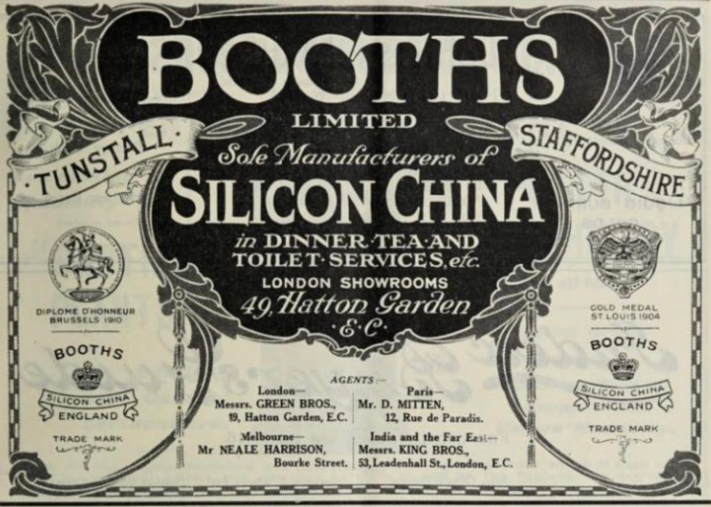


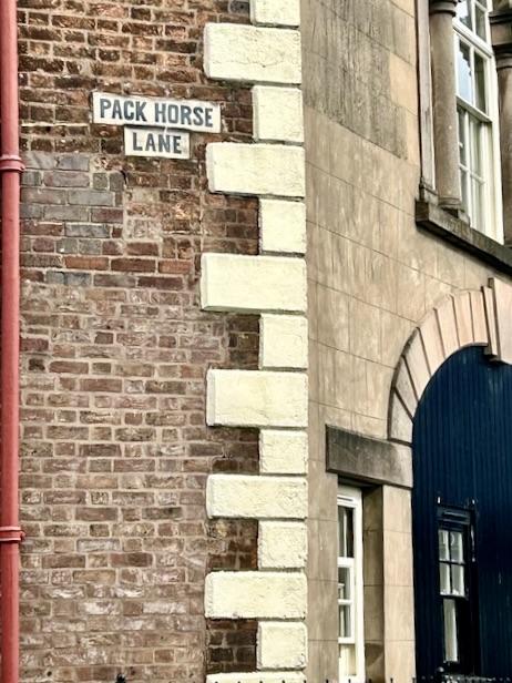
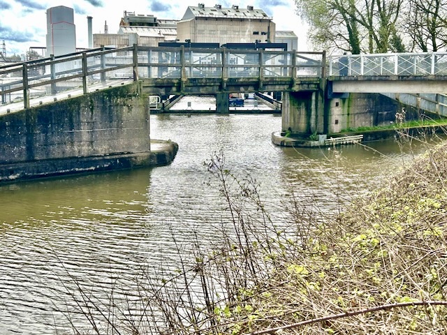
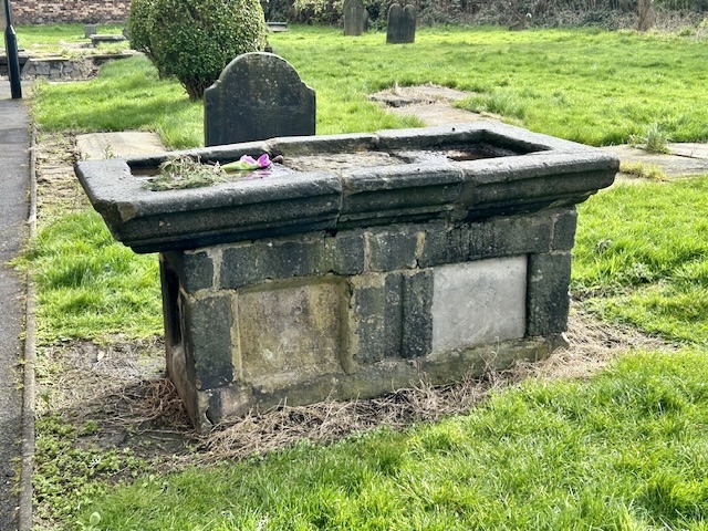


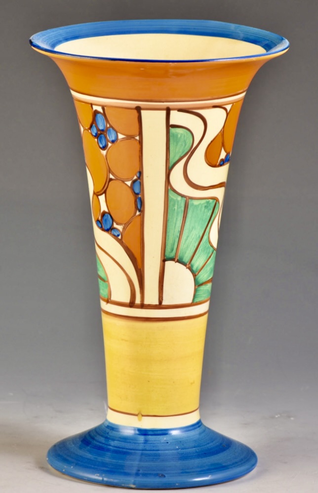
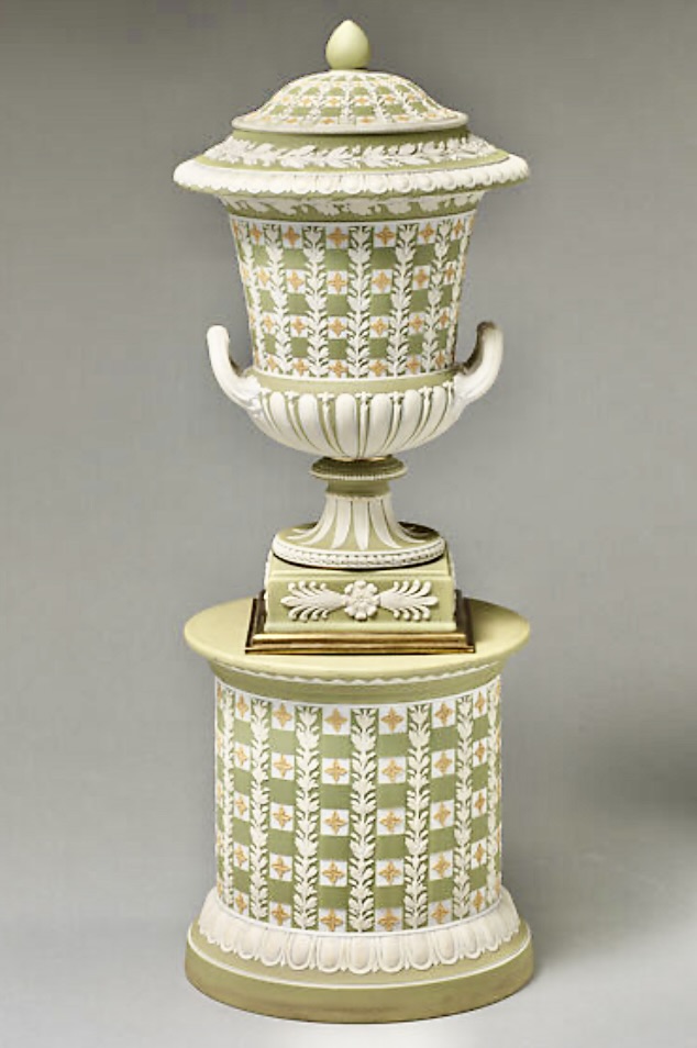


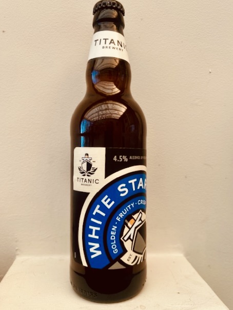


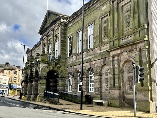


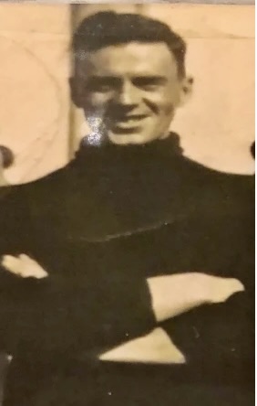


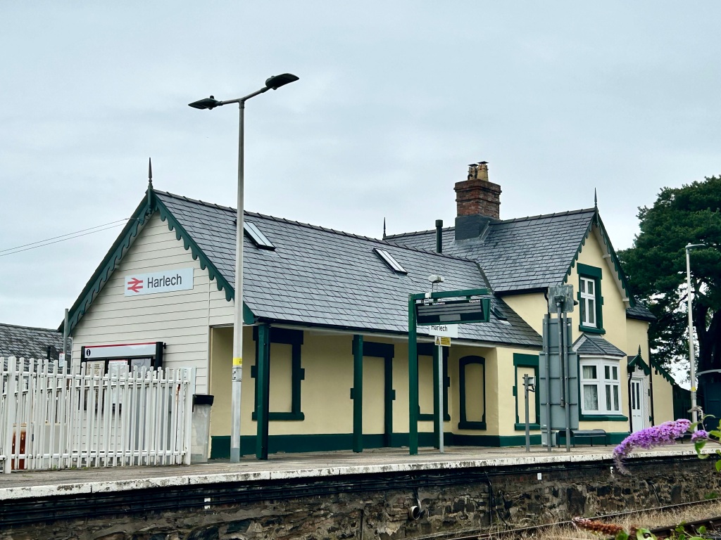

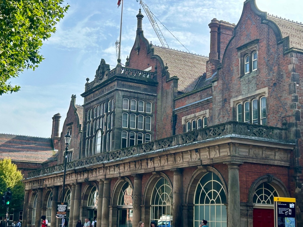
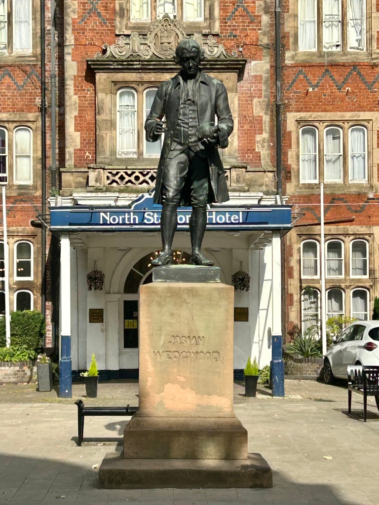


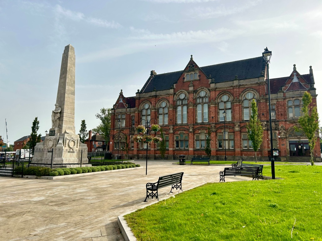


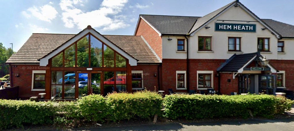


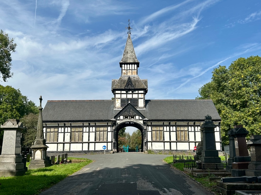
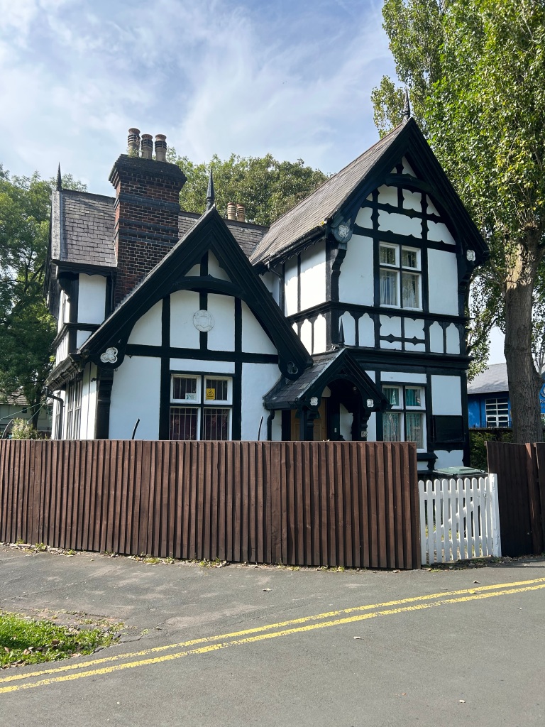

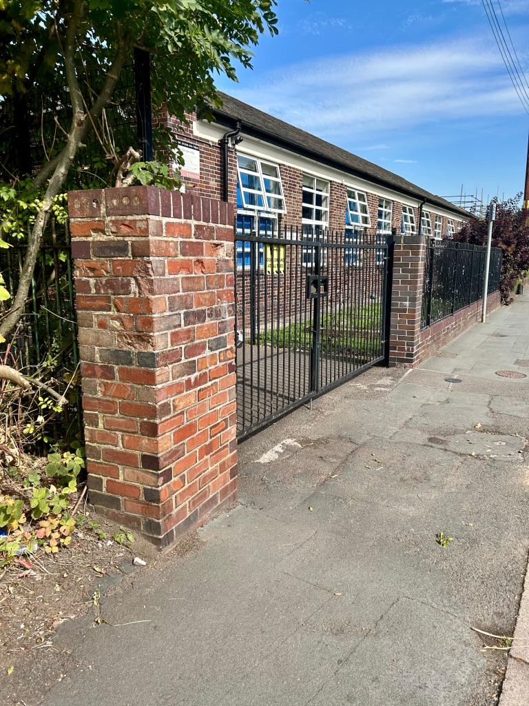

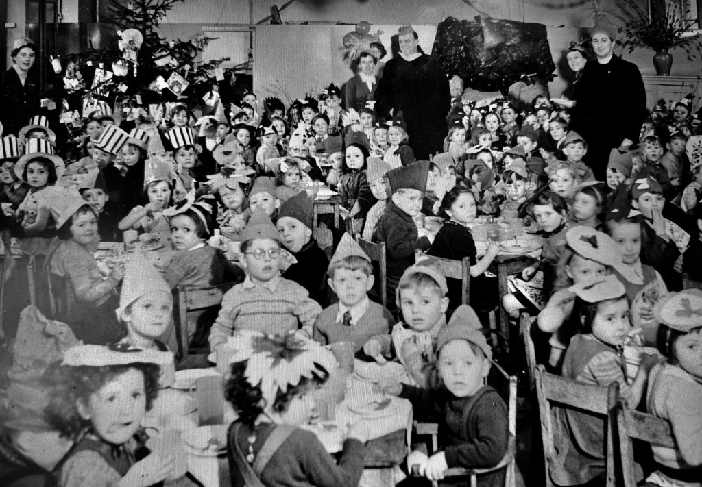


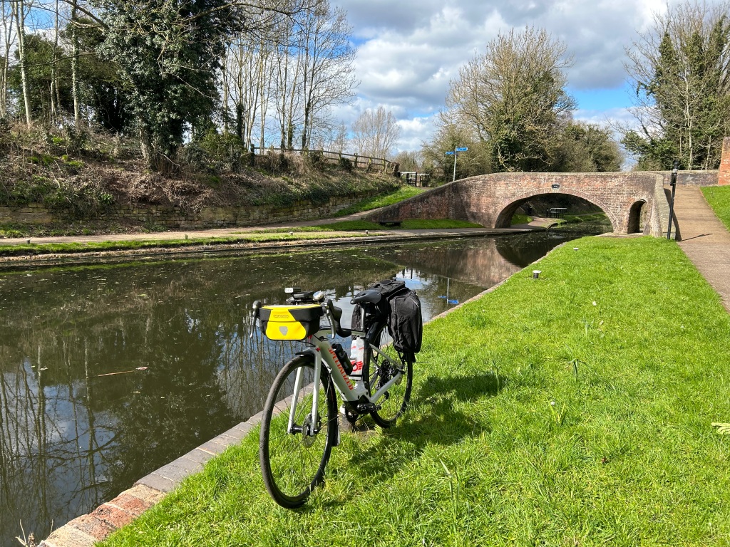


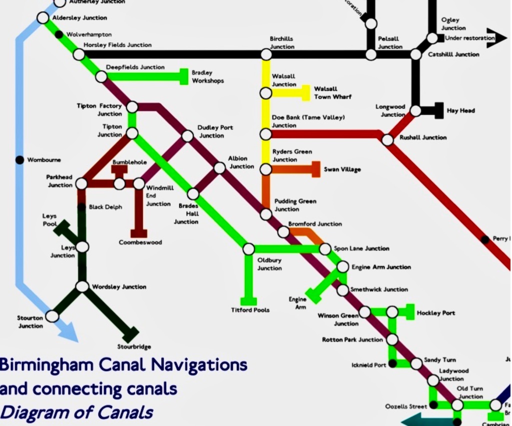


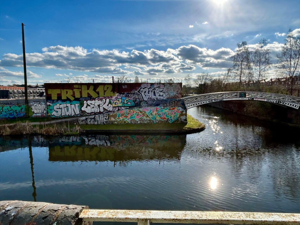


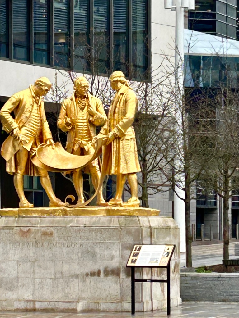


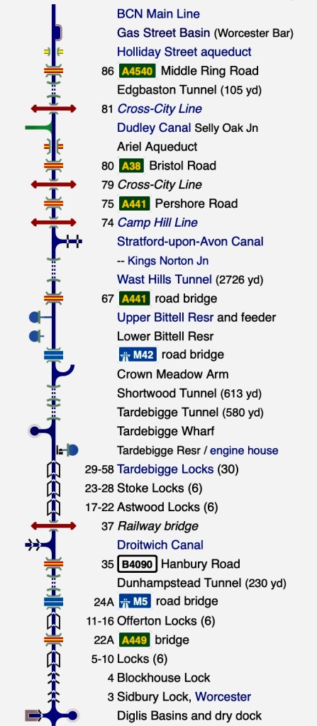
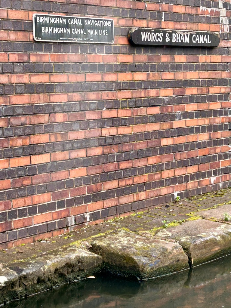


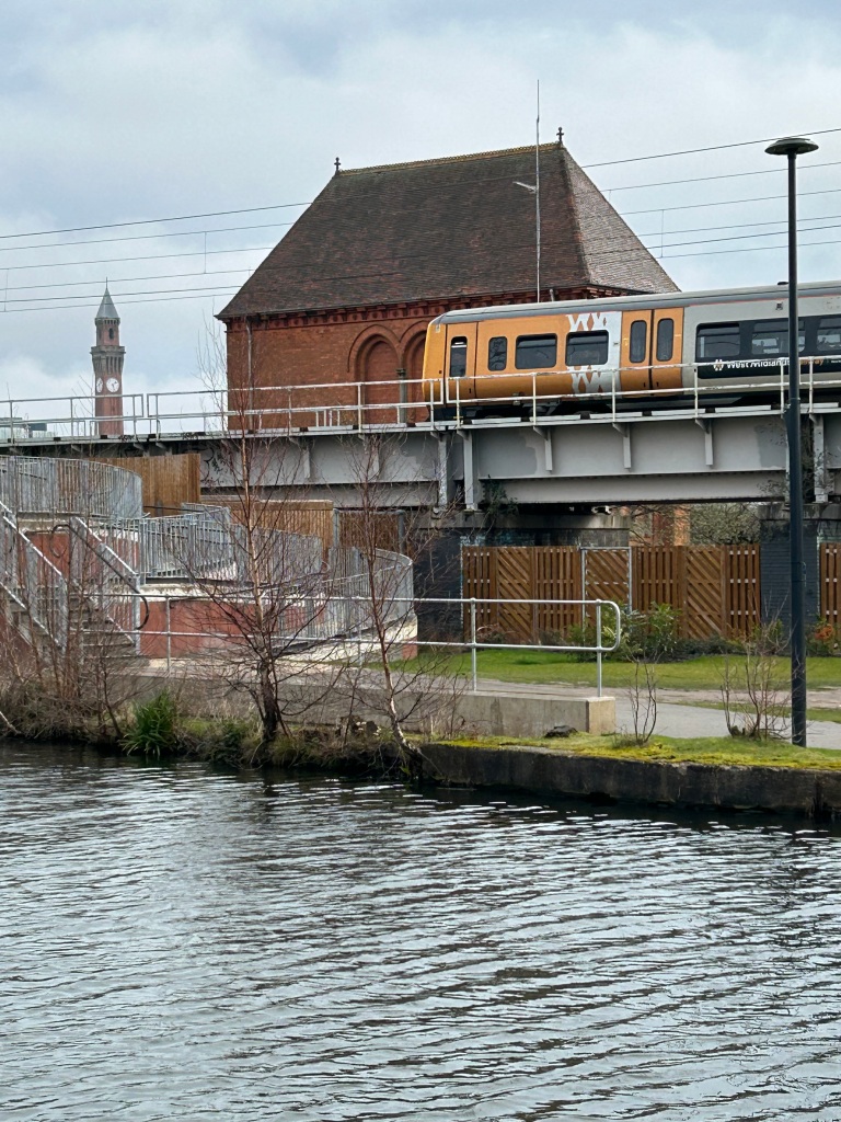


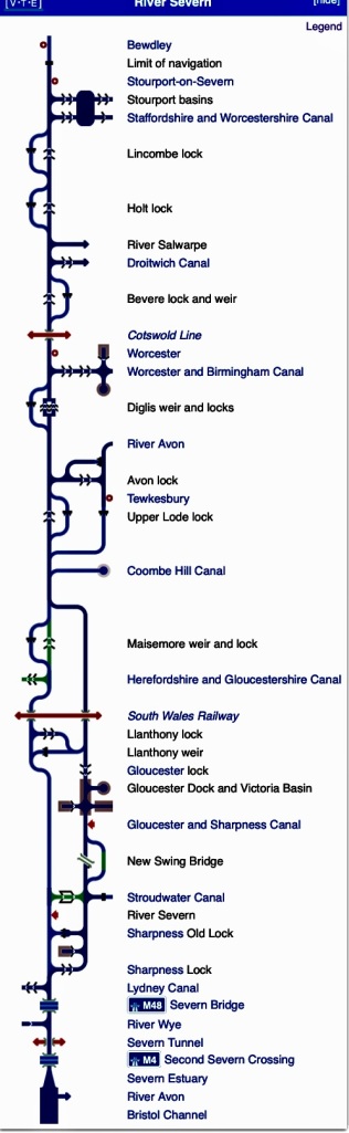


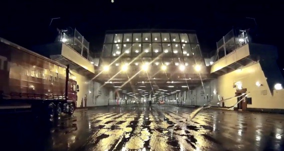


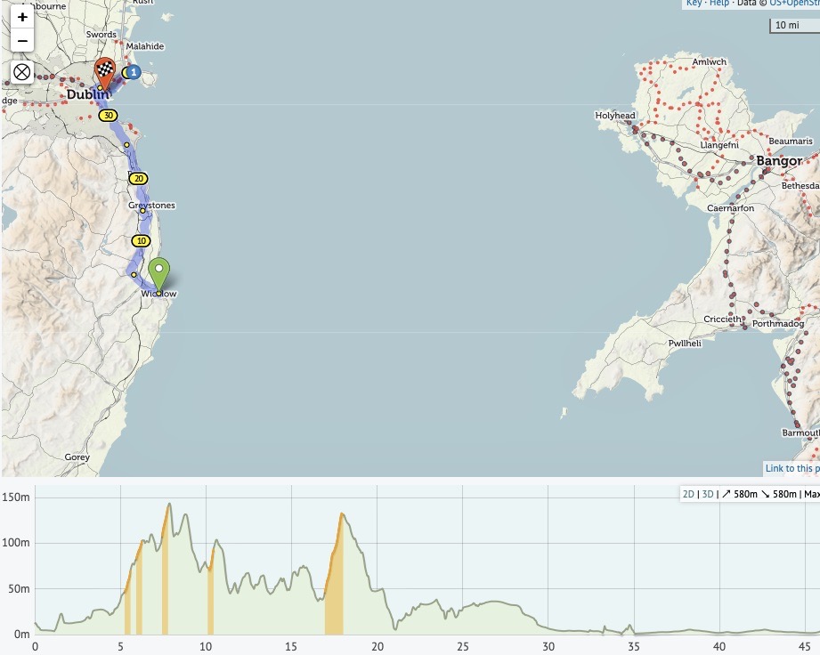


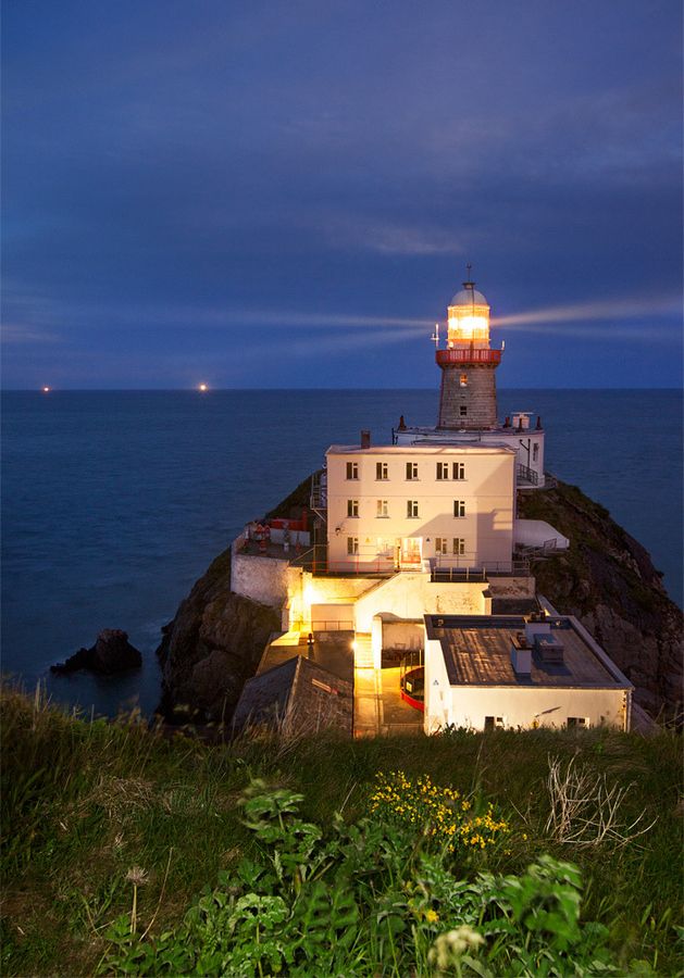


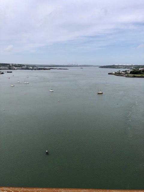


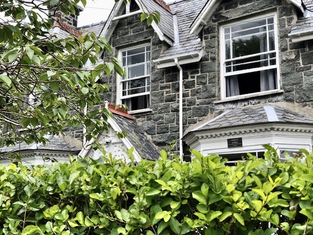

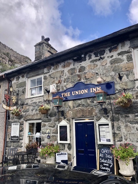


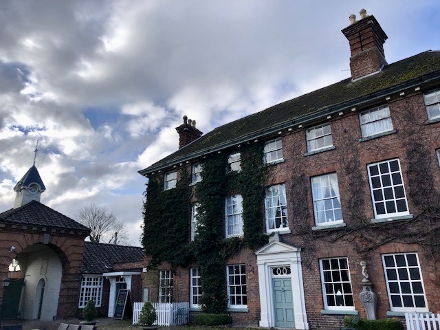


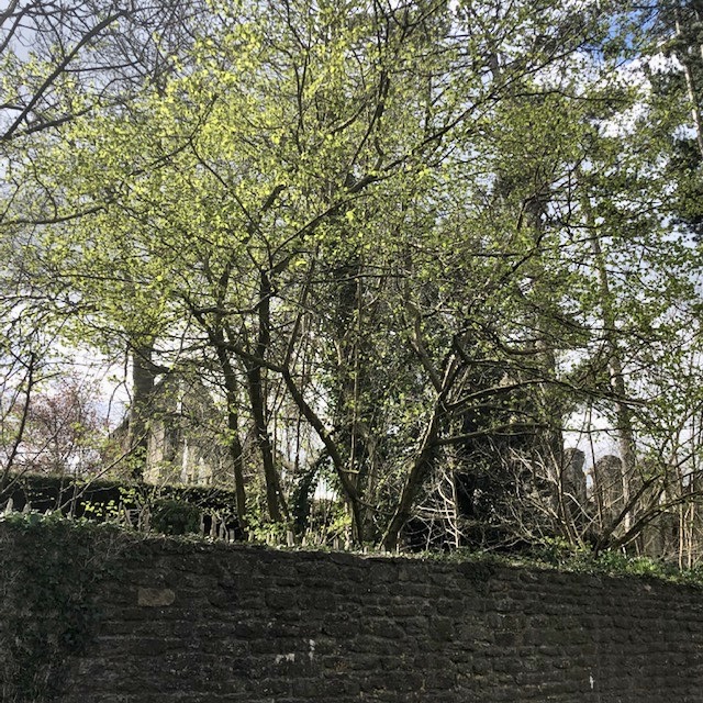


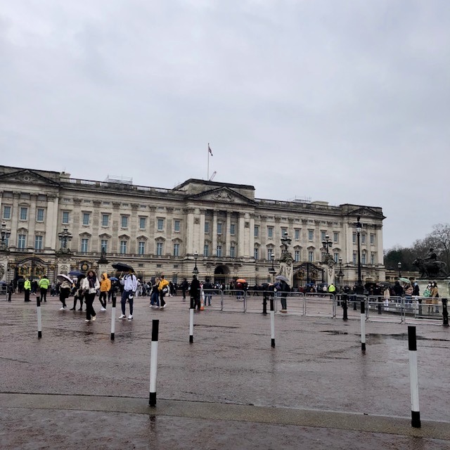


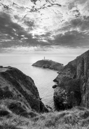

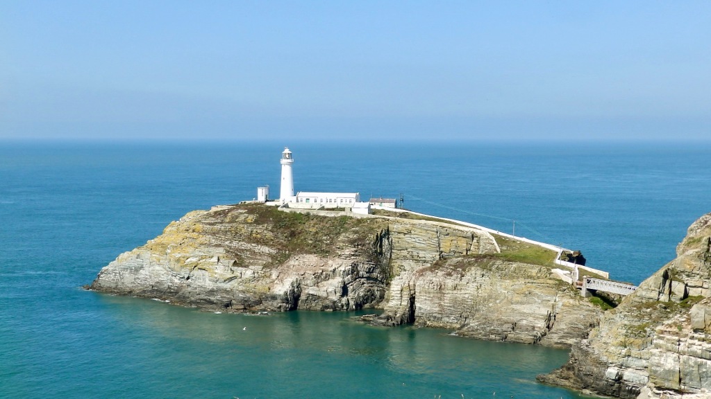


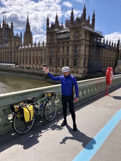


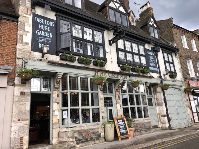
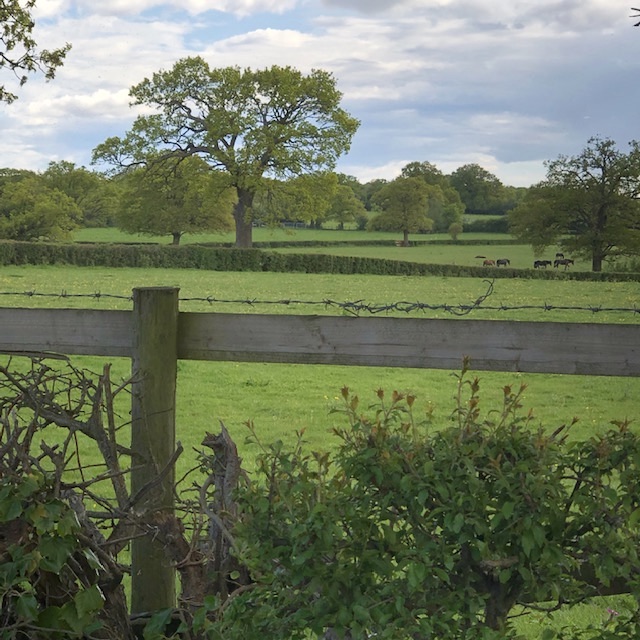


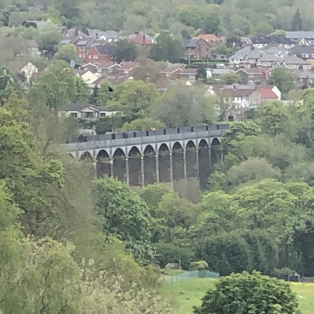

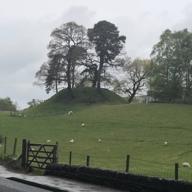


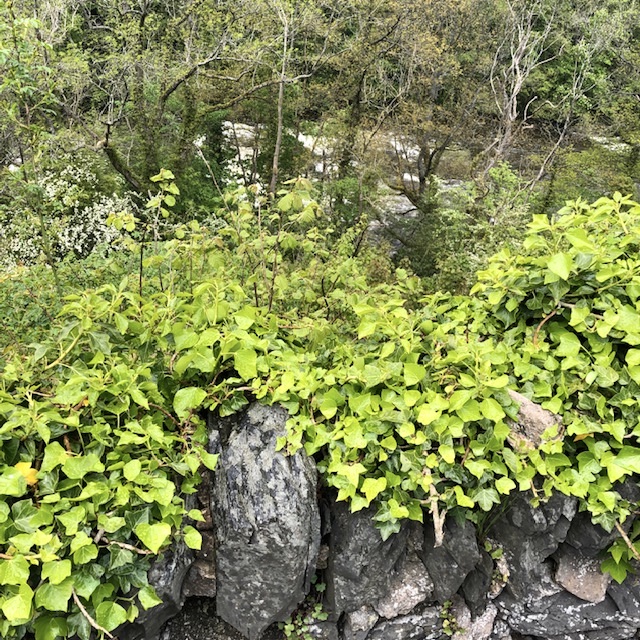
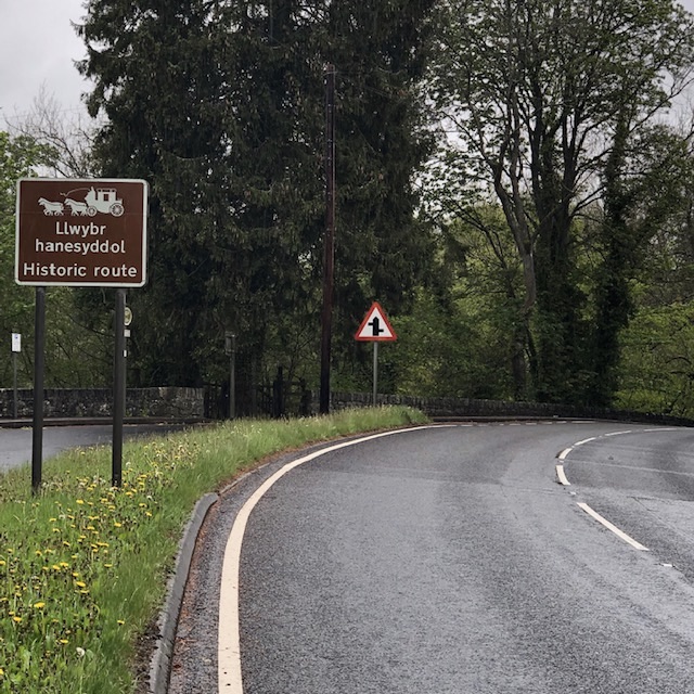


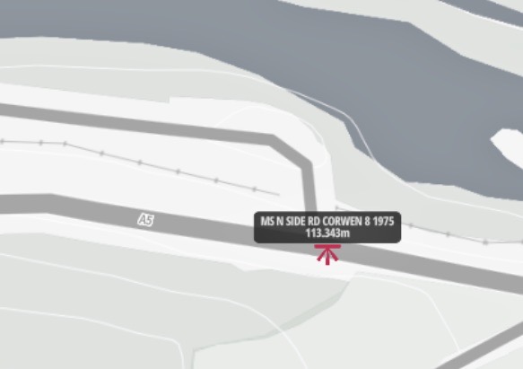
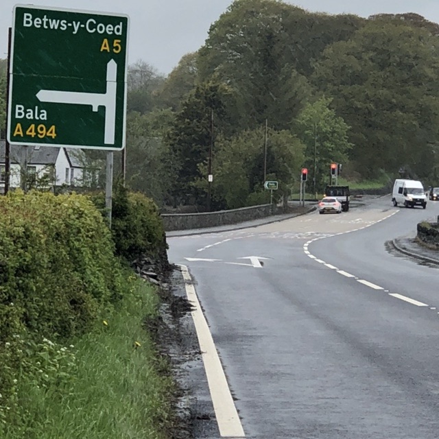


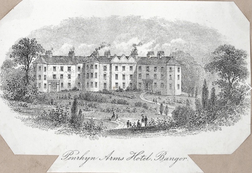
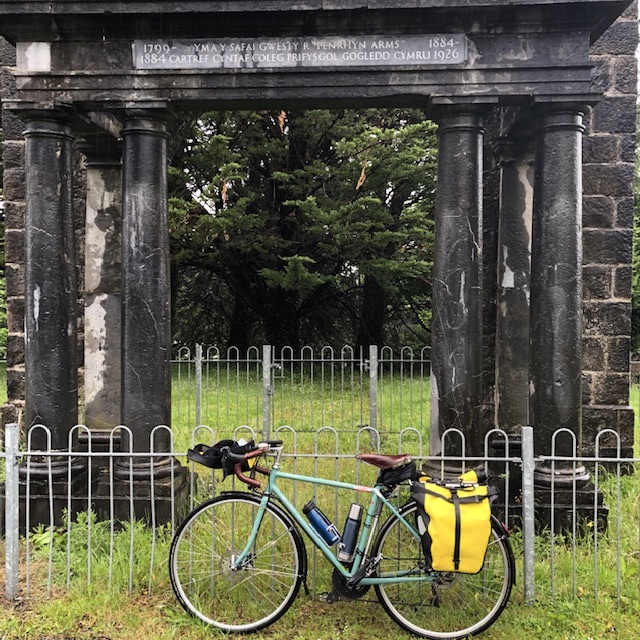
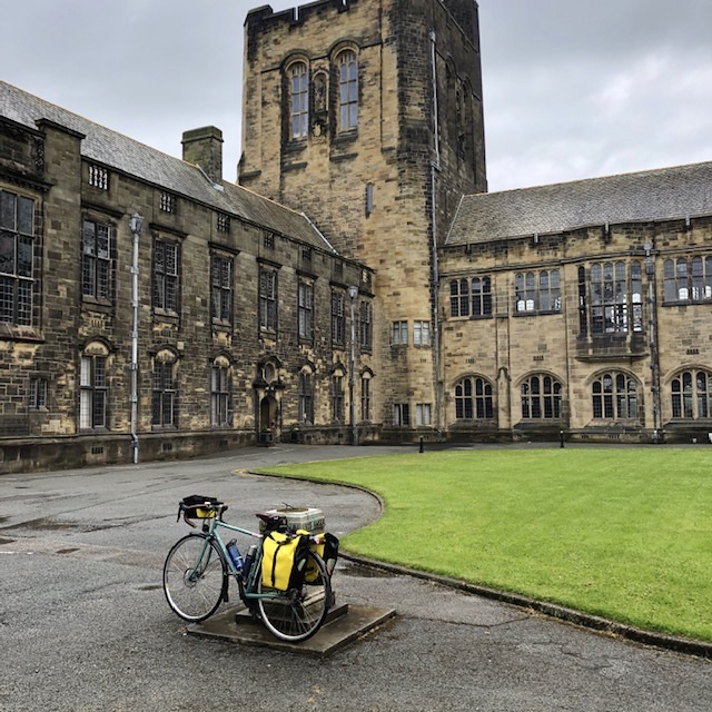


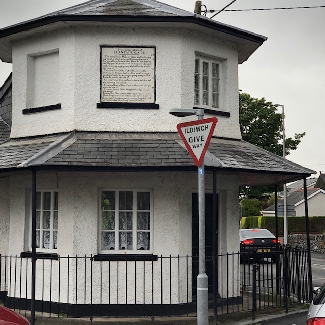


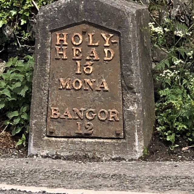


You must be logged in to post a comment.